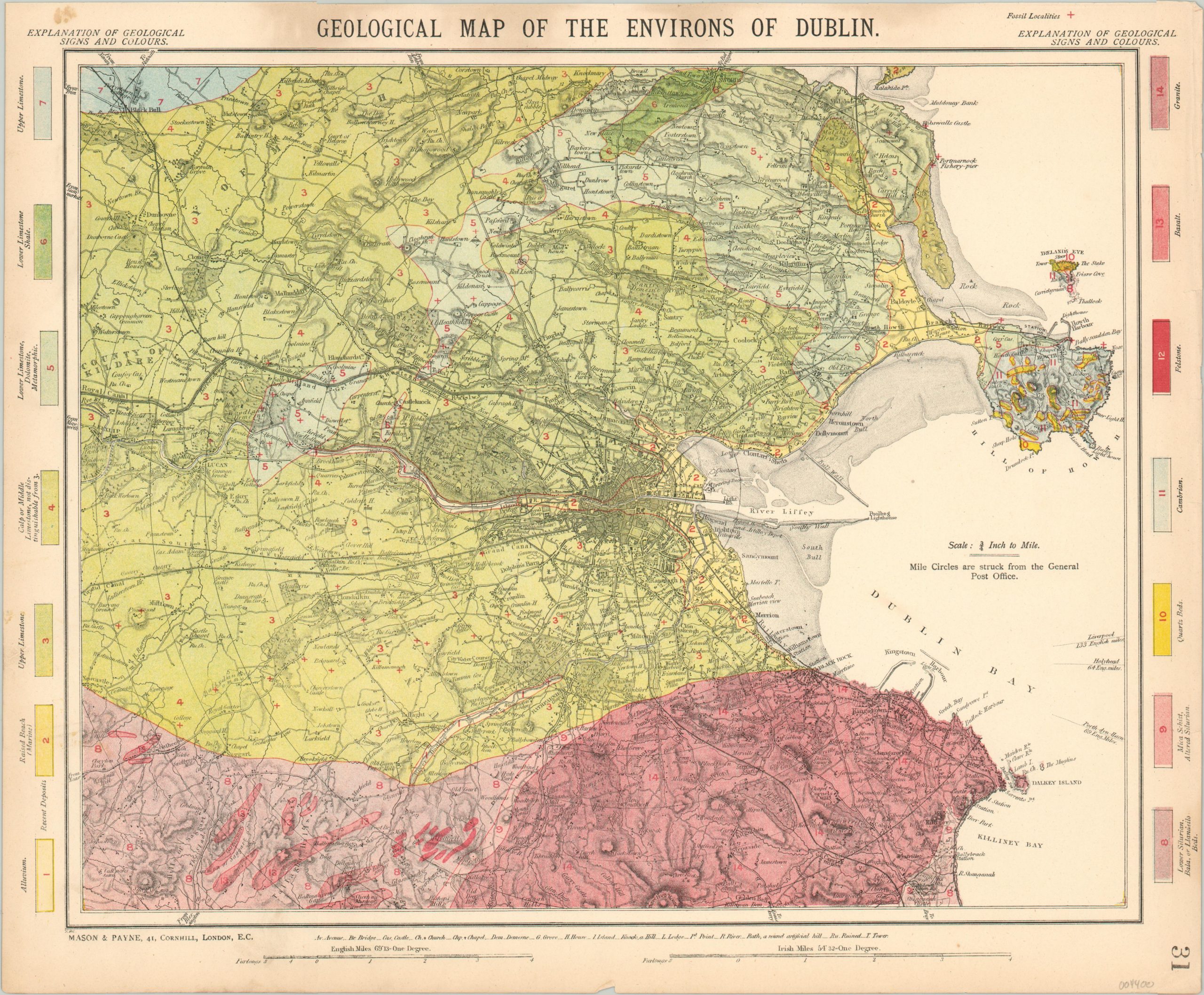
Geological Map of the Environs of Dublin
$89.00
Late 19th century geologic map of the area around Dublin, Ireland.
1 in stock
Description
This attractive geological map uses vivid color to distinguish between various types of rock deposits in the area around Dublin, on Ireland’s eastern coast. Fourteen separate compositions are identified within the border, which also indicates that the crosses scattered throughout the image are used to denote the location of identified fossil remains.
An additional key at the bottom of the sheet identifies the letters and symbols used for bridges, castles, churches, chapels, hills, houses, ruins, and more. The base map was originally issued decades earlier by the Society for the Diffusion of Useful Knowledge, but the plates were sold to Thomas Letts for publication in his ‘Popular Atlas’, subsequently reproduced by Mason & Payne in 1889.
Map Details
Publication Date: 1889
Author: Mason & Payne
Sheet Width (in): 17.00
Sheet Height (in): 14.00
Condition: B+
Condition Description: Worn outer edges, including several small tears, and a few small spots of soiling in the margin. Very good overall.
$89.00
1 in stock

