Geological Map of the Coal Region of Indiana (Sheet D) Knox, Daviess and Martin Counties
$75.00
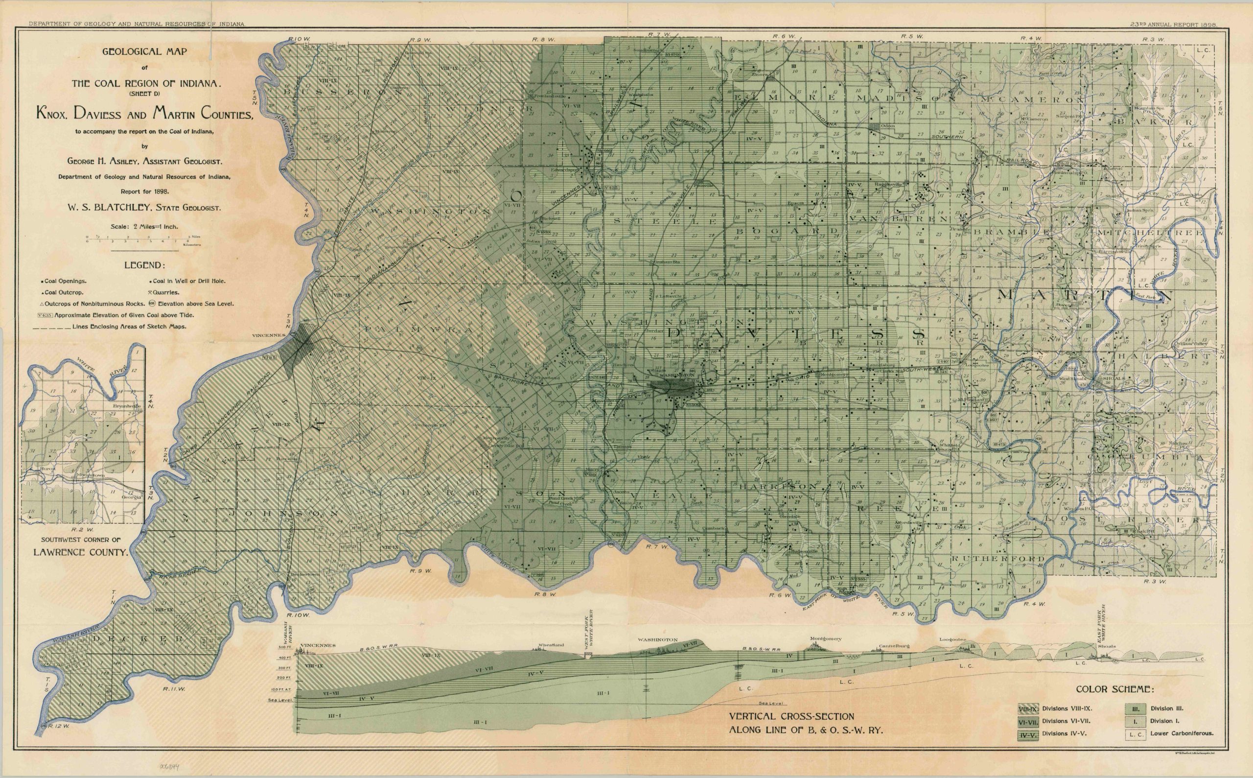
Coal resources in southern Indiana near the turn of the century.
1 in stock
Description
This finely detailed map of southwestern Indiana was prepared by George Hall Ashley in 1898 for inclusion in the Indiana Department of Geology and Natural Resources Annual Report. Emphasis is given to the extensive coal deposits across the region. Openings, outcrops, quarries, and drill holes are noted according to the legend in the center-left. A vertical cross-section between Vincennes and Shoals, along the line of the Baltimore and Ohio railroad, is shown along the bottom of the sheet. Varying shades of green reflect different geologic divisions, noted in the lower right.
Map Details
Publication Date: 1898
Author: George H. Ashley
Sheet Width (in): 30.5
Sheet Height (in): 18.75
Condition: B
Condition Description: Color lithographed sheet on thin and brittle paper that has toned with age. One closed tear, about 3", in the upper left repaired on the verso with archival tape, with minor paper loss as a result. One other clean tear, also repaired with no loss. Good condition overall
$75.00
1 in stock