Geologic Cross Section of the Cedar Breaks – Zion – Grand Canyon Region
$125.00
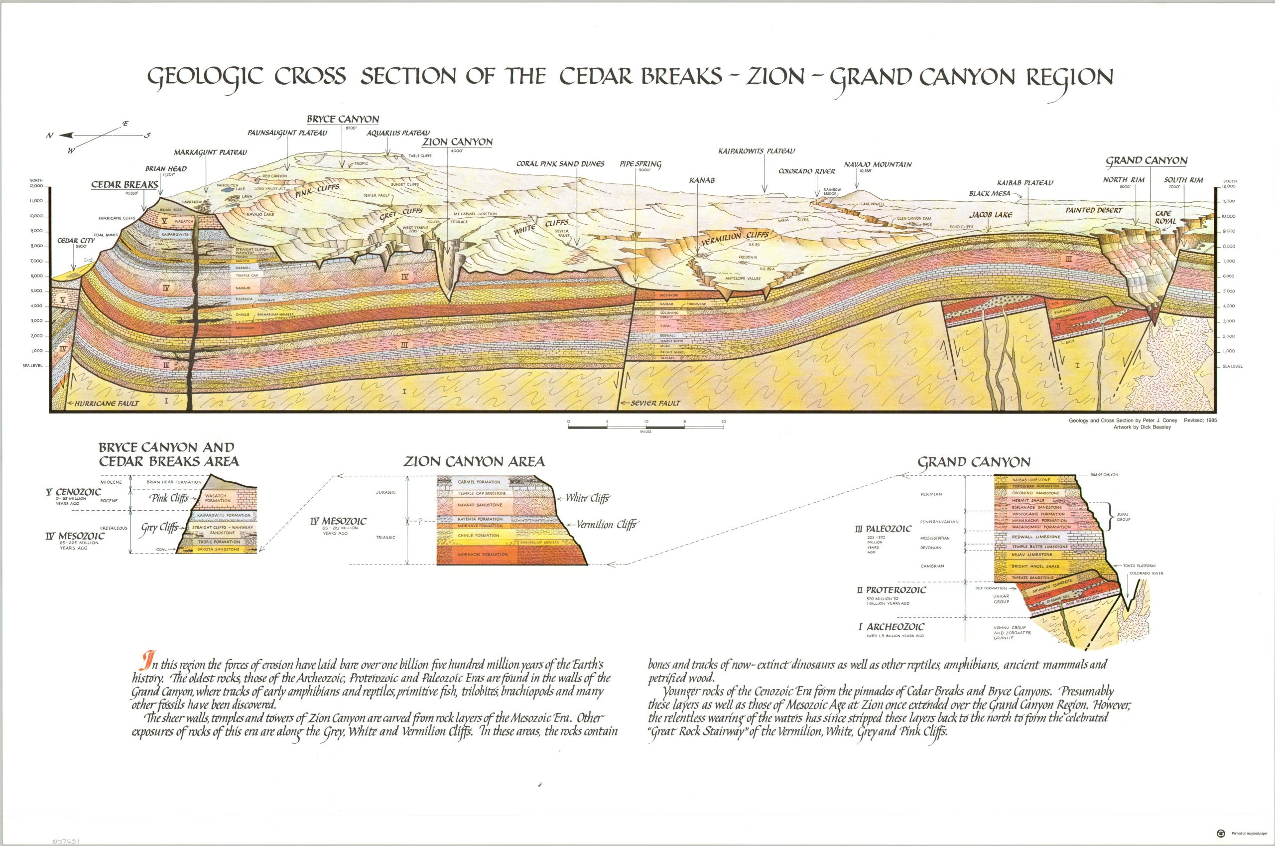
The vast geologic history of the American Southwest, visualized.
1 in stock

Description
This vibrant illustration shows the geologic strata that sit below the desert across the American Southwest between Cedar City, Utah, and the Grand Canyon in Arizona. Bryce Canyon, Zion Canyon, the Painted Desert, Coral Pink Sand Dunes, and numerous other natural features are labeled, with a chart on either side showing their relative height above sea level. The Roman numerals refer to the diagrams immediately below the main image, which provide further details on estimated dates and composition of the substrata. A text summary near the bottom of the page highlights the incredible power of nature – “In this region the forces of erosion have laid bare over one billion five hundred million years of the Earth’s history.”
The chart was designed by William J. Breed, with artwork by Dick Beasley. Originally published by the Zion Natural History Association in 1975, though this example is noted as being revised to 1985.
Map Details
Publication Date: 1985
Author: Peter Coney and Dick Beasley
Sheet Width (in): 23.8
Sheet Height (in): 15.75
Condition: A
Condition Description: Color cross-sections on both sides of a sheet of glossy paper. One faint crease on the right side. Near fine condition overall.
$125.00
1 in stock