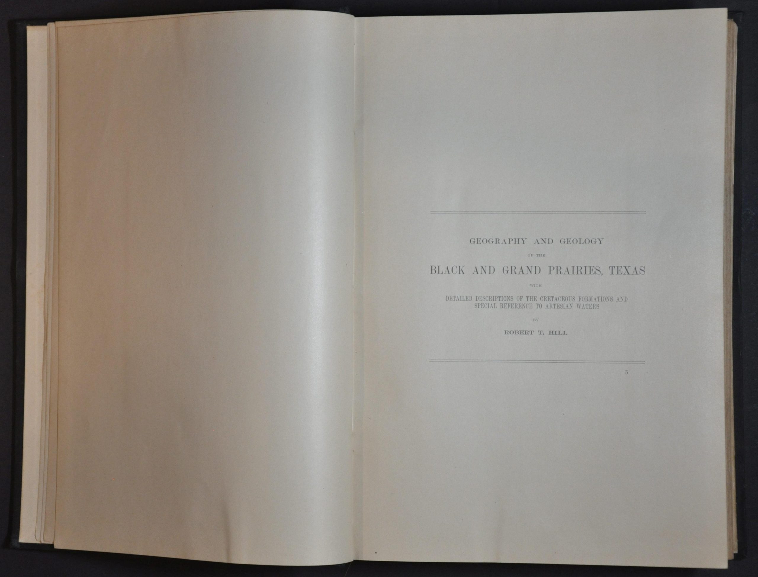
Geography and Geology of the Black and Grand Prairies, Texas
Part VII of the USGS Twenty-First Annual Report.
Out of stock

Description
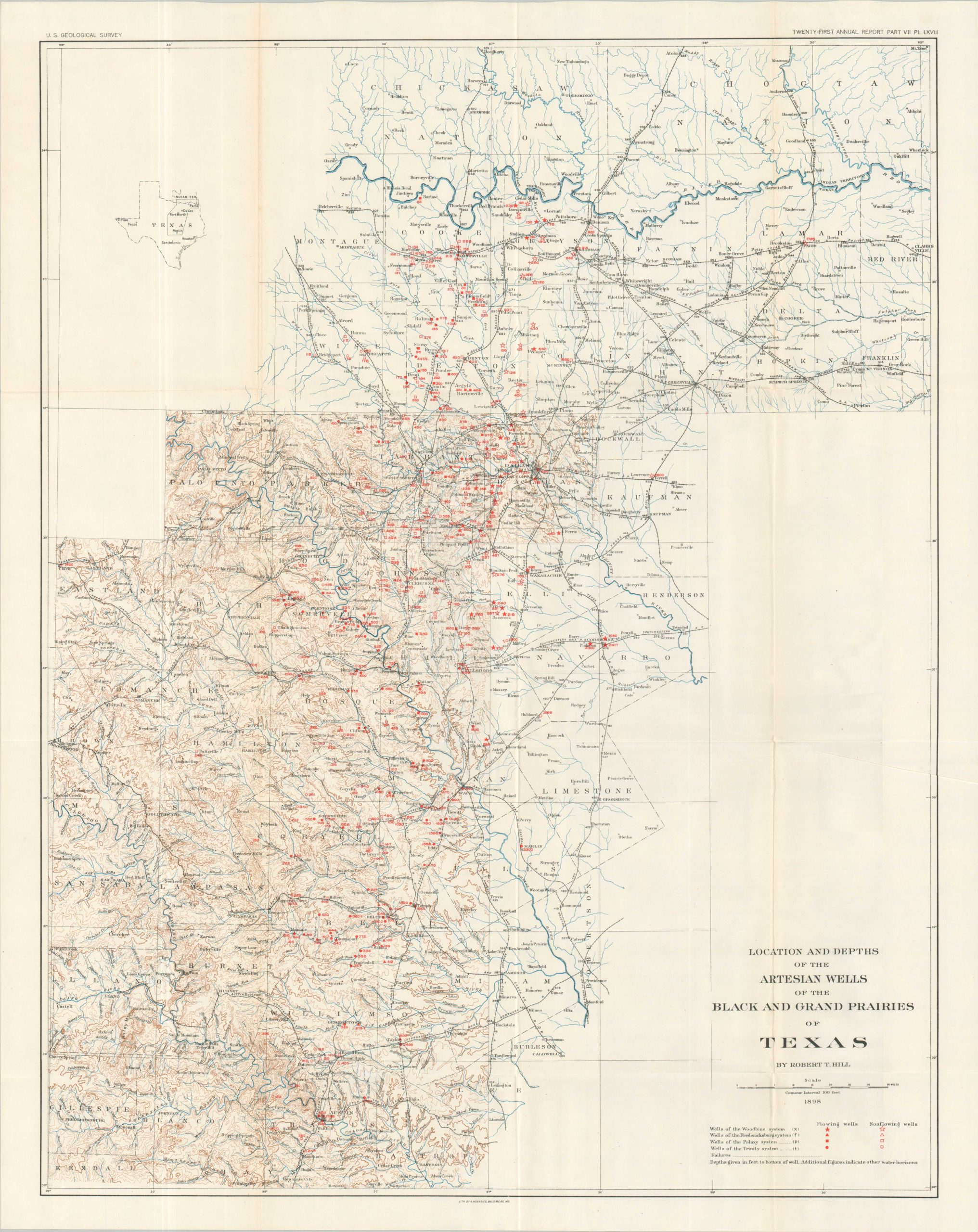
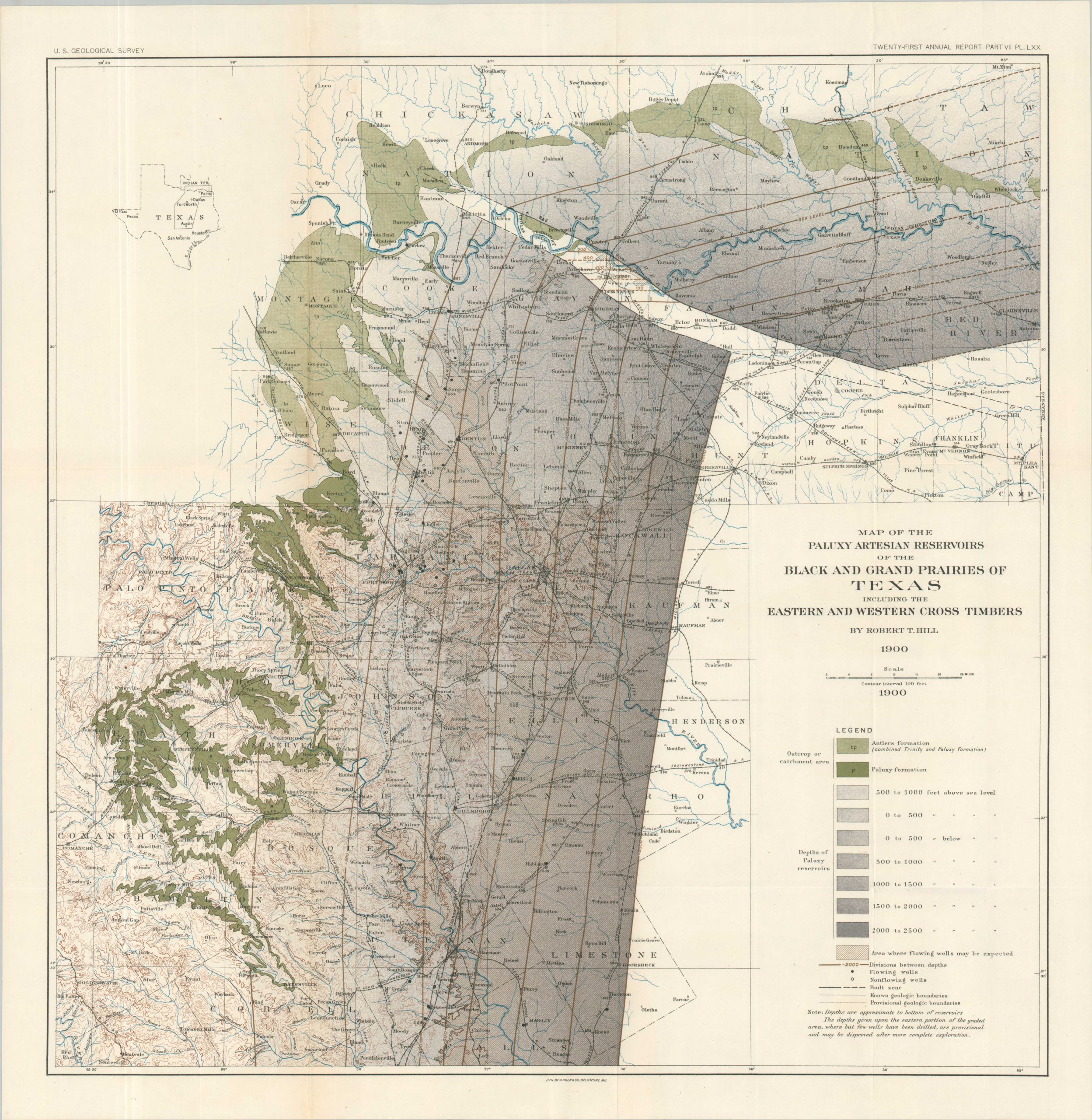
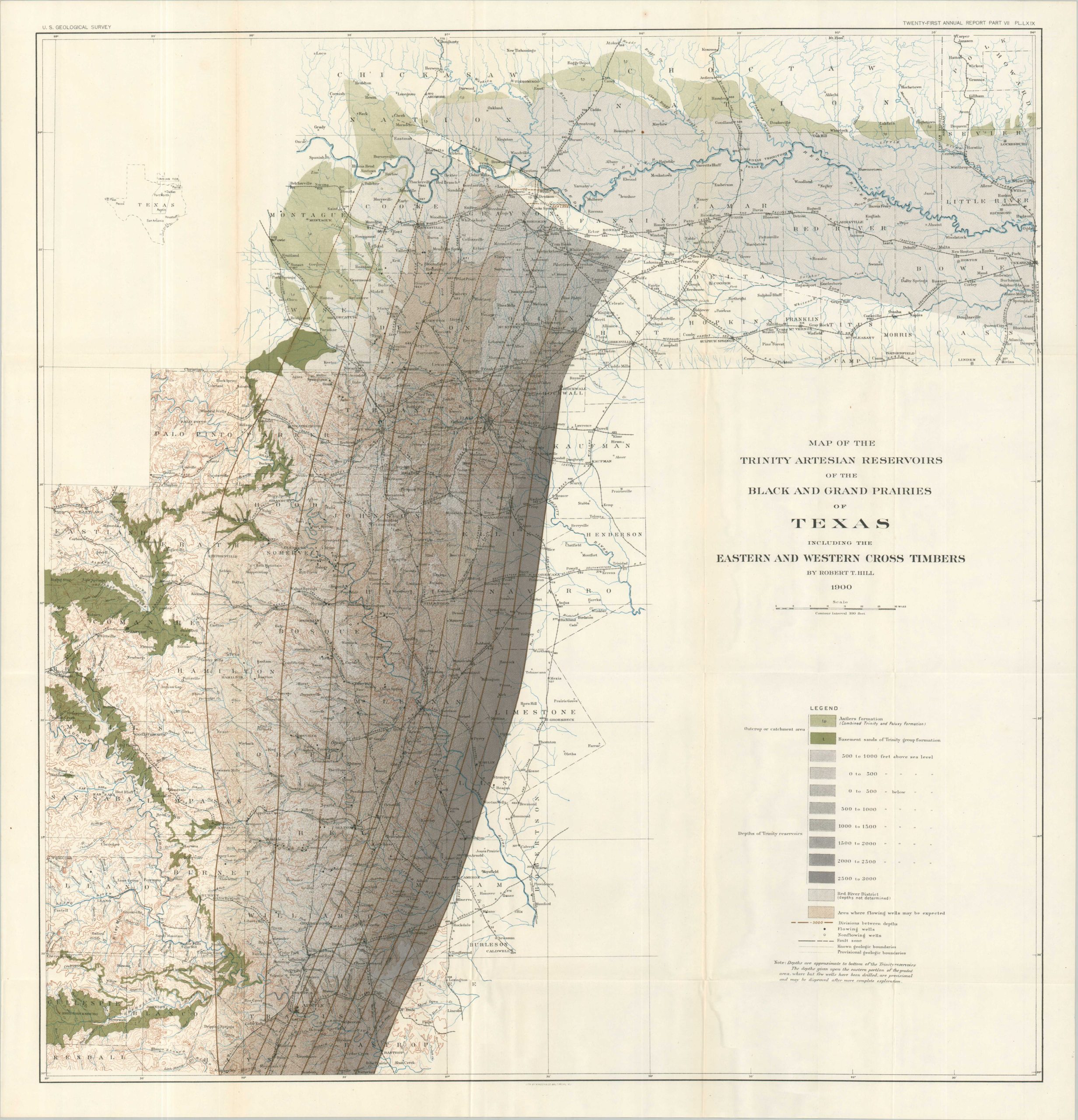
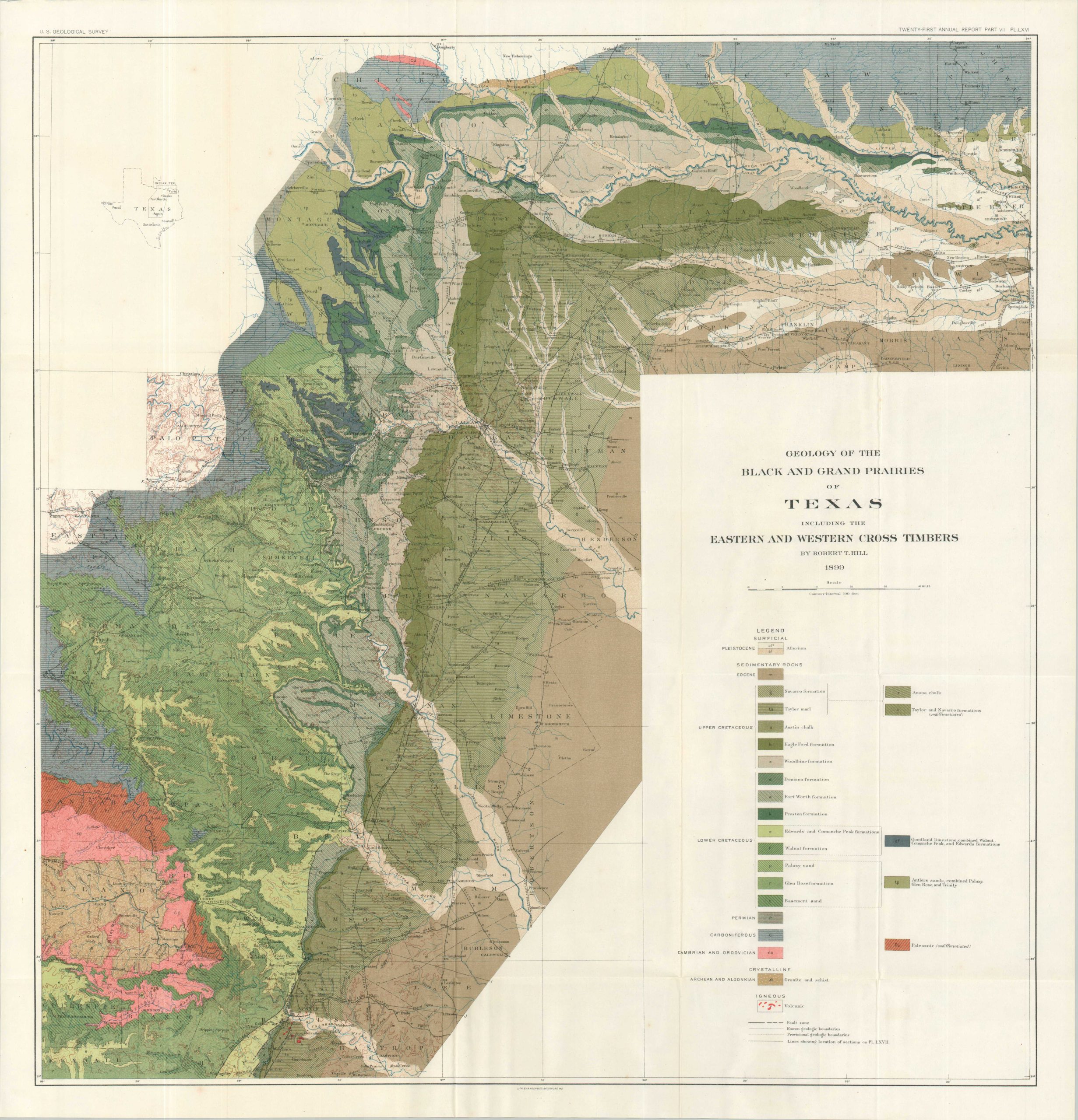
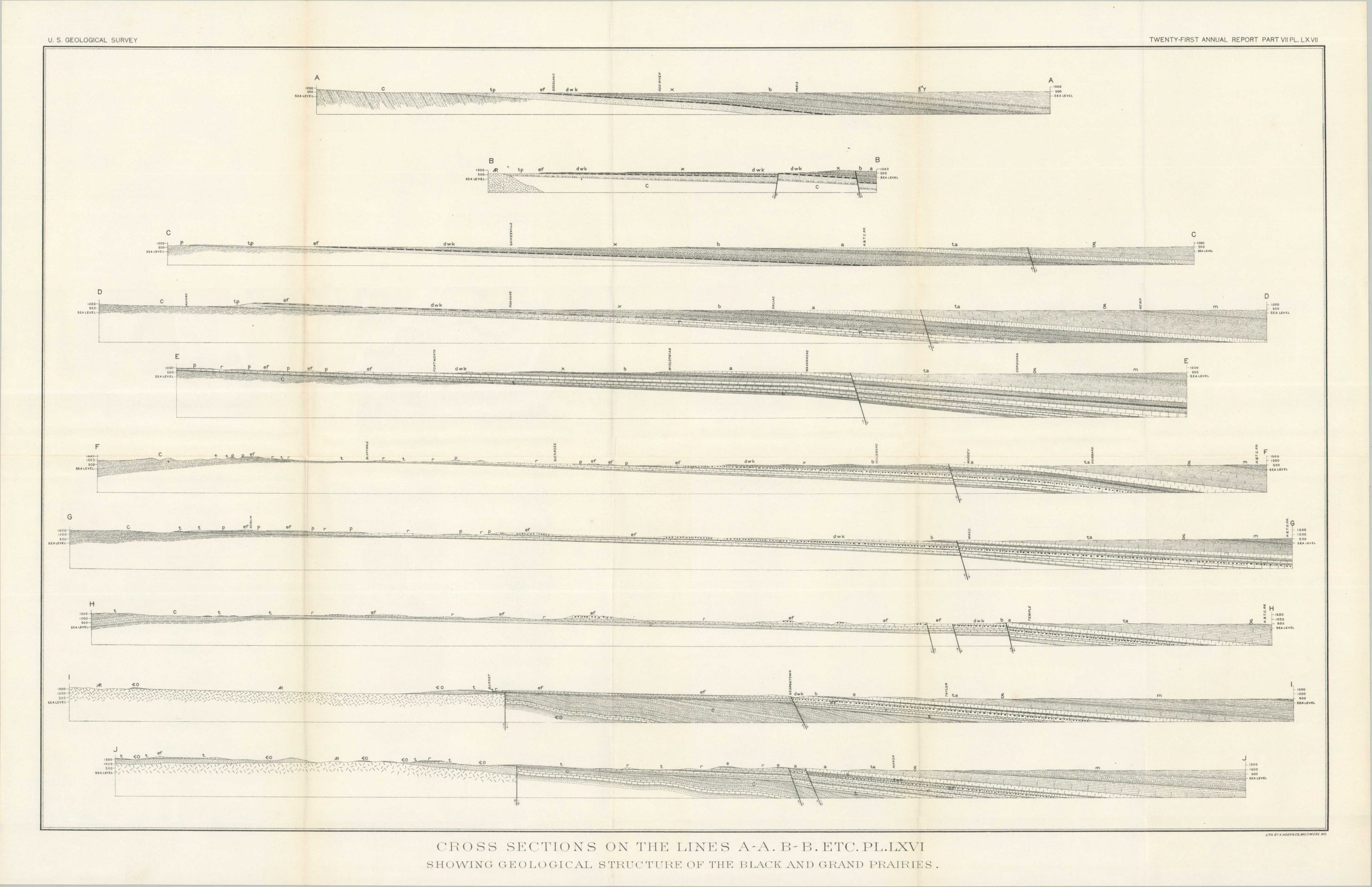
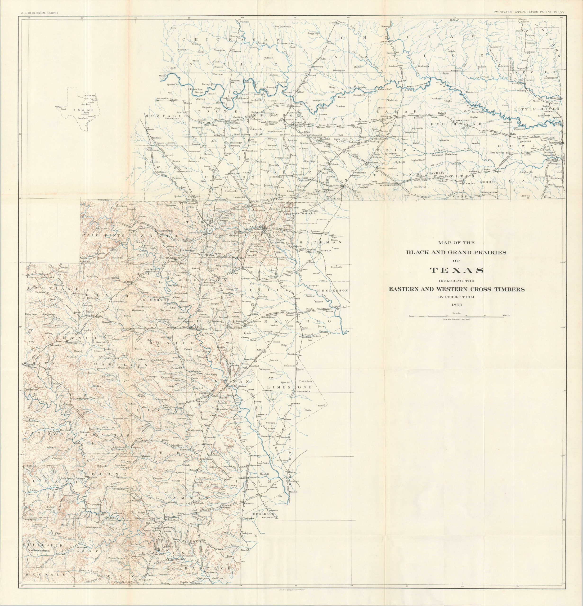
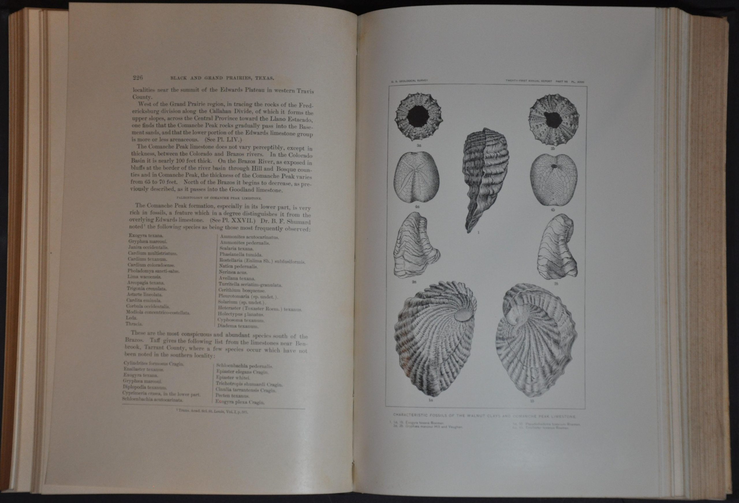
This incredibly detailed report on the prairies of Texas was compiled by Robert T. Hill of the United States Geological Survey and published in 1901 by the Government Printing Office. Over 650 pages, 64 plates, and 7 large folding maps provide a wealth of geologic information on the fertile region that runs across much of the central part of the state from Austin to Denison. Images of fossils and rock formations, tables of data, and cross-sections of boreholes provide much of the visually engaging content. The location of artestian wells is a critical component of the survey – necessary for the agricultural development that has essentially eradicated the original Texas Blackland Prairies.
The fold-out maps (the largest approximately 29″ x 30.5″) include:
- Topographic Map of the Black Prairie and Grand Prairie regions of Texas and southern Indian Territory, including the Eastern and Western Cross Timbers
- Geologic Map of the Black and Grand Prairies of Texas
- Profiles to Illustrate Section Lines on Plate LXVI (geologic map)
- Location and Depth of the Artesian Wells of the Black Prairie and Grand Prairie Regions of Texas
- Catchment, Embed, and Availability of Trinity Reservoirs
- Catchment, Embed, and Availability of Paluxy Reservoir
- Catchment, Embed, and Availability of Woodbine Reservoirs
Map Details
Publication Date: 1901
Author: Robert T. Hill
Sheet Width (in): 7.5
Sheet Height (in): 11
Condition: A-
Condition Description: Ex-libris, with old owner's bookplate and inscription on the front flyleaf. 666 pp. + i-xii hardbound in full black cloth with gilt lettering on the spine. Some soiling and paper residue on the front board, with a few small scuffs on the back. Contents, complete, are tightly bound and show light foxing and a bit of wear (toning, small chips, etc.) along the fore-edge, consistent with age and use. Contains all seven folding maps in the back pocket. Each is sharply creased and shows some light transference from the printed color. Very good condition overall.
Out of stock