Geographische beschryvinge van T’Beloofde-Landt Canaan…
Uncommon Dutch map of the Holy Land, likely based on Visscher.
Out of stock
Description
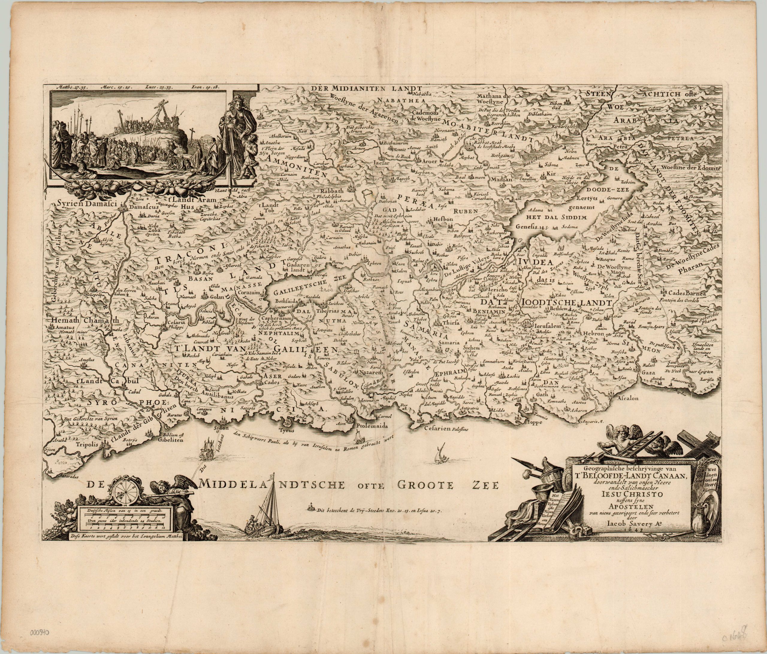
This is a decorative map of the Holy Land attributed to Jacob Savery III in 1648. The grandson of a popular Dutch artist, Savery likely based the image on a similar map issued 20 or so years earlier by Nicholas Visscher. Like many 16th and 17th century Bible maps, it shows various places and events prominently featured in the New Testament. A few examples include Jesus walking on water in the Sea of Galilee, Paul’s travels in the Mediterranean, and Sodom and Gomorrah submerged in the Dead Sea.
A decorative title cartouche is surrounded by implements used in the crucifixion, with putties holding aloft a ladder. Opposite the cartouche is a decorative compass rose, showing the orientation of the map with west at the top. Between the two can be seen the symbol for identifying the six Cities of Refuge, where perpetrators of certain crimes could claim asylum. An inset view of Cavalry and the crucifixion of Christ can be seen in the upper left, with Mary, mother of James and Joseph, looking away.
Map Details
Publication Date: 1648
Author: Jacob Savery
Sheet Width (in): 20.9
Sheet Height (in): 18
Condition: B
Condition Description: Wear and separation along centerfold has been professionally filled with old paper and reinforced. Some soiling in the margins, and several small tears in the outer edges. Good to very good.
Out of stock