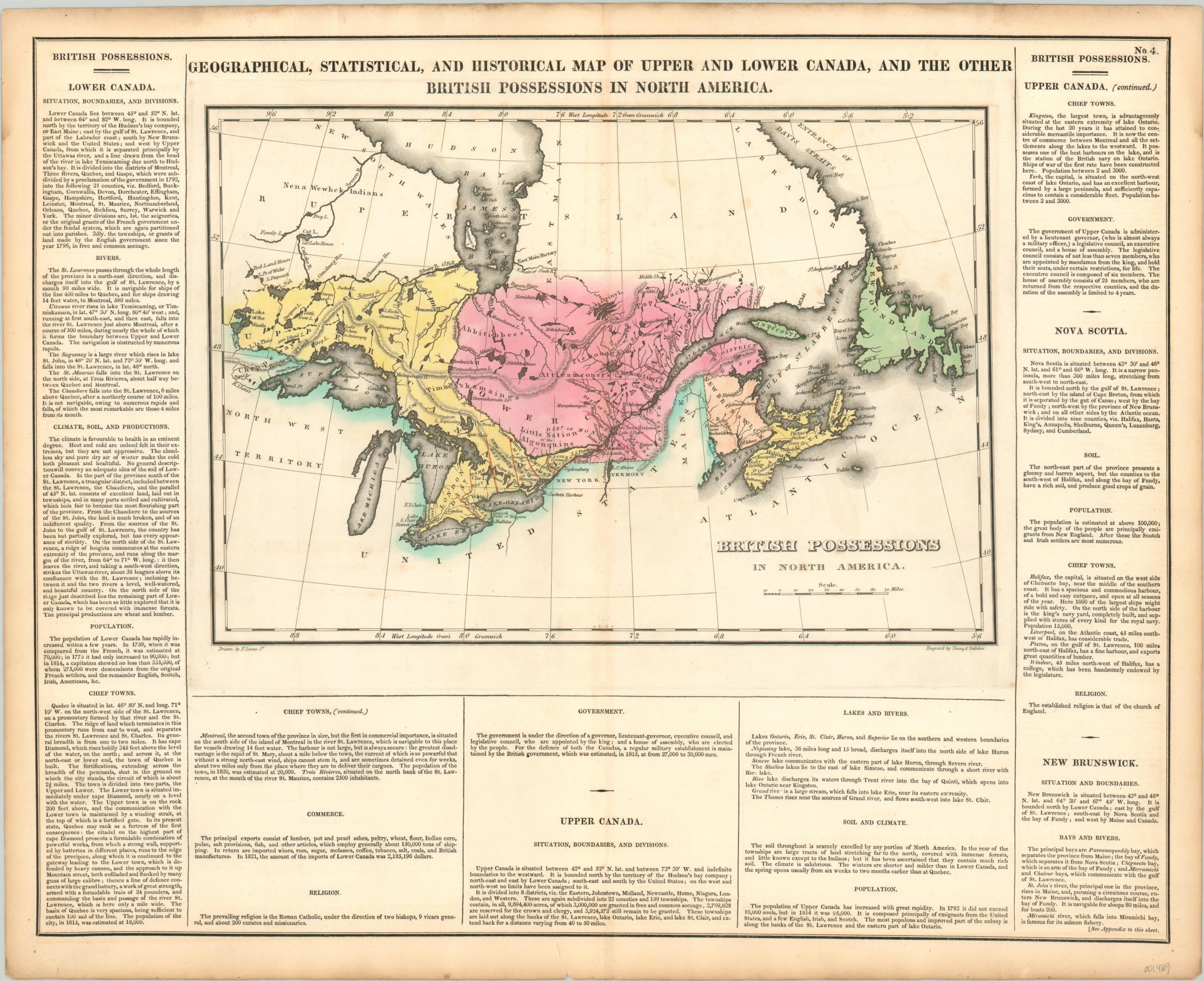
Geographical, Statistical, and Historical Map of Upper and Lower Canada
Original price was: $125.00.$85.00Current price is: $85.00.
Nice map of Canada from one of the most important atlases of the 19th century.
1 in stock
Description
This detailed map of eastern Canada and the Great Lakes shows the political organization of the provinces of Upper and Lower Canada after the first two decades of the 1800’s. Various colors are used to denote regional organization under British occupation, which include the area from the Lake of the Woods to the island of Newfoundland. Numerous native tribes are labeled across large swathes of this territory, while the frozen northern regions are left largely vacant.
Surrounding the map are blocks of text providing detailed information on the history, climate, geography, and aforementioned political organization of the provinces. The image was drawn by Fielding Lucas, Jr. and engraved by Young & Delleker. It was issued as sheet number 4 in the 1822 (first) edition of Carey & Lea’s A Complete Historical, Chronological, and Geographical American Atlas.
This important American publication was issued in six separate editions and three different languages between 1822 and 1827. It was heavily influenced by an earlier European atlas by Emmanuel Las Cases (published under the pseudonym A. Lesage.), which inspired the format of a base map surrounded by blocks of informative text and tables of statistics.
Henry Carey, a political economist and the son of prominent publisher Matthew Carey, and his brother-in-law Isaac Lea incorporated this novel theme into their atlas, which focused entirely on the countries of the Western Hemisphere. It was issued at a time of tremendous political change in both North and South America, and the detailed maps accompanied by extensive text provide a unique, often insightful, perspective on the problems and possibilities of the Americas in the first quarter of the 19th century.
Wheat, C. I. (2004). Mapping the Transmississippi West: 1540-1861. Mansfield Centre (CT): Martino Publishing. #348
Egli, L. G., & Phillips, P. L. (1974). A list of geographical atlases in the Library of Congress. Washington: Library of Congress. #1373
Map Details
Publication Date: 1822
Author: Carey & Lea
Sheet Width (in): 21.75
Sheet Height (in): 17.50
Condition: A-
Condition Description: Outer margins are slightly toned from age and there is faint discoloration along the binding edge of the vertical centerfold. Very good or better condition, with original hand color.
Original price was: $125.00.$85.00Current price is: $85.00.
1 in stock

