Geographical, Statistical and Historical Map of Ohio
$95.00
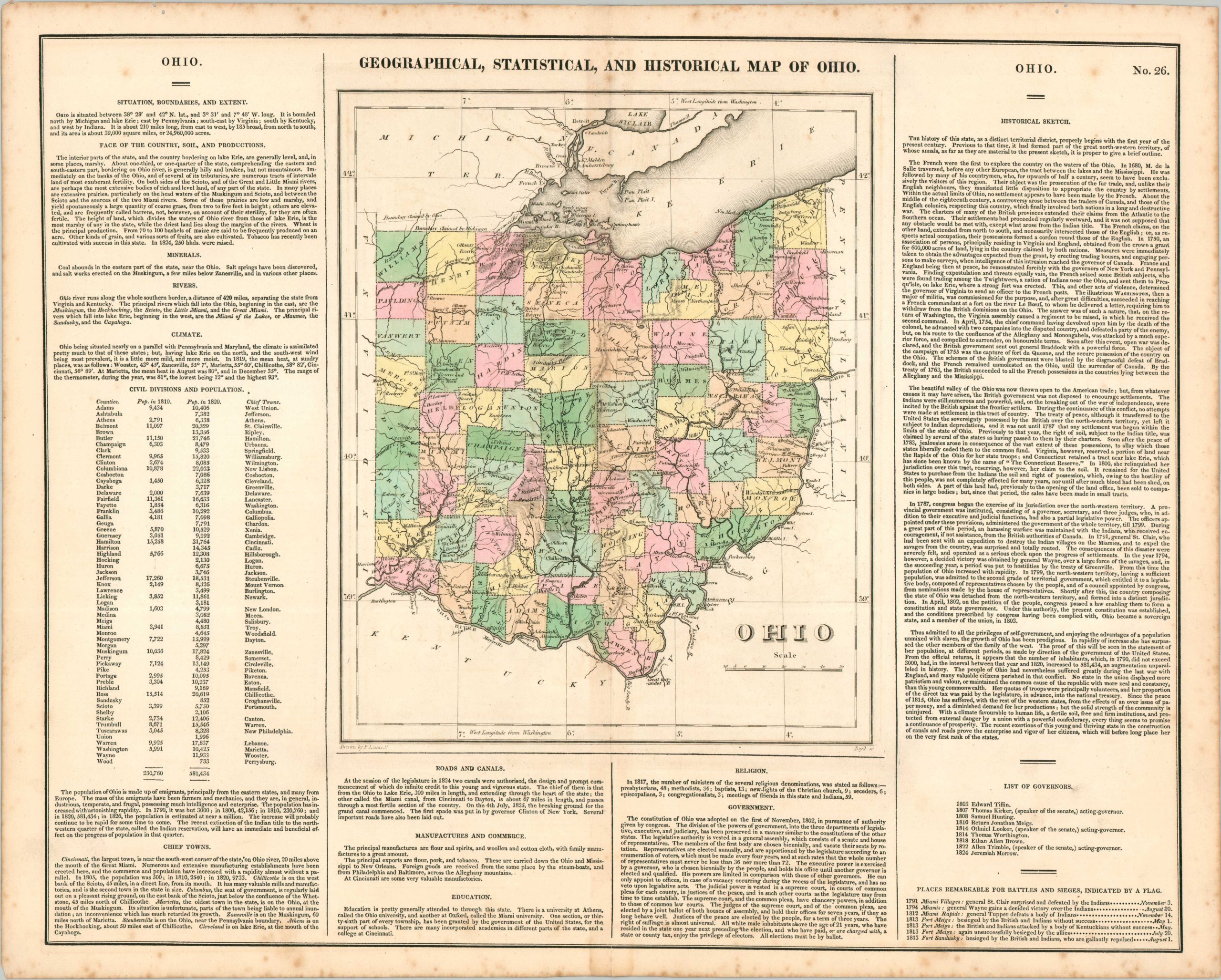
Comprehensive geographic overview of Ohio from 1822.
1 in stock
Description
This is a nice example of Carey & Lea’s first edition map of Ohio with old hand color. With descriptive text on either side, the sheet provides a fascinating summary of the Buckeye State in the first quarter of the 19th century. The map labels roads, railroads, counties, rivers and forts and references the ongoing northern border dispute with Michigan that would ultimately culminate in what is known as the Toledo War.
Drawn by Fielding Lucas Jr. for inclusion as plate number 26 in Carey & Lea’s “A Complete Historical, Chronological, and Geographical American Atlas.” This atlas was published in six separate editions and three languages between 1822 and 1827, this being the 1826 version.
Map Details
Publication Date: 1826
Author: Carey & Lea
Sheet Width (in): 22.1
Sheet Height (in): 17.5
Condition: B+
Condition Description: Copperplate engraved map with original hand color. Faint toning along centerfold and scattered spotting along the outer edges of the sheet, concentrated in the margins. Good condition overall.
$95.00
1 in stock