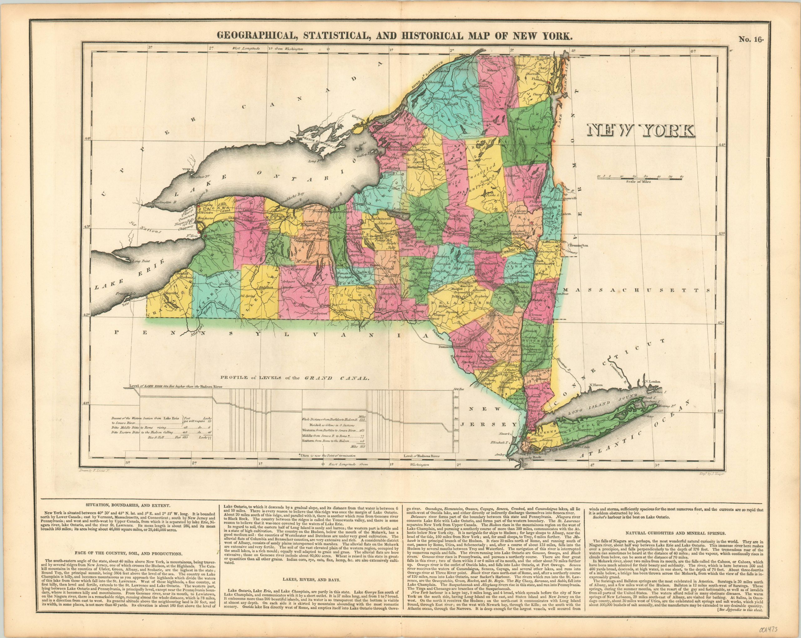
Geographical, Statistical, and Historical Map of New York
Original price was: $195.00.$145.00Current price is: $145.00.
Gorgeous map of New York published during the construction of the Erie Canal.
1 in stock
Description
The impact of the opening of the Erie Canal in 1825 on the economy of New York and the entire United States cannot be overstated. Freight shipping costs from east to west (and vice versa) plummeted, allowing for the easier delivery of manufactured goods to rural areas in the region that will eventually become known as the Midwest. Furthermore, the new transportation option allowed for huge waves of immigrants to settle in the now accessible areas.
A profile of the “Grand Canal” can be seen in the lower left on this map of New York, published just a few years before it opened. The canal route is boldly shown bisecting the state horizontally, with the excavation progress having been made as far as Utica. Counties are boldly colored by hand and topography is depicted in hachure. Numerous flags are also scattered throughout the image and colored in red, representing important historic battle sites. The map was designed by Fielding Lucas Jr. and engraved by J. Yeager. It was included as sheet number sixteen in the 1822 edition of Carey & Lea’s Complete Historical, Chronological, and Geographical American Atlas.
This important American publication was issued in six separate editions and three different languages between 1822 and 1827. It was heavily influenced by an earlier European atlas by Emmanuel Las Cases (published under the pseudonym A. Lesage.), which inspired the format of a base map surrounded by blocks of informative text and tables of statistics.
Henry Carey, a political economist and the son of prominent publisher Matthew Carey, and his brother-in-law Isaac Lea incorporated this novel theme into their atlas, which focused entirely on the countries of the Western Hemisphere. It was issued at a time of tremendous political change in both North and South America, and the detailed maps accompanied by extensive text provide a unique, often insightful, perspective on the problems and possibilities of the Americas in the first quarter of the 19th century.
Wheat, C. I. (2004). Mapping the Transmississippi West: 1540-1861. Mansfield Centre (CT): Martino Publishing. #348
Egli, L. G., & Phillips, P. L. (1974). A list of geographical atlases in the Library of Congress. Washington: Library of Congress. #1373
Map Details
Publication Date: 1822
Author: Carey & Lea
Sheet Width (in): 22.50
Sheet Height (in): 17.60
Condition: A
Condition Description: Very faint toning around the extreme outer edges and some darkening to the sheet near the plateline. Otherwise in fine condition, with bold original hand color on a crisp, clean sheet.
Original price was: $195.00.$145.00Current price is: $145.00.
1 in stock

