Geographical, Statistical, and Historical Map of Maryland
$110.00
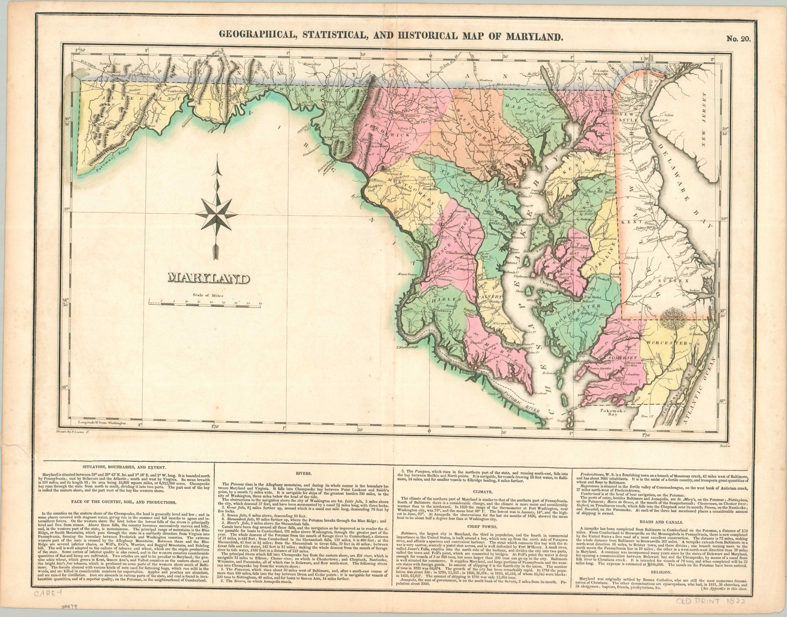
The first edition of Carey & Lea’s map of Maryland, designed by Fielding Lucas, Jr.
1 in stock
Description
This attractive map of Maryland uses bright hand color to distinguish between the state’s 19 counties, plus the District of Columbia on the banks of the Potomac River. Bright red flags are planted in the locations of important battle sites, and pictorial topography highlights Sugarloaf Mound, ridges of the Blue Range Mountains, and more. Towns and settlements are mostly connected by a robust network of roads and turnpikes, detailed further in the accompanying text. Mileage is helpfully provided between various points along each route.
Proposed canals, the other primary method of 19th-century transportation, are also shown. The most influential, the Chesapeake & Delaware Canal, was originally planned in 1802 but underwent a series of delays due to engineering difficulties and financial mismanagement. A paragraph in the lower right alludes to these setbacks, and subsequent editions of the map will revise upwards the estimated cost.
This particular example was issued as sheet number 20 in the 1822 (first) edition of Carey & Lea’s Complete Historical, Chronological, and Geographical American Atlas.
Map Details
Publication Date: 1822
Author: Carey & Lea
Sheet Width (in): 22.5
Sheet Height (in): 17.6
Condition: A-
Condition Description: Faint discoloration and some discoloration along the vertical centerfold, which has a 2" clean split at the top (repaired on verso). Some irregular tears in the lower right (confined to the margin) and a bit of light scattered spotting visible. Good to very good condition overall with nice original hand color.
$110.00
1 in stock