Geographical, Statistical, and Historical Map of Jamaica
Original price was: $125.00.$85.00Current price is: $85.00.
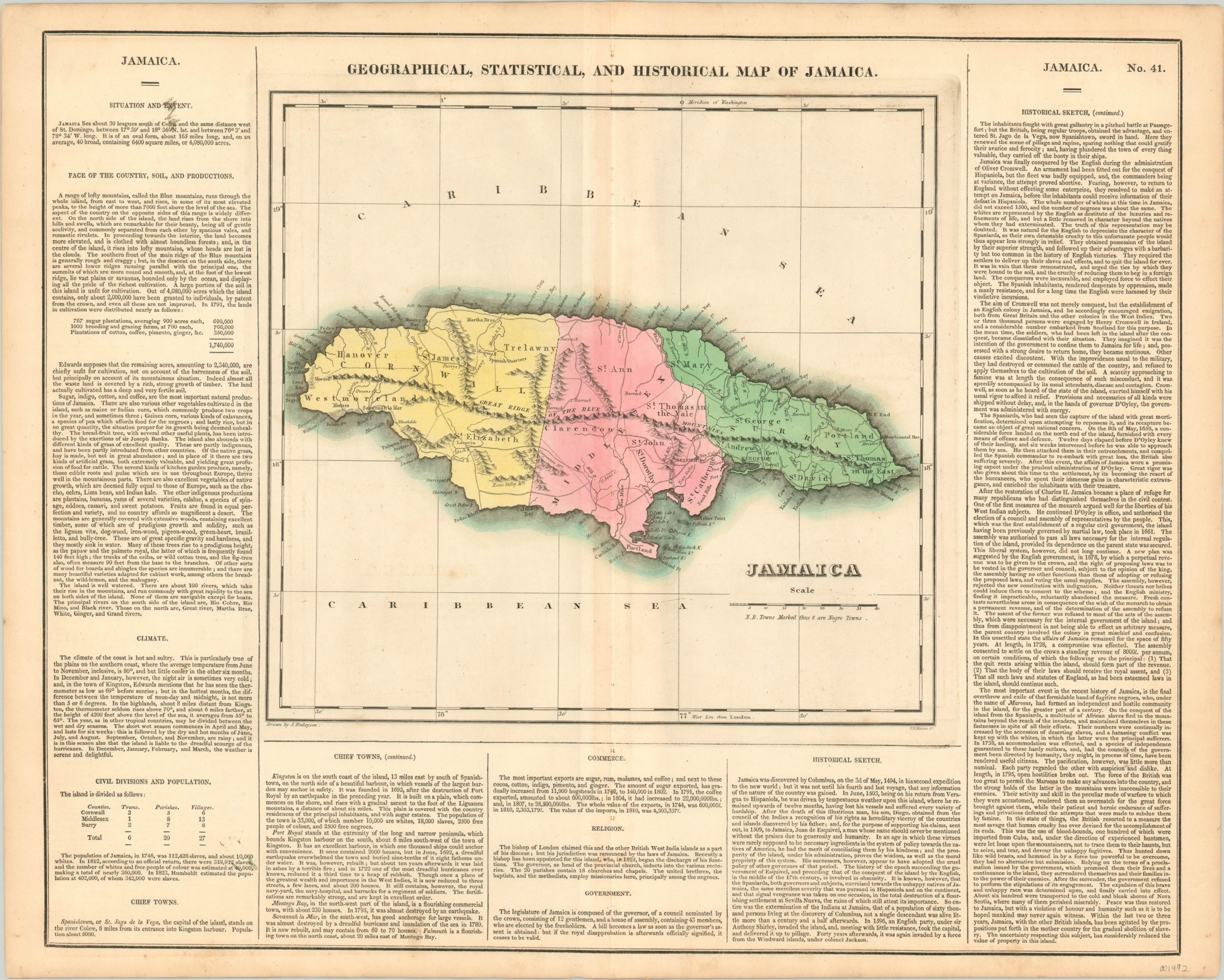
Fascinating historical map of Jamaica highlighting the island’s tumultuous racial history.
1 in stock
Description
This detailed map of Jamaica uses bright hand color to distinguish between the island’s three counties, each named after a counterpart back in England. The rugged topography is depicted pictorially, while towns, barracks, and numerous geographic features are individually labeled. Several settlements are noted with a small cross, identifying them as “Negro Towns” according to the key beneath the title. These refer to the few remaining strongholds of escaped African slaves, who began establishing small outposts in the mountainous interior almost immediately after they began to be imported to the island’s plantations.
Called maroons, the tenacious survivors would wage an ongoing series of conflicts with the Spanish, then the British, colonial occupiers. The Second Maroon War is covered in some detail in the accompanying text, which excoriates the British for the cruel use of bloodhounds and the false promises of the peace negotiations – American hypocrisy at its finest. Population statistics also highlight the racial tension, as black slaves wildly outnumbered the white overlords. “In 1823, Humboldt estimated the population at 402,000, of whom 342,000 were slaves.” The map was drawn by J. Finlayson and engraved by P.E. Hamm. It was issued as sheet number 41 in the 1826 edition of Carey & Lea’s Complete Historical, Chronological, and Geographical American Atlas.
This important American publication was issued in six separate editions and three different languages between 1822 and 1827. It was heavily influenced by an earlier European atlas by Emmanuel Las Cases (published under the pseudonym A. Lesage.), which inspired the format of a base map surrounded by blocks of informative text and tables of statistics.
Henry Carey, a political economist and the son of prominent publisher Matthew Carey, and his brother-in-law Isaac Lea incorporated this novel theme into their atlas, which focused entirely on the countries of the Western Hemisphere. It was issued at a time of tremendous political change in both North and South America, and the detailed maps accompanied by extensive text provide a unique, often insightful, perspective on the problems and possibilities of the Americas in the first quarter of the 19th century.
Wheat, C. I. (2004). Mapping the Transmississippi West: 1540-1861. Mansfield Centre (CT): Martino Publishing. #348
Egli, L. G., & Phillips, P. L. (1974). A list of geographical atlases in the Library of Congress. Washington: Library of Congress. #1373
Map Details
Publication Date: 1826
Author: Carey & Lea
Sheet Width (in): 22.10
Sheet Height (in): 17.50
Condition: B+
Condition Description: Faint discoloration along the vertical centerfold and a few small spots of soiling in the margins. Two blemishes within the text (lower left, upper left corner) and there is a bit of darkening to the map around the plateline. Remains in very good condition, with bright original hand color.
Original price was: $125.00.$85.00Current price is: $85.00.
1 in stock