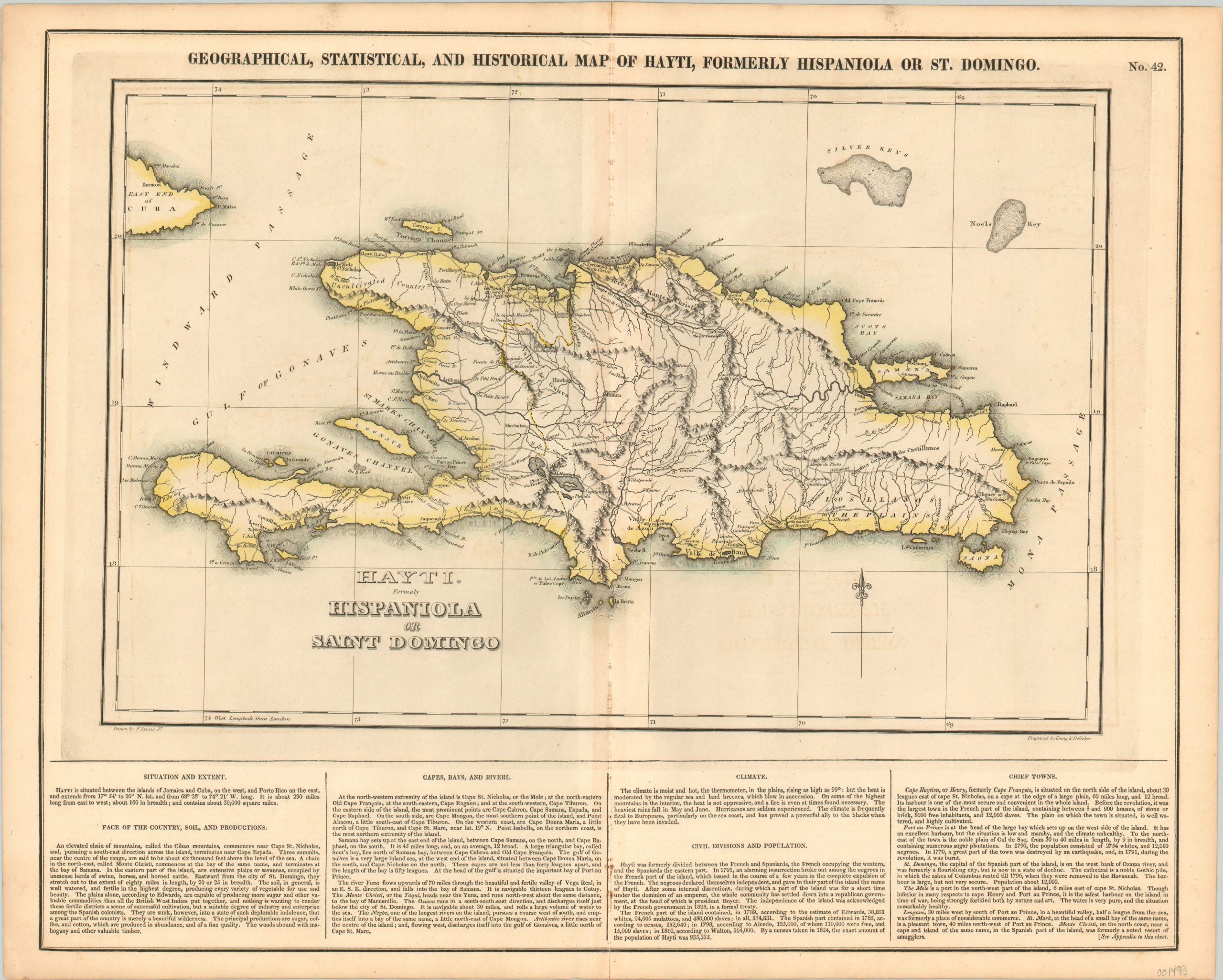
Geographical, Statistical, and Historical Map of Hayti, Formerly Hispaniola or St. Domingo.
Original price was: $125.00.$85.00Current price is: $85.00.
Compelling copperplate engraving of the short lived unification of the island of Hispaniola.
1 in stock
Description
The first thing that may catch the eye of a modern audience is the absence of the geopolitical division on the island of Hispaniola, equating to the modern day countries of Haiti and the Dominican Republic. For a few decades in the mid-19th century, the island was unified under one governmental administration (1822-1844) into the Republic of Haiti, seen on this map published a few years after the reorganization of the territory. Place names reflect the former division of the island under Spanish and French colonial occupation, while the island’s rugged topography is depicted pictorially.
Text along the bottom of the sheet provides further information on the history, geography and political organization of Haiti; including criticisms of the “indolent” Spanish and warnings of tropical diseases “frequently fatal to Europeans.” The map was drawn by Fielding Lucas, Jr. and engraved by Young & Delleker. It was included as page number 42 in the 1826 edition of Carey & Lea’s Complete Historical, Chronological, and Geographical American Atlas.
This important American publication was issued in six separate editions and three different languages between 1822 and 1827. It was heavily influenced by an earlier European atlas by Emmanuel Las Cases (published under the pseudonym A. Lesage.), which inspired the format of a base map surrounded by blocks of informative text and tables of statistics.
Henry Carey, a political economist and the son of prominent publisher Matthew Carey, and his brother-in-law Isaac Lea incorporated this novel theme into their atlas, which focused entirely on the countries of the Western Hemisphere. It was issued at a time of tremendous political change in both North and South America, and the detailed maps accompanied by extensive text provide a unique, often insightful, perspective on the problems and possibilities of the Americas in the first quarter of the 19th century.
Wheat, C. I. (2004). Mapping the Transmississippi West: 1540-1861. Mansfield Centre (CT): Martino Publishing. #348
Egli, L. G., & Phillips, P. L. (1974). A list of geographical atlases in the Library of Congress. Washington: Library of Congress. #1373
Map Details
Publication Date: 1826
Author: Carey & Lea
Sheet Width (in): 22.00
Sheet Height (in): 17.50
Condition: B
Condition Description: Moderate discoloration and spotting along the vertical centerfold, and some darkening to the sheet from the impression of the plate. A bit of soiling in the upper margin, but overall the map remains in good to very good condition.
Original price was: $125.00.$85.00Current price is: $85.00.
1 in stock

