
Geographical, Statistical, and Historical Map of Chili
Original price was: $125.00.$85.00Current price is: $85.00.
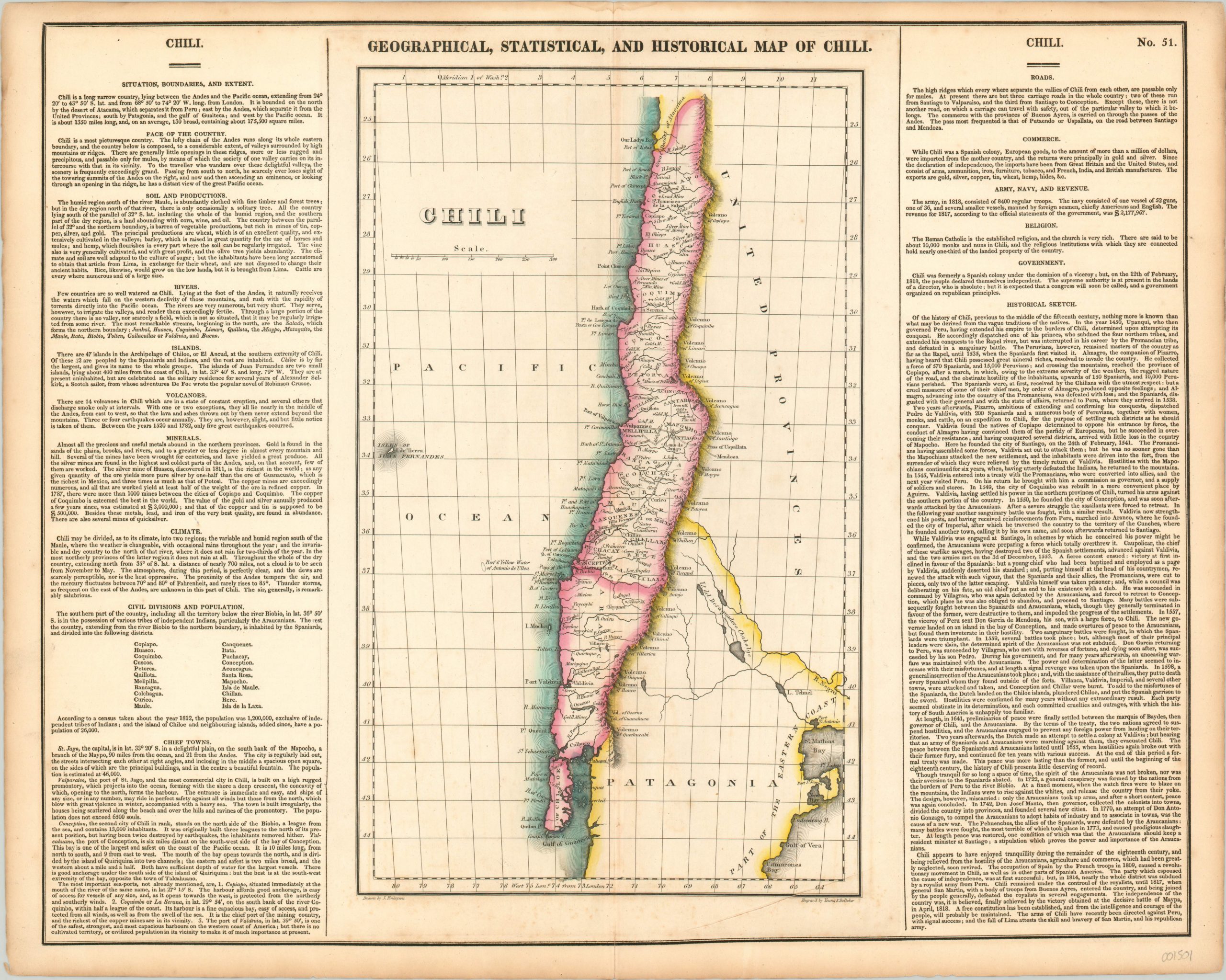
Finely engraved map of Chili issued during its struggle for independence.
1 in stock
Description
Napoleon’s conquest of the Iberian Peninsula in 1807 fundamentally rocked the Spanish Empire to the core. The French emperor forced the abdication of King Ferdinand VII, and as a result, independence movements gained momentum across the globe. Chile was one such hotspot, and a local provisional government, or junta, declared a provisional Constitution in 1812. Royalist opposition responded with force, and a series of engagements took place across the country in the following several years. It wasn’t until 1818, after a series of victories by Jose de San Martin and Bernardo O’Higgins, that independence could be formally declared.
The map presents the new state just a few years after this re-organization, and includes a host of interesting contemporary details. Mines, the principal source of Chile’s wealth, can be seen dotted throughout, and the Andes are prominently depicted pictorially running from north to south along the length of the country. Numerous volcanoes are individually labeled, as is the Pass of Uspallata, which played a critical role in the aforementioned wars of intendance. Surrounding the image are numerous blocks of text which provide further information on the climate, economy, industry, and history of the country. The map was drawn by J. Finlayson and engraved by Young & Delleker. It was published as sheet number 51 in the 1822 (first) edition of Carey & Lea’s Complete Historical, Chronological, and Geographical American Atlas.
This important American publication was issued in six separate editions and three different languages between 1822 and 1827. It was heavily influenced by an earlier European atlas by Emmanuel Las Cases (published under the pseudonym A. Lesage.), which inspired the format of a base map surrounded by blocks of informative text and tables of statistics.
Henry Carey, a political economist and the son of prominent publisher Matthew Carey, and his brother-in-law Isaac Lea incorporated this novel theme into their atlas, which focused entirely on the countries of the Western Hemisphere. It was issued at a time of tremendous political change in both North and South America, and the detailed maps accompanied by extensive text provide a unique, often insightful, perspective on the problems and possibilities of the Americas in the first quarter of the 19th century.
Wheat, C. I. (2004). Mapping the Transmississippi West: 1540-1861. Mansfield Centre (CT): Martino Publishing. #348
Egli, L. G., & Phillips, P. L. (1974). A list of geographical atlases in the Library of Congress. Washington: Library of Congress. #1373
Map Details
Publication Date: 1822
Author: Carey & Lea
Sheet Width (in): 22.00
Sheet Height (in): 17.60
Condition: A-
Condition Description: Faint scattered foxing visible near the lower middle of the sheet, and a bit of discoloration is evident along the vertical centerfold. The margins are toned from age, and there is one small damp stain across the top edge, well away from the neatline. Very good condition overall, with bright original hand color.
Original price was: $125.00.$85.00Current price is: $85.00.
1 in stock