Geographical and Statistical Map of Ireland
$175.00
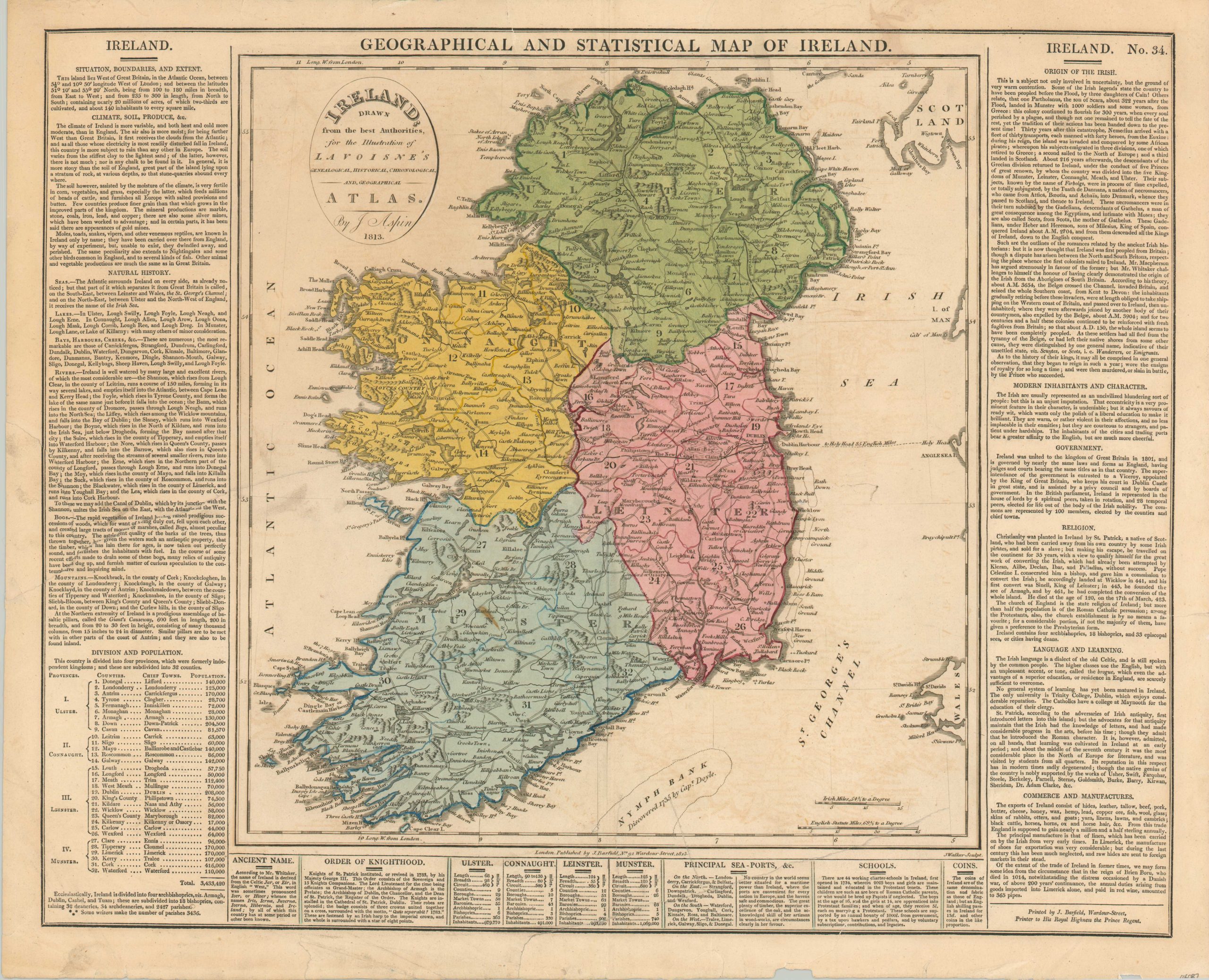
Detailed map of Ireland about a decade after the 1800 Acts of Union.
1 in stock
Description
This attractive copperplate engraved map of Ireland presents an informative overview of the island from the early 19th century. Original hand color vibrantly distinguishes the territory of the four Irish counties. Dozens of place names are connected via a robust network of roads. Topography is depicted pictorially, reflecting rugged terrain in the north and the south, and prominent geographic features are labeled.
Text describing the physical landscape, climate, history, and culture of Ireland can be seen in the borders. This presents a distinctly British perspective, with one notable entry in the Language and Learning section reading, “The Irish language is a dialect of the old Celtic, and is still spoken by the common people. The higher classes use the English, but with an unpleasant accent, or tone, called the brogue, which even the advantages of a superior education, or residency in England, are scarcely sufficient to overcome.”
The map was designed by Jehoshaphat Aspin (possibly a nom-de-plume for a female author) and published in 1813 as part of Lavoisne’s Genealogical Historical Chronological and Geographical Atlas.
Map Details
Publication Date: 1813
Author: Jehoshaphat Aspin
Sheet Width (in): 21.1
Sheet Height (in): 17.25
Condition: B
Condition Description: Several repaired tears along the outer edges of the sheet, the largest of which enters the text but not the image. A heavy printer's crease is visible on the left side of the page. Minor offsetting and a few dark smudges in the map, which features attractive original body color. About good condition overall. Blank on verso.
$175.00
1 in stock