Geographia Map Company’s Large Scale Map of Korea
$40.00
Educating the public during the Korean War.
1 in stock
Description
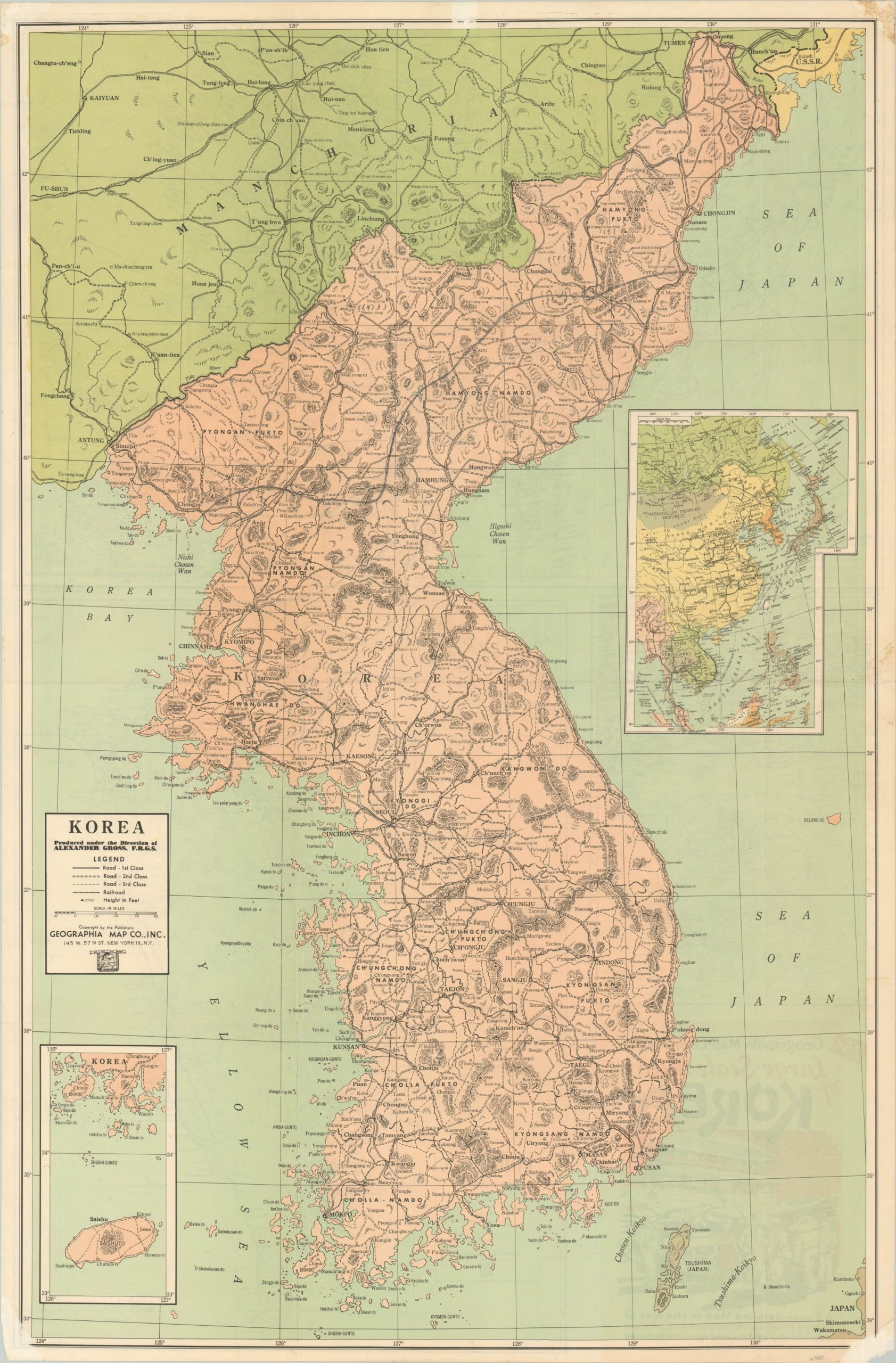
This densely informative, yet highly comprehensible, map of Korea was published in New York City by the Geographia Map Company around 1950 – during the early years of American involvement in the conflict. Roads and railroads are noted according to the legend, while towns and geographic features are labeled within the image.
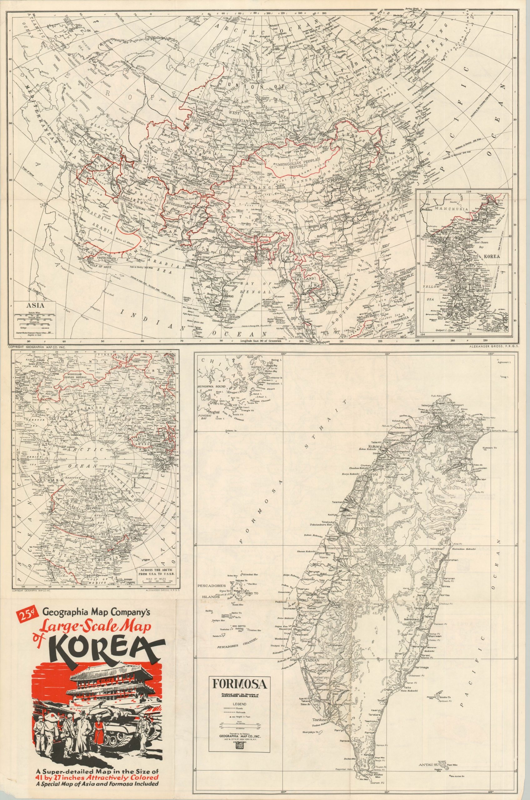
An inset map in the upper right shows more of eastern Asia, while a second inset in the lower left shows Jeju, South Korea’s largest island. The verso of the sheet presents a series of wartime maps that cover the island of Formosa (Taiwan), the entire continent of Asia, and the aviation routes over the Arctic Circle.
Map Details
Publication Date: c. 1951
Author: Geographia Map Company
Sheet Width (in): 26.50
Sheet Height (in): 40.60
Condition: B+
Condition Description: Double sided map creased along former fold lines and with minor image loss in the corners due to where previously hung with old tape. Light soiling and edge wear, consistent with age and use.
$40.00
1 in stock