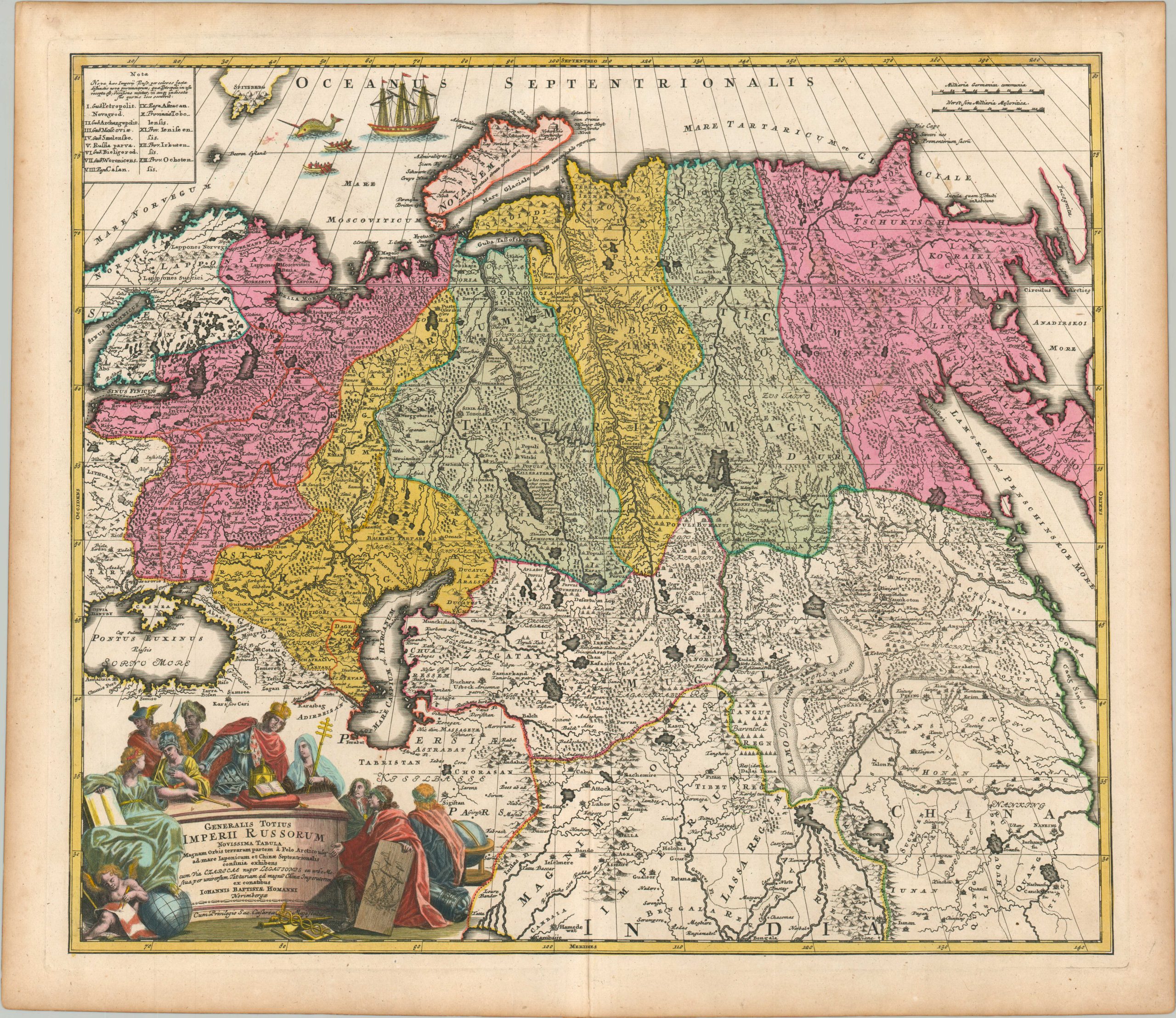
Generalis Totius Imperii Russorum Novissima Tabula
$450.00
Beautiful map of the Russian Empire in the early 18th century.
1 in stock
Description
This largely speculative map of the massive Russian Empire was originally published around 1723 in Nuremberg as part of an atlas by Johann Baptiste Homann. The recently concluded Great Northern War (1700 – 1721) between Sweden and Russia led Tsar Peter the Great to proclaim himself an emperor just a few years prior. Newly acquired lands along the Gulf of Finland can be seen in pink on the far left, with Russian territory extending from the Arctic Circle to the shores of the Caspian and Black Seas.
Thirteen distinct provinces and kingdoms are outlined in a text box in the upper left, with a fascinating whaling scene depicted nearby. Geographic features, settlements, and even the Great Wall of China are shown pictorially. The decorative title cartouche, lower left, reflects contemporary ideologies of the new Russian Empire, with an emphasis on exploration, the Orthodox Church, trade, and scientific advancements. A fierce-looking Cossack looms in the shadow, offering a subtle reminder of the threatening hordes.
Map Details
Publication Date: c. 1723
Author: Johnann Baptiste Homann
Sheet Width (in): 24.5
Sheet Height (in): 21.25
Condition: A-
Condition Description: Copperplate engraved map printed on thick, watermarked paper. Light wear and faint soiling visible in the margins and a few spots within the image (see upper corners). Very good overall, with nice modern hand color.
$450.00
1 in stock

