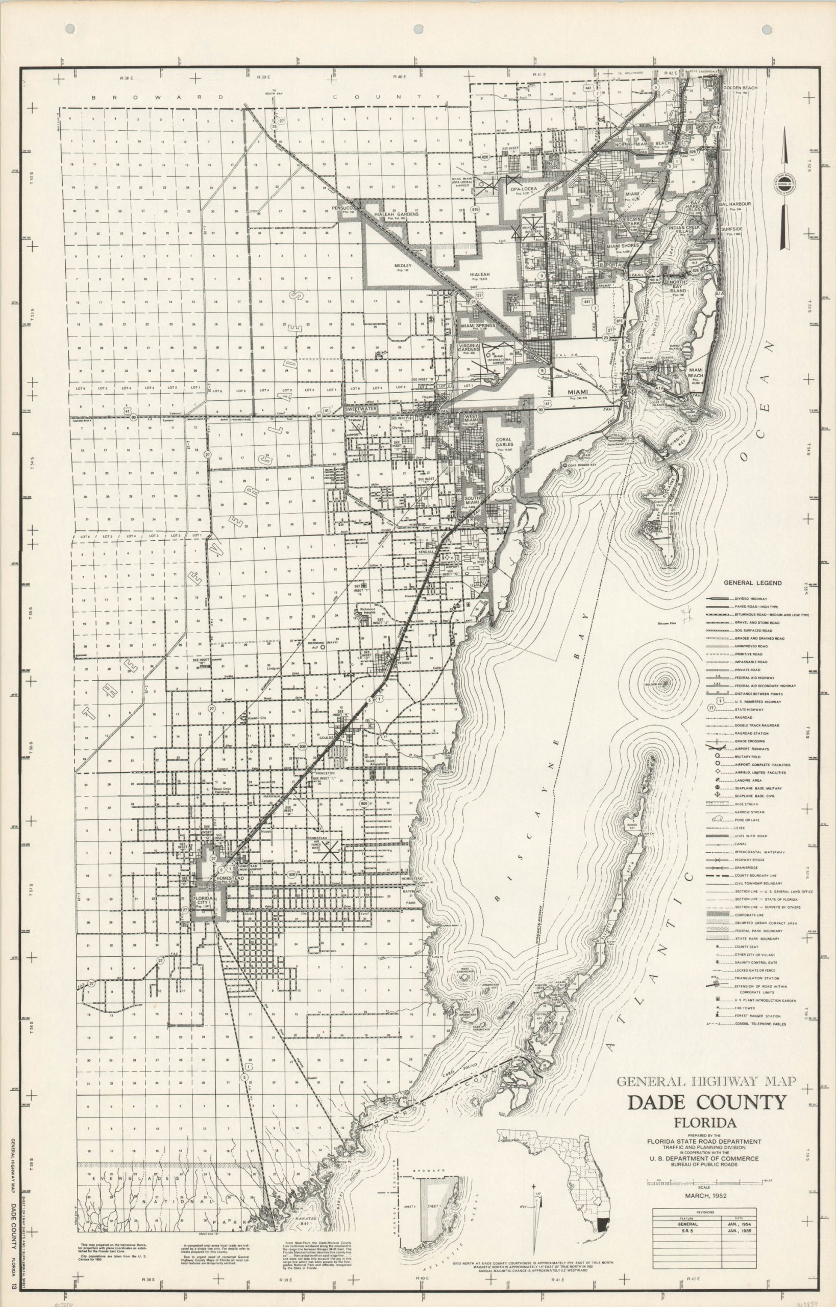
General Highway Map Dade County Florida
Intricate mid-century road map covering Florida’s Dade County.
Out of stock
Description
This detailed highway map of eastern Dade County, Florida was originally published by the State Road Department in 1952, though this example shows updates to 1955 according to the revision table in the lower right. One of two sheets that cover the county, this one includes the cities of Miami, Coral Gables, and Homestead. Over a dozen different categories and types of roads are identified throughout the image; along with other transportation routes, important infrastructure, and survey lines.
The early 1950s’ were a period of significant growth for the road network across Florida, as a booming postwar economy brought tourists and permanent residents to the state by the thousands. The need for updated maps by the road department were such that a disclaimer can be seen at the bottom of the sheet, “Due to urgent need of corrected General Highway County Maps of Florida, all rural cultural features are temporarily omitted.”
Map Details
Publication Date: 1955
Author: Florida State Road Department Traffic and Planning Division
Sheet Width (in): 17.5
Sheet Height (in): 27.5
Condition: A-
Condition Description: Faint discoloration and very light wear along the outer edges of the sheet and three hole punches in the upper margin. Very good to near fine overall.
Out of stock