General Highway and Transportation Map Lee County Florida
Lee County, Florida just two years before the founding of Cape Coral.
Out of stock
Description
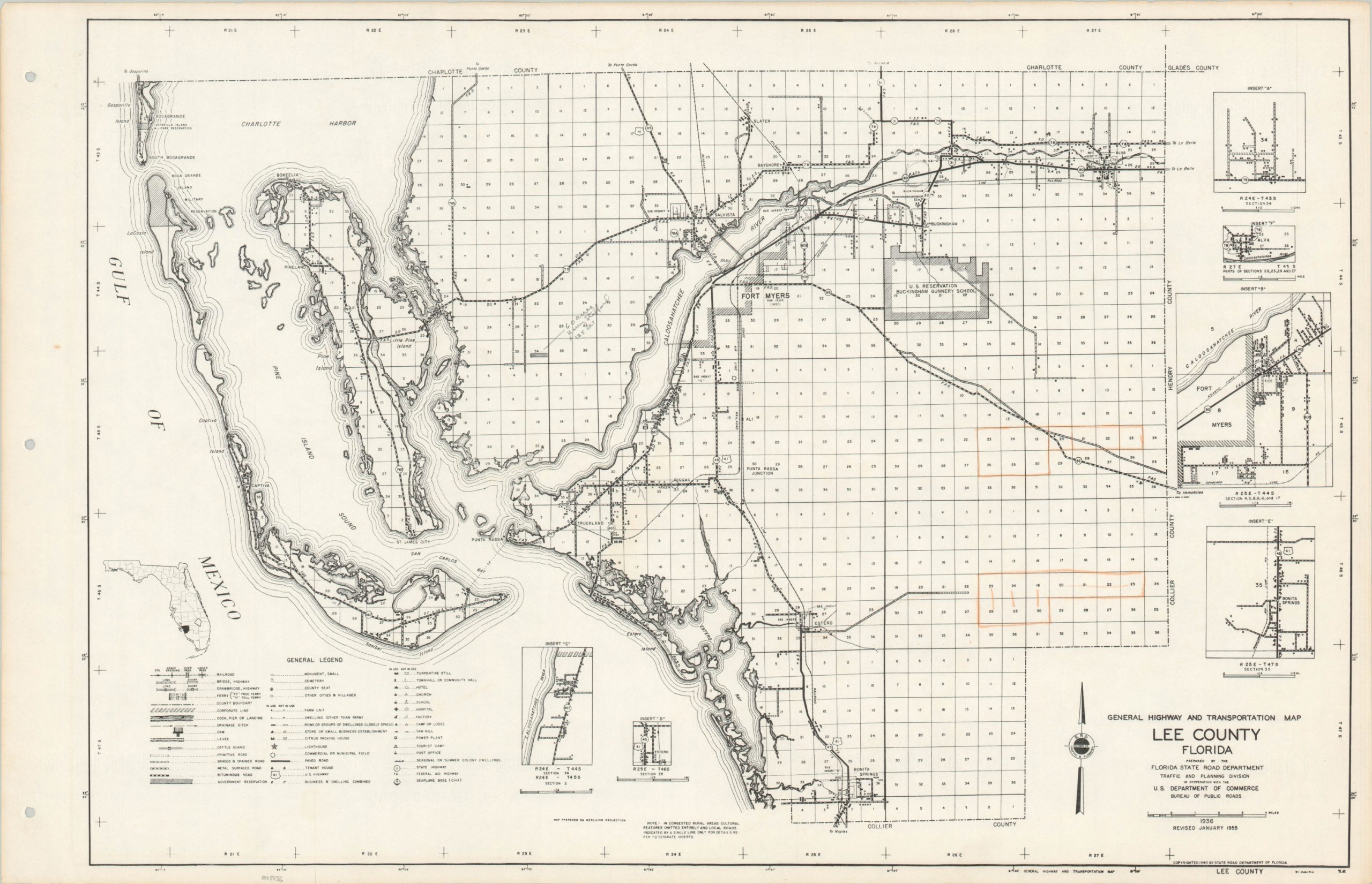
This informative highway map of Lee County, Florida was originally published by the State Road Department in 1936, though this example has been revised to show updates as of January, 1955. A comprehensive legend in the lower-left presents the symbols used to denote numerous types of road surfaces and other transportation options, infrastructure improvements, local businesses (including turpentine stills), and other structures.
A note in the lower center states “in congested rural areas cultural features omitted entirely and local roads indicated by a single line only. For details refer to separate inserts.” Six of these inset street plans outlining various rural communities can be seen throughout the negative spaces of the map.
The early 1950s’ were a period of significant growth for the road network across Florida, as a booming postwar economy brought tourists and permanent residents to the state by the thousands. (The city of Fort Meyers would grow by over 70% between 1950 and 1960). The map predates Cape Coral, developed as a planned community in 1957 and today the largest city in Lee County.
Map Details
Publication Date: 1955
Author: Florida State Road Department Traffic and Planning Division
Sheet Width (in): 27.5
Sheet Height (in): 17.75
Condition: A-
Condition Description: Faint toning around the outer edges of the sheet and three hole punches visible in the left margin. Scattered annotations including orange and graphite pencil visible within the image. Remains in very good condition overall.
Out of stock