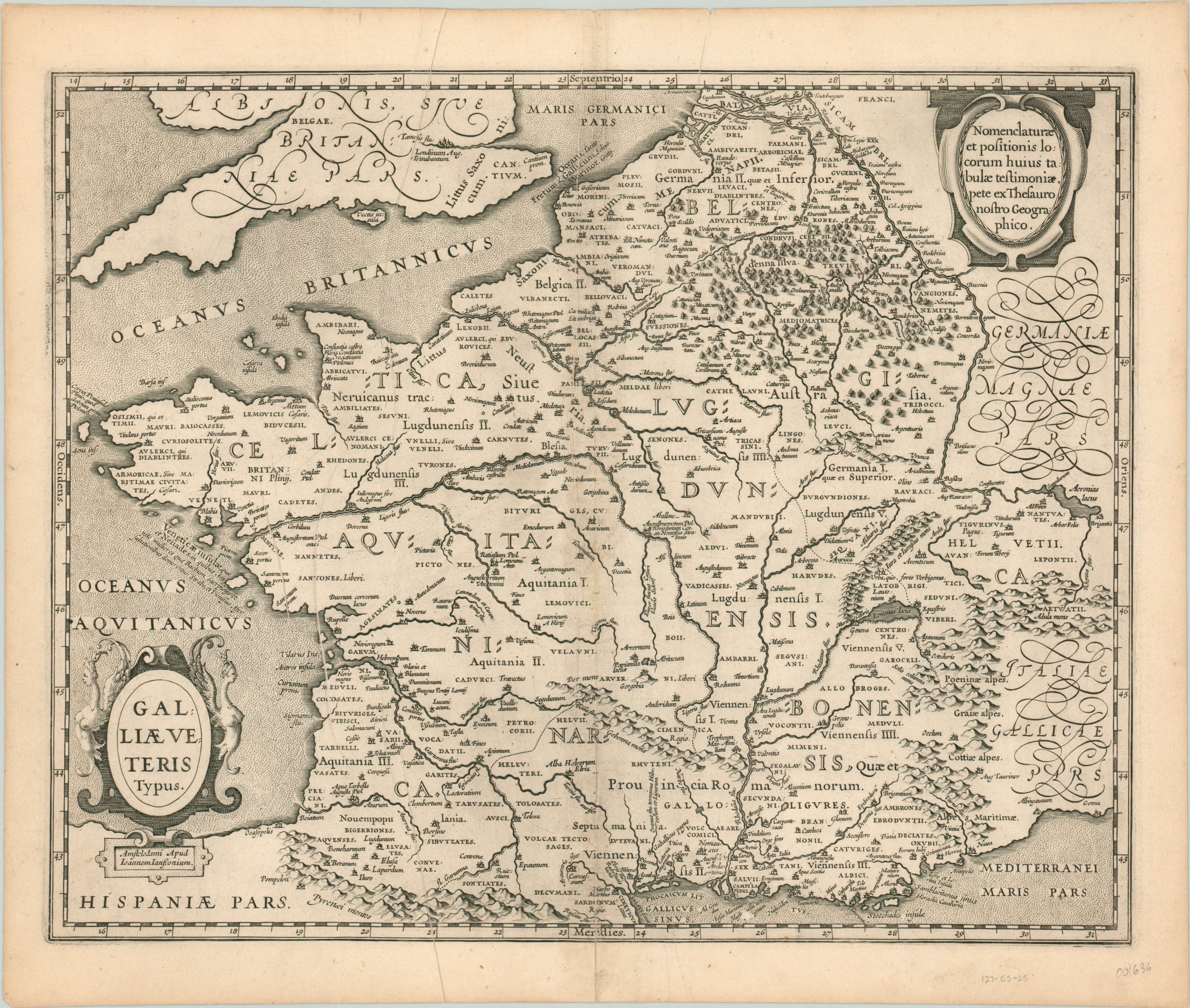
Galliae Veteris Typus
$300.00
A bold example of Jansson’s map of Roman Gaul, based on Ortelius.
1 in stock
Description
The Roman conquest of Gaul (roughly corresponding to modern day France) began in the second century BC, and culminated in Julius Caesar’s final destructive campaigns in 52 BC. Over the next five centuries, the Romans would settle the territory and Latinize it to a great extent, until they would be ousted by the Franks at the Battle of Soissons in 486.
The ancient city, labeled Suessonum, can be seen just northeast of Paris on this map, which presents Gaul under Roman rule. It was published in Amsterdam by Jan Jansson and is based on an earlier map from the 16th century by Abraham Ortelius, who in turn used classical sources such as Strabo, Ptolemy, and of course, Caesar. Several sources are quoted directly in annotations within the image, such as Strabo’s observation on the excellent dancers in the Venetian Islands.
The territory is divided into five parts; Belgica, Celtica, Lugdunensis, Cisalpina, Narbonensis, and Aquitania and numerous barbarian tribes are labeled. Pictorial elements are used to great effect to show topography, forests, settlements, and even an aqueduct. Two decorative cartouches and delicate stipple work in the sea complete the attractive image.
Map Details
Publication Date: c. 1640
Author: Jan Jansson
Sheet Width (in): 21.00
Sheet Height (in): 17.50
Condition: B
Condition Description: Moderate wear and some discoloration along the centerfold, and there are several pre-printed creases on the left side of the sheet which result in a bit of overlapping text. An attractive black and white example with a bold impression.
$300.00
1 in stock

