Gallatin County
$95.00
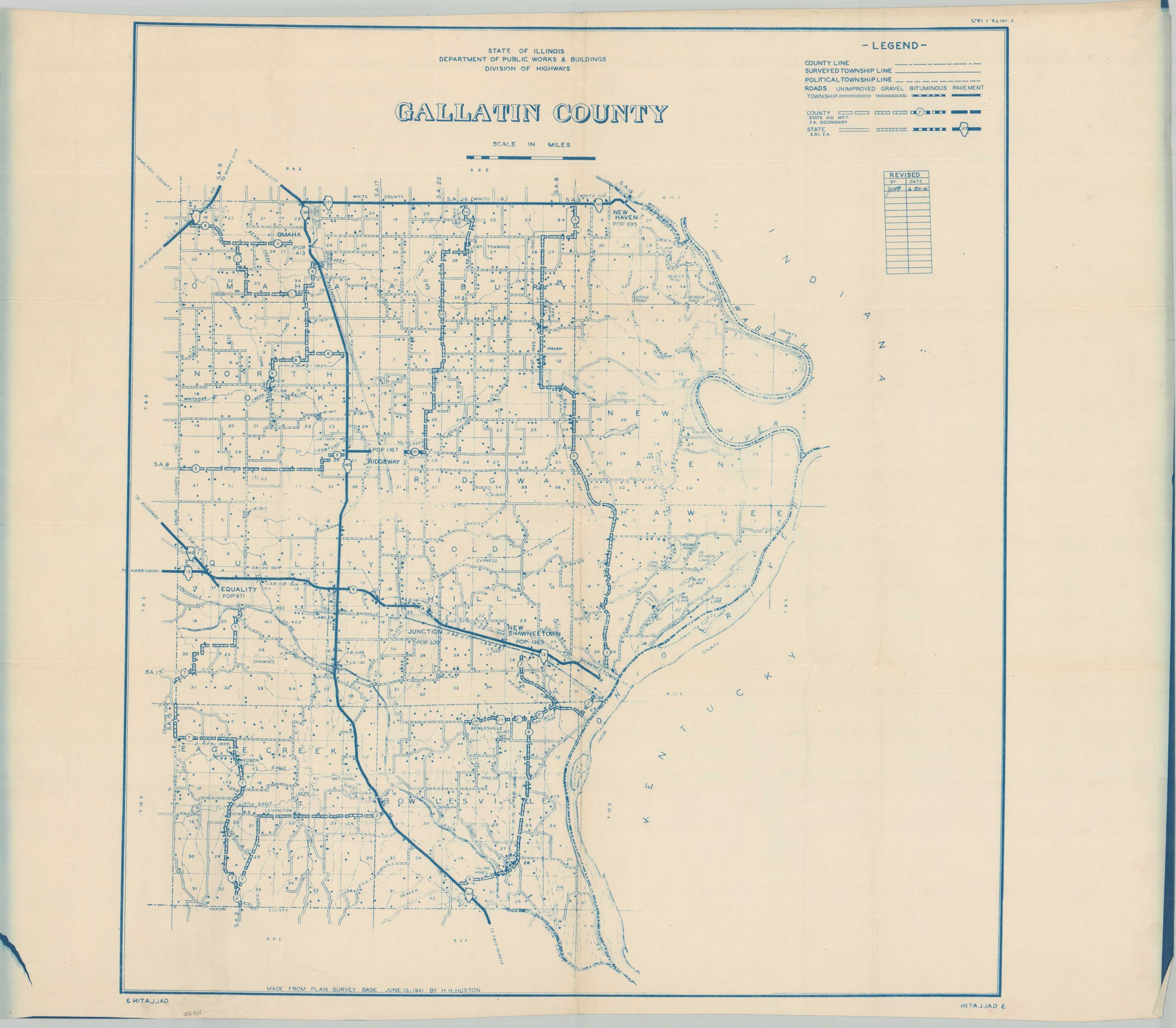
The roads of Gallatin County, Illinois during the early 1940s.
1 in stock
Description
This interesting plan of Gallatin County, Illinois provides a detailed overview of the county’s school districts, transportation routes, and boundary lines. A table in the lower right indicates the map was originally drawn in 1942, with revisions performed regularly through 1944. The effects of the devastating 1937 Ohio River Flood are still visible in the eastern part of the county. Manuscript annotations indicate further use in redesignating school and fire protection districts into the early 1950s.
Towns and villages are labeled, though Equality might be a misnomer. At the time of publication, much of southern Illinois was steeped in deeply racist attitudes. Ridgeway (population 1,167) was a sundown town, where it was widely considered unsafe for African-Americans (residents or visitors) to remain after sunset.
Source: Medium
Map Details
Publication Date: 1941
Author: Illinois Department of Public Works & Buildings Division of Highways
Sheet Width (in): 36
Sheet Height (in): 30.75
Condition: A-
Condition Description: Blueprint style map on a single-sided sheet with soft creasing along old folds. Wrinkling along the edge in the lower left and one or two spots in the image as a result of the printing process. Good to very good condition overall.
$95.00
1 in stock