G. Freytag’s Neue Verkehrskarte von Österreich-Ungarn
$250.00
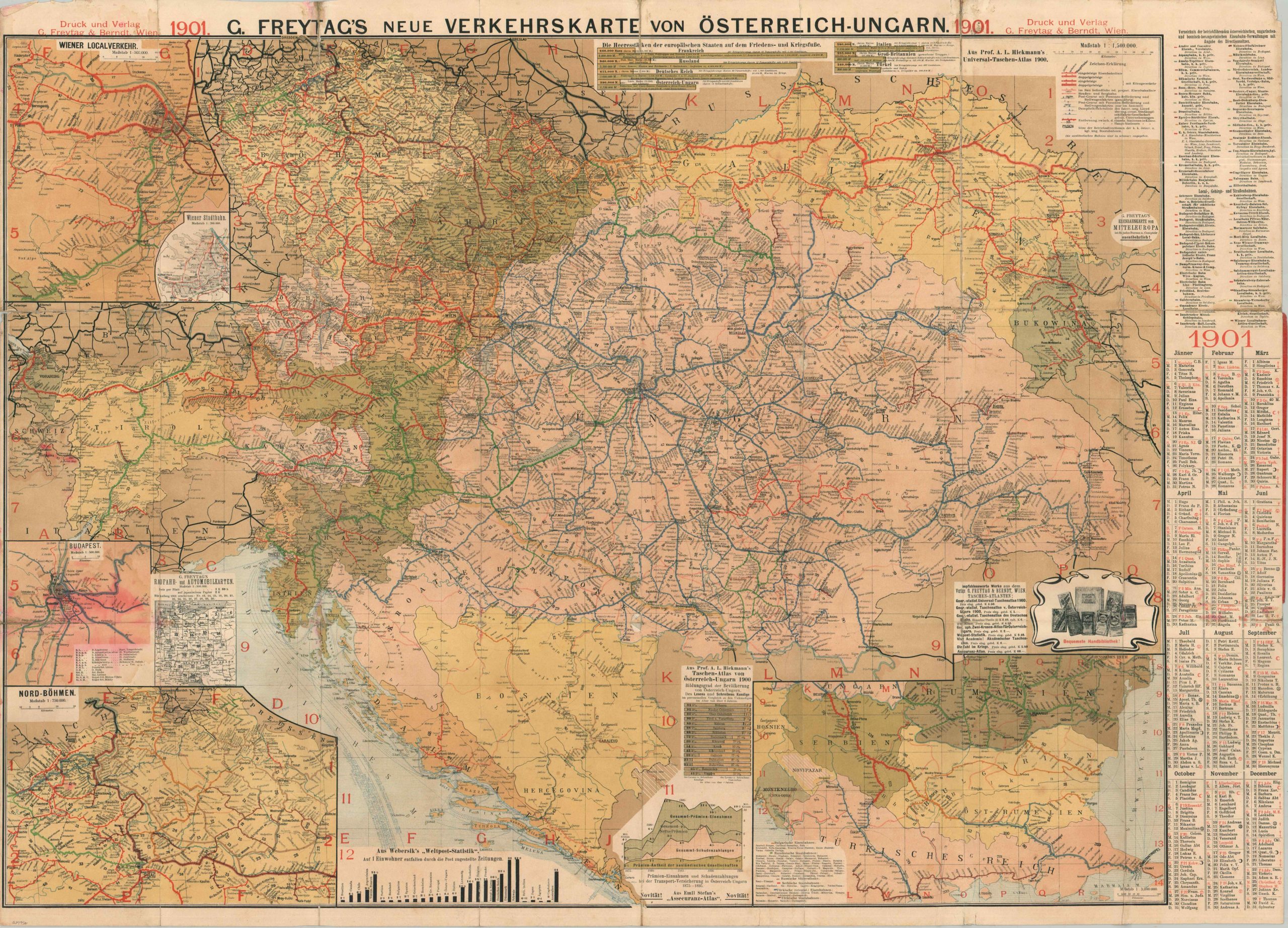
The transportation network of Austria-Hungary at the start of the 20th century.
1 in stock
Description
This well-designed transportation map of Austria-Hungary was drawn by Georg Freytag and published by the Vienna-based firm of G. Freytag & Berndt in 1901. A multi-faceted image provides a host of information about the railways, steamship lines, post routes, settlements, geographic features, and approximate distances across the vast dual-monarchy, with vibrant color highlighting the constituent possessions of the former Habsburgs.
Insets show the areas around North Bohemia (including Prague), Budapest, the Balkan states, and Vienna’s local transportation system. Several charts provide statistics on regional literacy (only 12.5% of Bukovina), transportation insurance rates, and military strengths of various European powers. All three of these reflect the underlying economic, social, and political tensions that were engulfing Austria-Hungary (and much of Europe) at the time of publication.
Map Details
Publication Date: 1901
Author: Georg Freytag
Sheet Width (in): 38.25
Sheet Height (in): 27.50
Condition: B-
Condition Description: Double-sided map pocket map affixed to original red paper wraps, heavily tattered. Extensive wear and separation along folds, much of which has been repaired and stabilized on the verso with a mix of old and contemporary archival tape. Heavy marginal wear and soiling and a large damp stain affects the inset of Budapest, lower left. Between fair and good condition overall.
$250.00
1 in stock