“Furness” Line Track Chart
$195.00
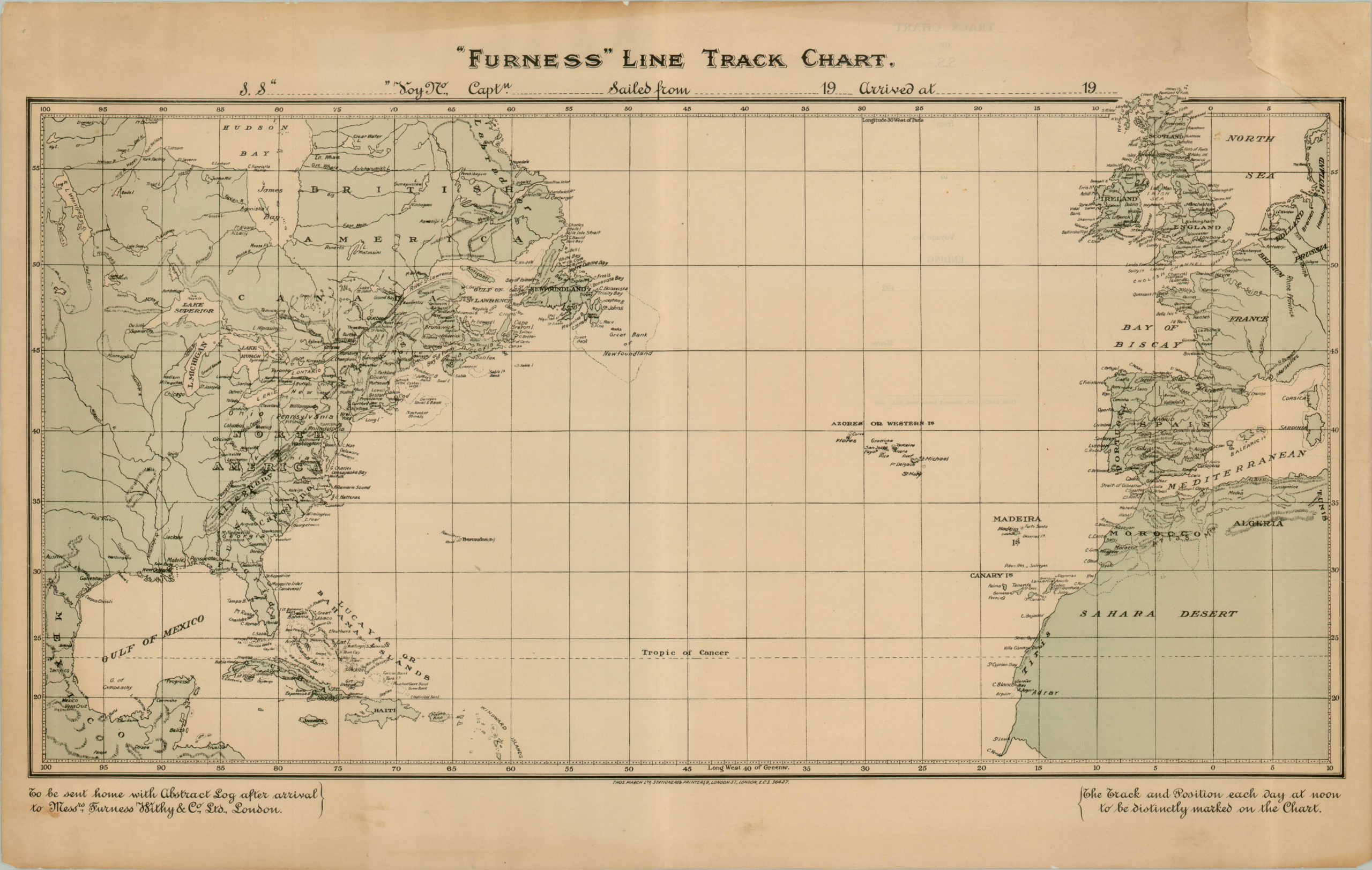
Excellent mid-century map of the Atlantic Ocean published to accompany transatlantic travel.
Description
Published by Thomas March Ltd. in London for the Furness, Withy & Co. transportation business, this map was designed as a souvenir for individuals to commemorate their trip across the Atlantic. It covers the area on both sides of the sea, including western Europe, northwest Africa, the Caribbean and North America beyond the Great Lakes.There are blanks spaces for the ship’s name, the debarkation port, destination and dates of travel. The map would be sent as a courtesy by the shipping company as a service for its customers sharing their trip with friends and family.
Furness & Withy operated both passenger and cargo lines primarily from Liverpool from 1891 to 1980, and like many shipping companies suffered severe losses in the Atlantic during World War II.
Map Details
Publication Date: c. 1935
Author: Furness, Withy & Co.
Sheet Width (in): 27.00
Sheet Height (in): 17
Condition: B
Condition Description: The map is in very good condition and has been professionally conserved on tissue. One section missing and professionally restored in the upper right corner. Some discoloration associated with age, otherwise fine.
$195.00