
Fronte Occidentale
$195.00
Italian speculation on German actions against France during World War II.
1 in stock
Description
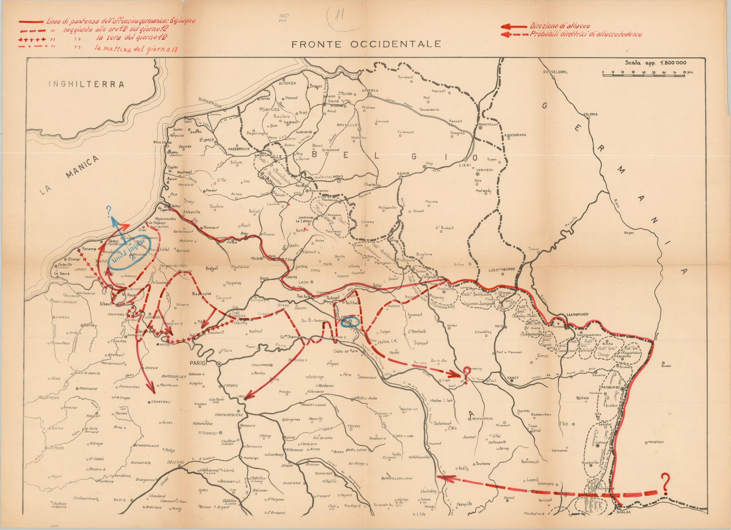
This unusual map of Northern Europe and the English Channel, published anonymously in Italian, shows the Western Front of World War II in the early months of the conflict. Major fortified areas along the Maginot Line are labeled, in addition to major railway lines, waterways, and strategic locations. Manuscript additions in red and blue theorize about the route of German attacks during the first and second weeks of the offensive. While the initial push through the Ardennes near Sedan is somewhat accurate, the follow-up is lacking in detail and mostly speculative. A possible English evacuation is shown near Dieppe.
Map Details
Publication Date: c. 1940
Author: Anonymous
Sheet Width (in): 34.4
Sheet Height (in): 25.2
Condition: B+
Condition Description: Black & white map printed on color news sheet with manuscript additions in red and blue. Toning and wear along folds, including small spots of separation at fold intersection. Good condition overall. Blank on verso.
$195.00
1 in stock