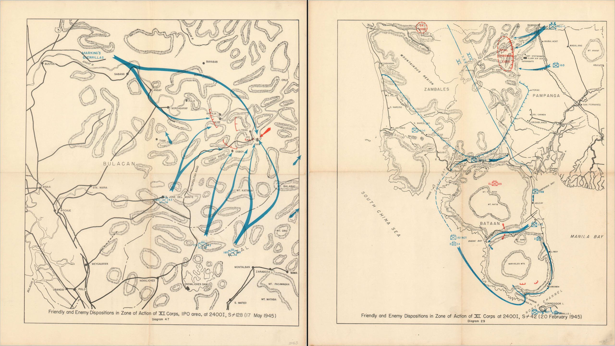
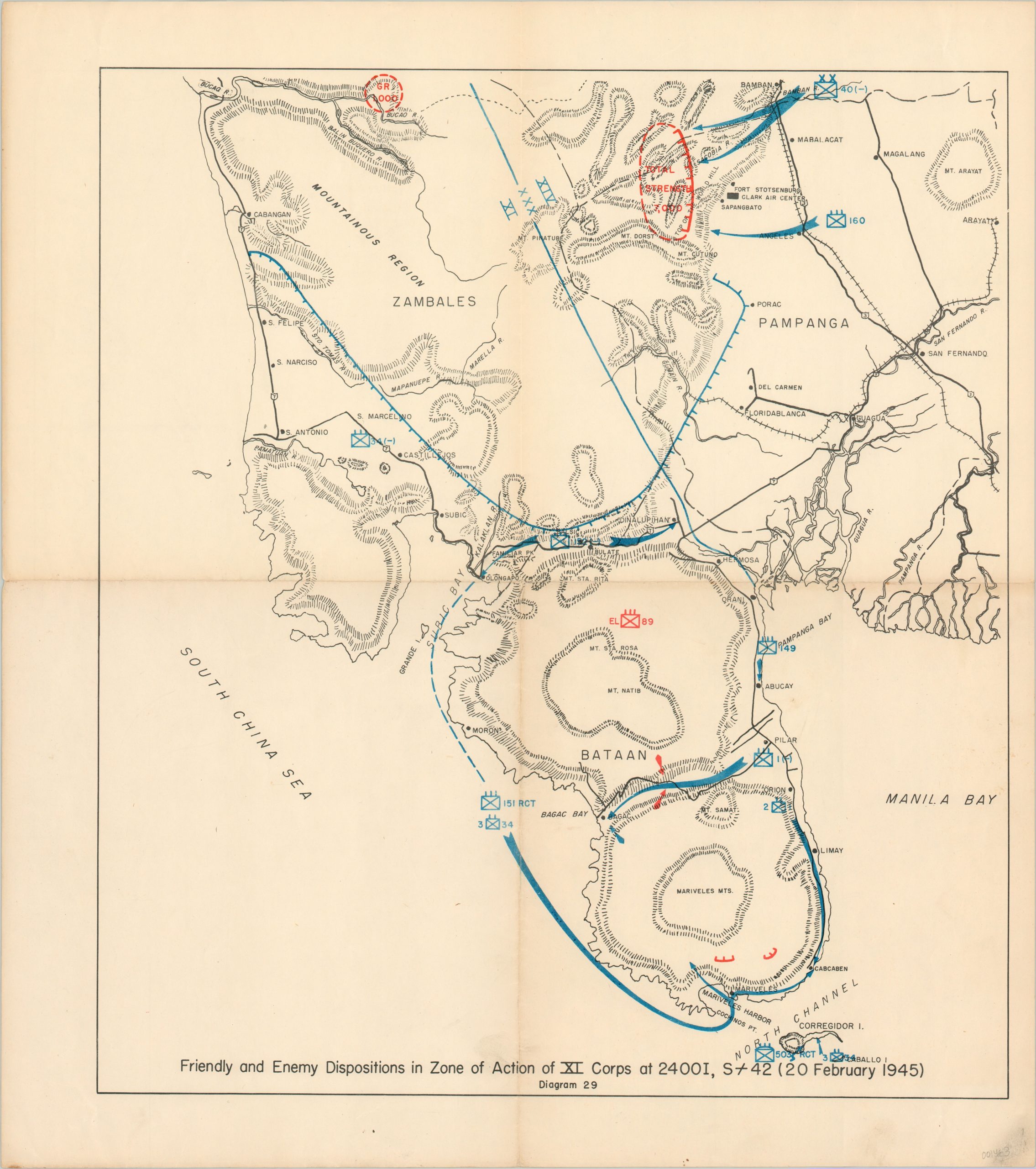
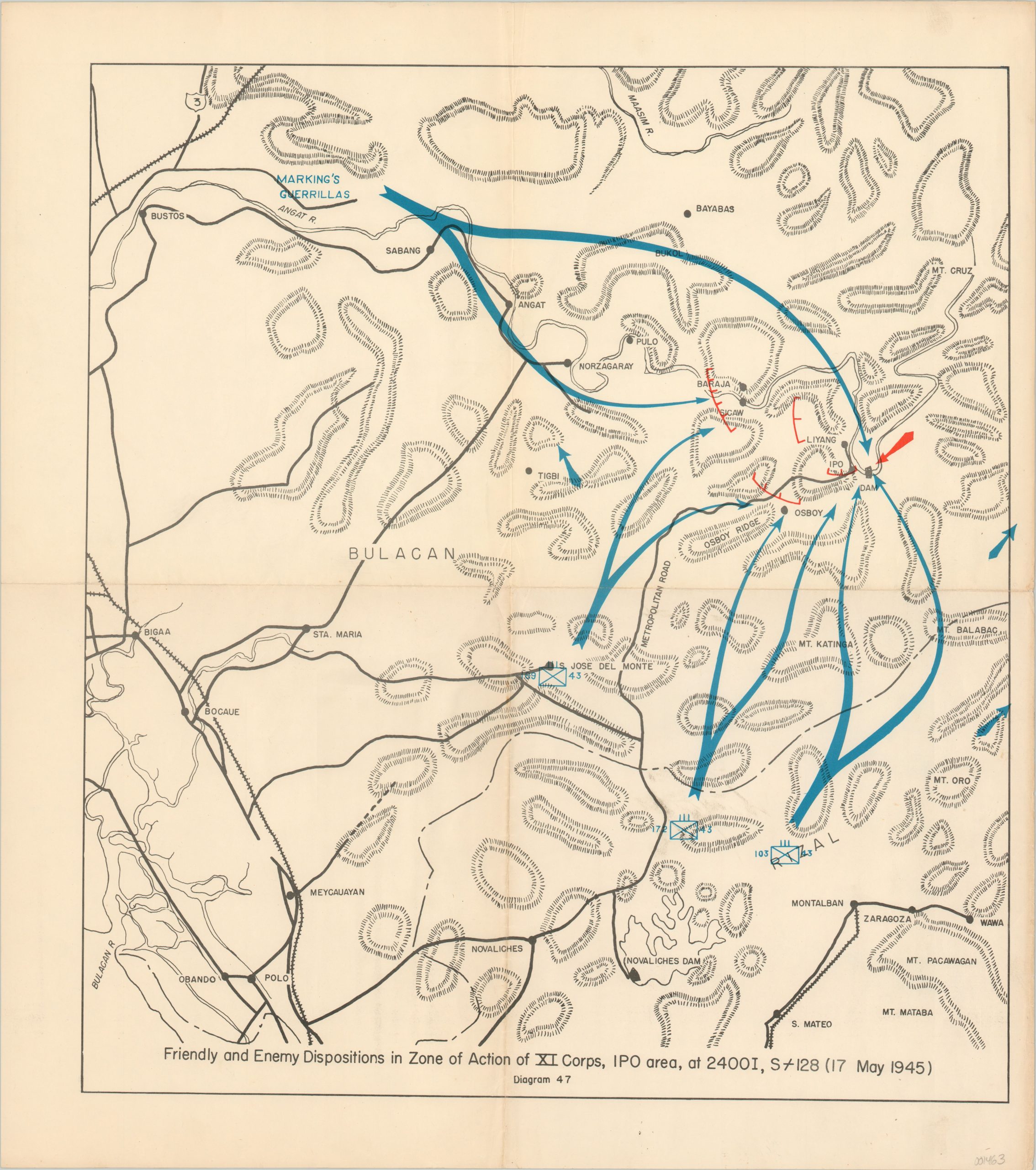
Friendly and Enemy Dispositions in the Zone of Action of XI Corps
A pair of maps highlighting combat in the Philippines near the close of World War II.
Out of stock
Description
This pair of maps was issued anonymously in late 1945, apparently as part of a larger set depicting the campaign against the Japanese in the Philippines. The first sheet covers portions of the province of Bulacan, just north of Manila, and shows the movements of the 43rd Infantry Division as it secured Ipo Dam in mid-May, 1945. Of particular interest is the coordination with Marking’s Guerillas, one of numerous local insurgent forces supported remotely by the U.S. Armed Forces.
The second sheet shows a combined forces amphibious landing on the Bataan Peninsula in February of 1945, in preparation for the forthcoming assault on Manila. Numerous U.S. Infantry units encircled large contingents of Japanese fighters in the mountainous terrain, which saw some of the most vicious fighting in the entire Pacific theater. The assault on the fortress island of Corregidor, which took place on February 16, is also depicted near the bottom of the map (note the symbol used to identify the 503rd Parachute Infantry Regiment, the “Rock Regiment” earned a Presidential Unit Citation for the aerial assault).
Map Details
Publication Date: 1945
Author: Anonymous
Sheet Width (in): 20.00
Sheet Height (in): 22.40
Condition: B
Condition Description: Creasing and wear along vertical and horizontal centerfolds and minor soiling confined most to the margins. A few small smudges and fingerprints within the image, but the two maps are in good shape overall.
Out of stock


