Freeway System Los Angeles & Vicinity
$75.00
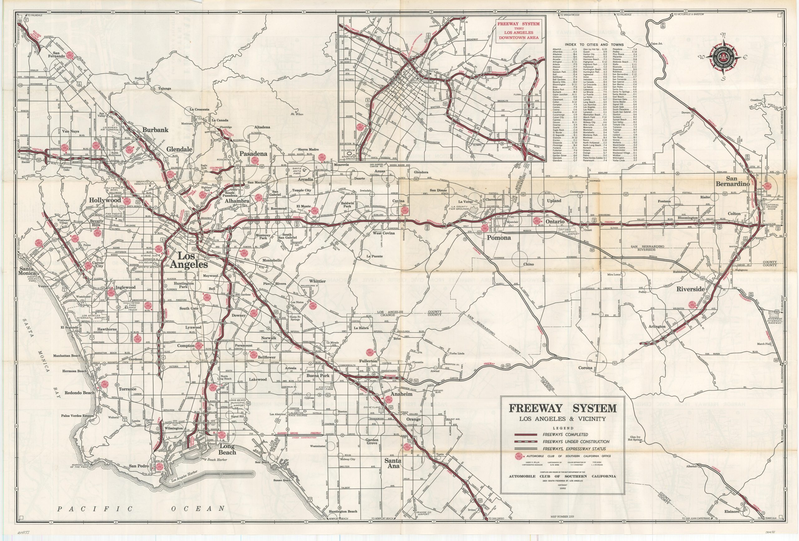
The evolving freeway network of Southern California.
1 in stock

Description
This eye-catching map of the Los Angeles freeway network shows the robust road system during a period of tremendous growth during the late 1950s/early 1960s. Freeways, both completed and under construction, are shown with solid and striped lines, respectively, while those roads with expressway status are also outlined. An inset map in the upper center presents the roads of Downtown Los Angeles, while a series of fifty-six strip maps on the verso shows the complex group of interchanges along each route.
Cartography by G.W. Hayes, performed under the supervision of Cartographic Manager Harry P. Pflum. Published in Los Angeles by the Automobile Club of Southern California around 1960. Dated using the construction of the Garden Grove Freeway (begun in 1959) and the re-numbering of California’s state route system in 1964.
Map Details
Publication Date: c. 1960
Author: G.W. Hayes
Sheet Width (in): 34.5
Sheet Height (in): 23
Condition: B
Condition Description: Moderate creasing along former fold lines, with some showing moderate toning as well. Light wear along the outer edges of the sheet as well as a bit of extraneous creasing.
$75.00
1 in stock