Freestone Fishing for Mountain Trout in northern Pennsylvania
Fishing for trout in rural northern Pennsylvania!
Out of stock
Description
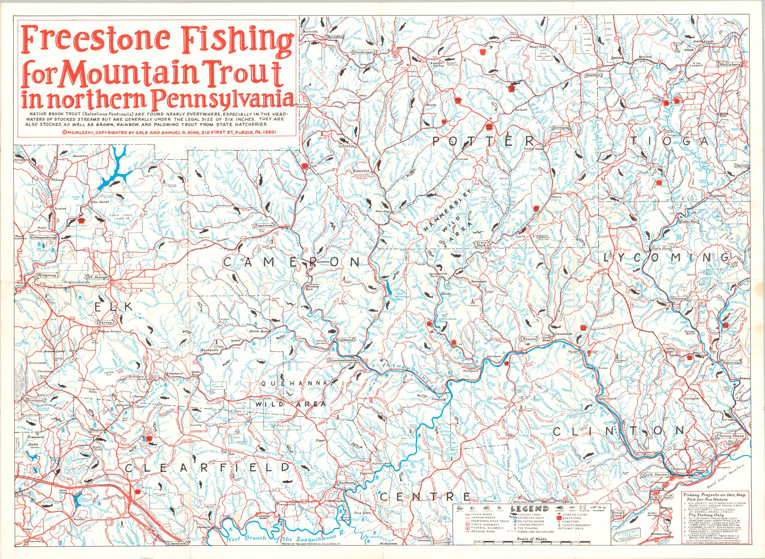
This brightly colored map boldly presents the roads, trails, and waterways across a large, remote region in northern Pennsylvania. The area was prime territory for trout fishing, and dozens of streams and rivers are marked as stocked or unstocked (though opportunity abounds in both). Other features included fee fishing sites, state parks, ongoing fishing projects (see text box in lower right for further details), and local vistas. A surprising number of areas are marked with a skull and crossbones, indicating polluted water.
The map was copyrighted in 1977 by locals Gale and Samuel A. King of DuBois, Pennsylvania (visible in the lower left). Printed by the Gray Printing Company of Falls Creek, Pennsylvania.
Map Details
Publication Date: 1977
Author: Gale and Samuel King
Sheet Width (in): 31.1
Sheet Height (in): 22.75
Condition: A-
Condition Description: Color printed map on a single-sided sheet, moderately creased along old fold lines. Several small damp stains are visible - center right margin and lower left are two evident examples. Otherwise in very good condition.
Out of stock