Frankfurt
$100.00
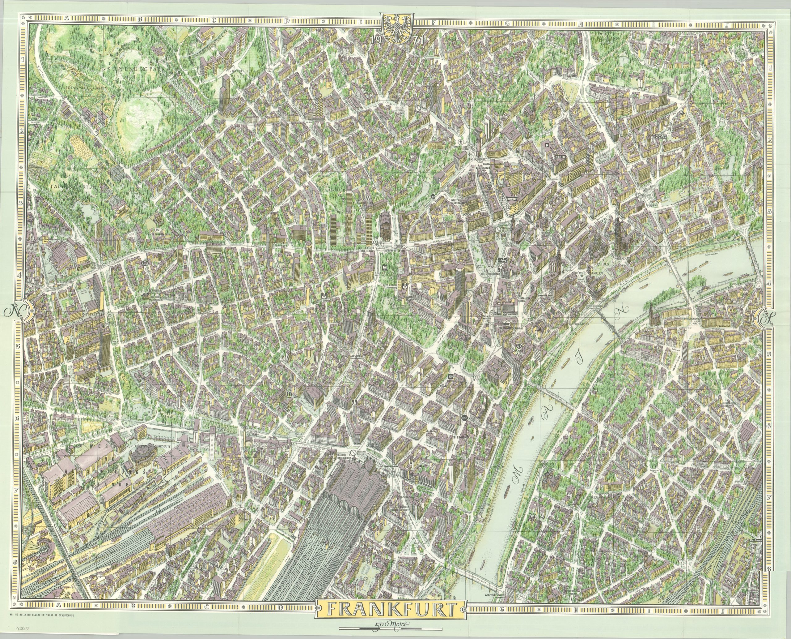
A mathematically precise view of Frankfurt am Main from the late 1960s.
1 in stock
Description
This finely detailed pictorial map of Frankfurt am Main was designed by the talented Hermann Bollmann and published in 1968. It presents an incredible aerial overview of the city at the height of its post war reconstruction and economic resurgence, allowing the reader to practically take a stroll through the streets.
Using thousands of aerial photographs and ground-level references captured from his specially modified Volkswagen, Bollmann captured the city’s architectural recovery with unmatched precision. Notable points of interest featured in this edition include the historic Römerberg square, the towering Frankfurt Cathedral, and the bustling Hauptwache, all depicted with individual building-level details.
Map Details
Publication Date: 1968
Author: Hermann Bollmann
Sheet Width (in): 26.80
Sheet Height (in): 21.50
Condition: A
Condition Description: Color printed map folded and affixed to 32 pp. booklet with stapled binding and illustrated stiff paper wraps. Covers are lightly worn and there is some light wrinkling along folds. Very good condition overall.
$100.00
1 in stock