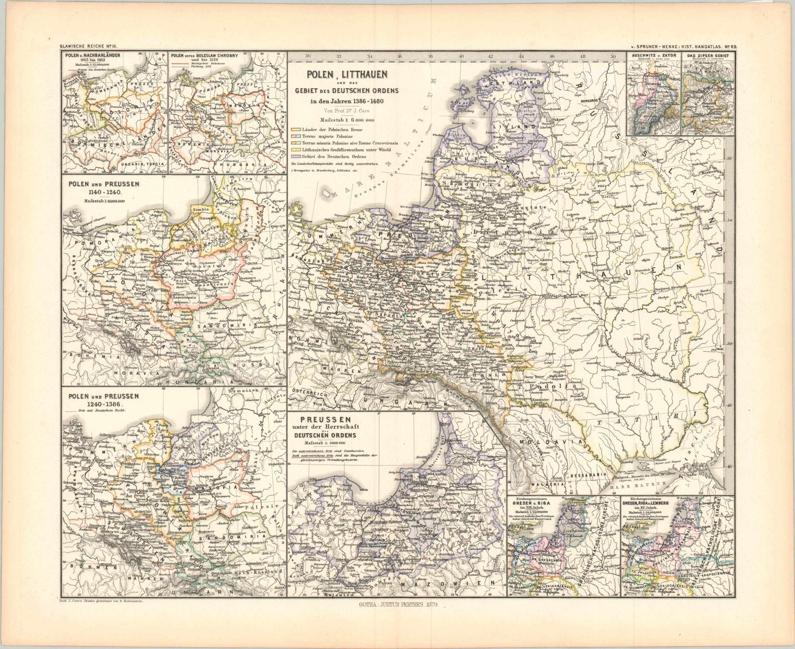
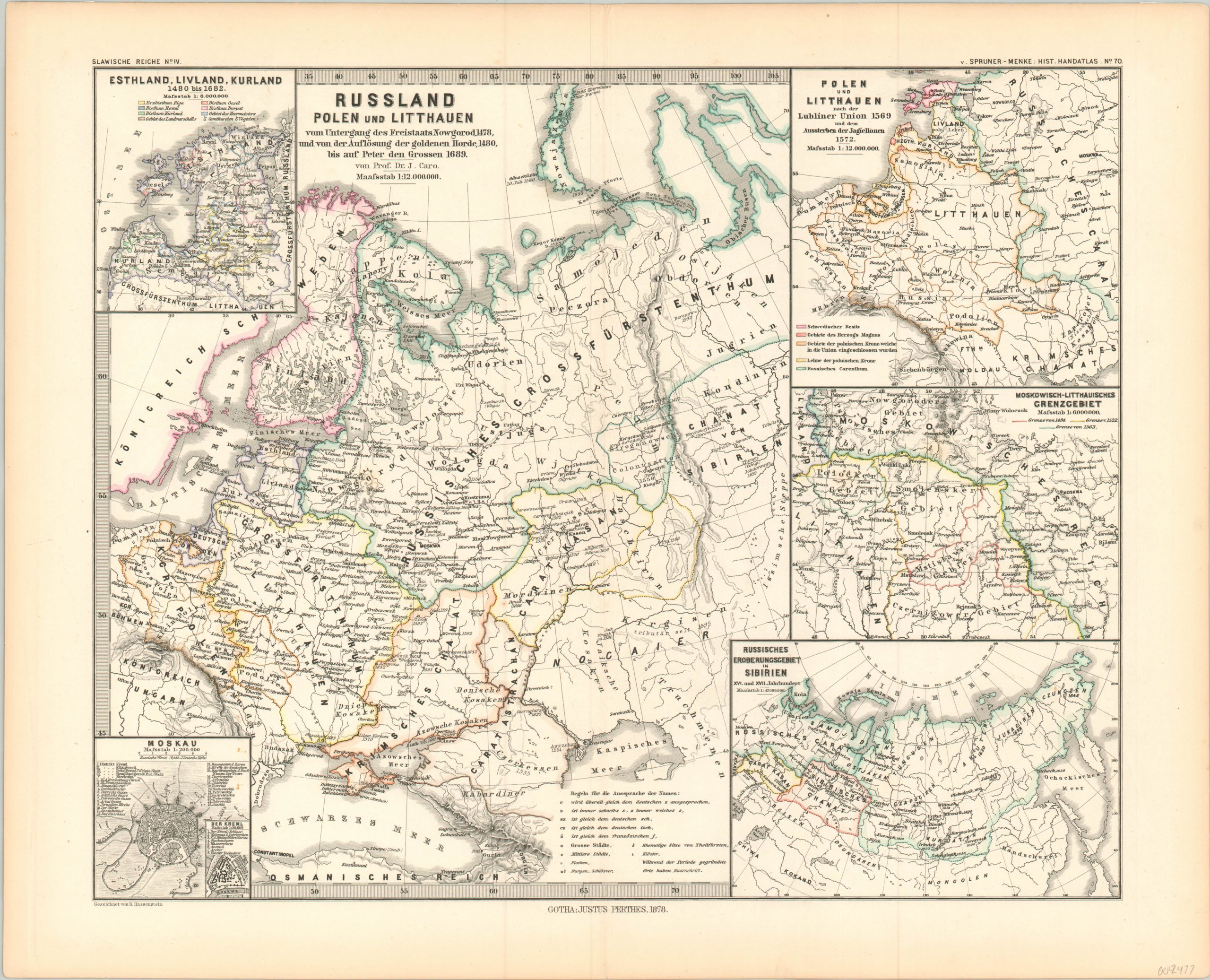
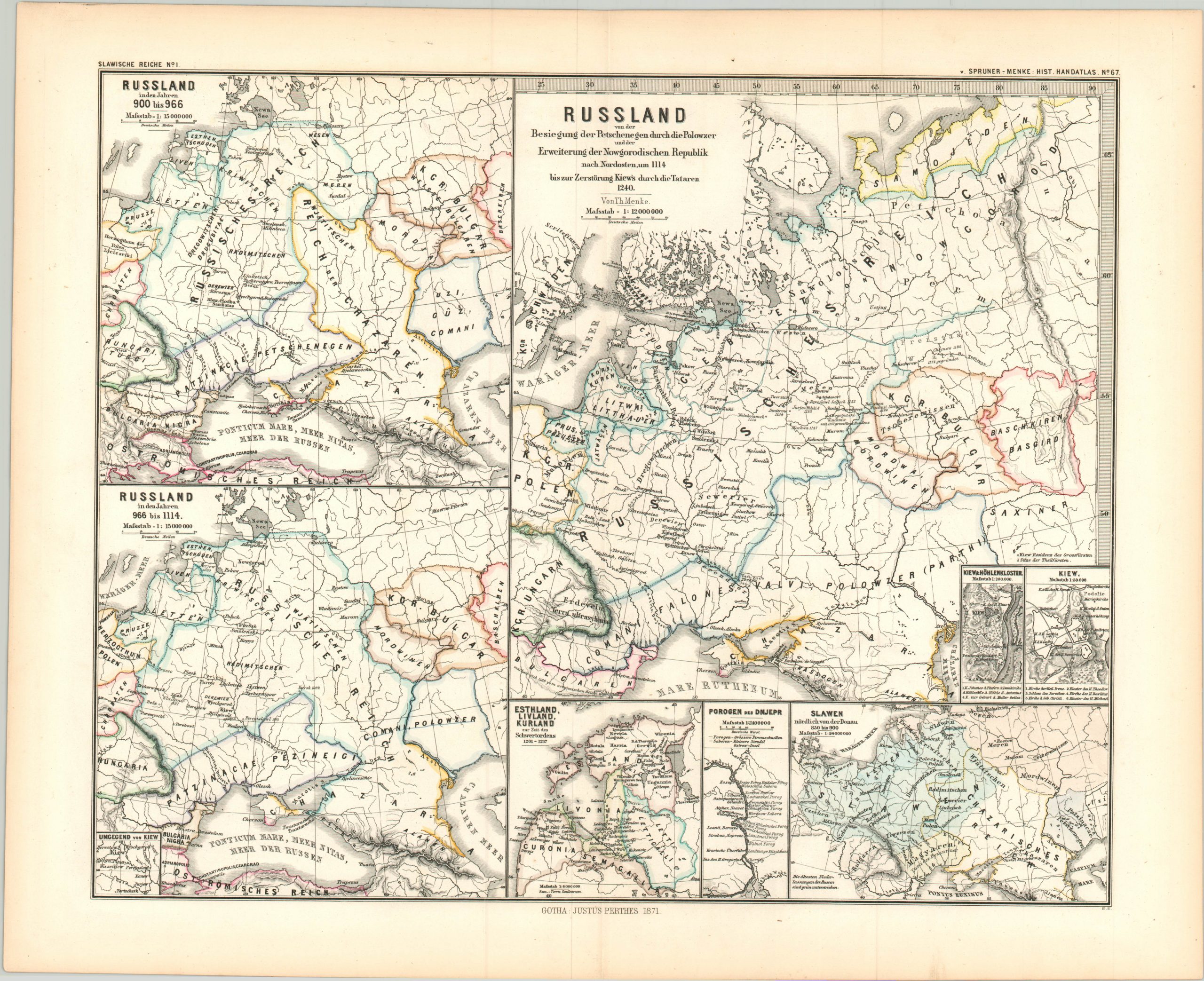
[Four maps of the Slavic Empires]
$125.00
A 900 year cartographic overview of the Slavic Empires across Europe and Asia.
1 in stock

Description
This collection of four maps provided a fascinating historical overview of the often complicated geographical extent of various Slavic Empires. Beginning with the year 900 on the first sheet, each page presents a myriad of regional maps and inset plans that detail the chronological development of various states east of the Baltic and Black Seas.
The maps show such development up to the establishment of the Russian Empire under Peter the Great. Published in Gotha, Germany by Justus Perthes between 1871 and 1879.
Map Details
Publication Date: 1871 - 1879
Author: Justus Perthes
Sheet Width (in): 18.40
Sheet Height (in):
Condition: A-
Condition Description: Four separate sheets, each measuring 18.4" x 14.9" with light wear along the centerfold. A bit of mild toning in the outer margins, but all remain in very good, or better condition.
$125.00
1 in stock