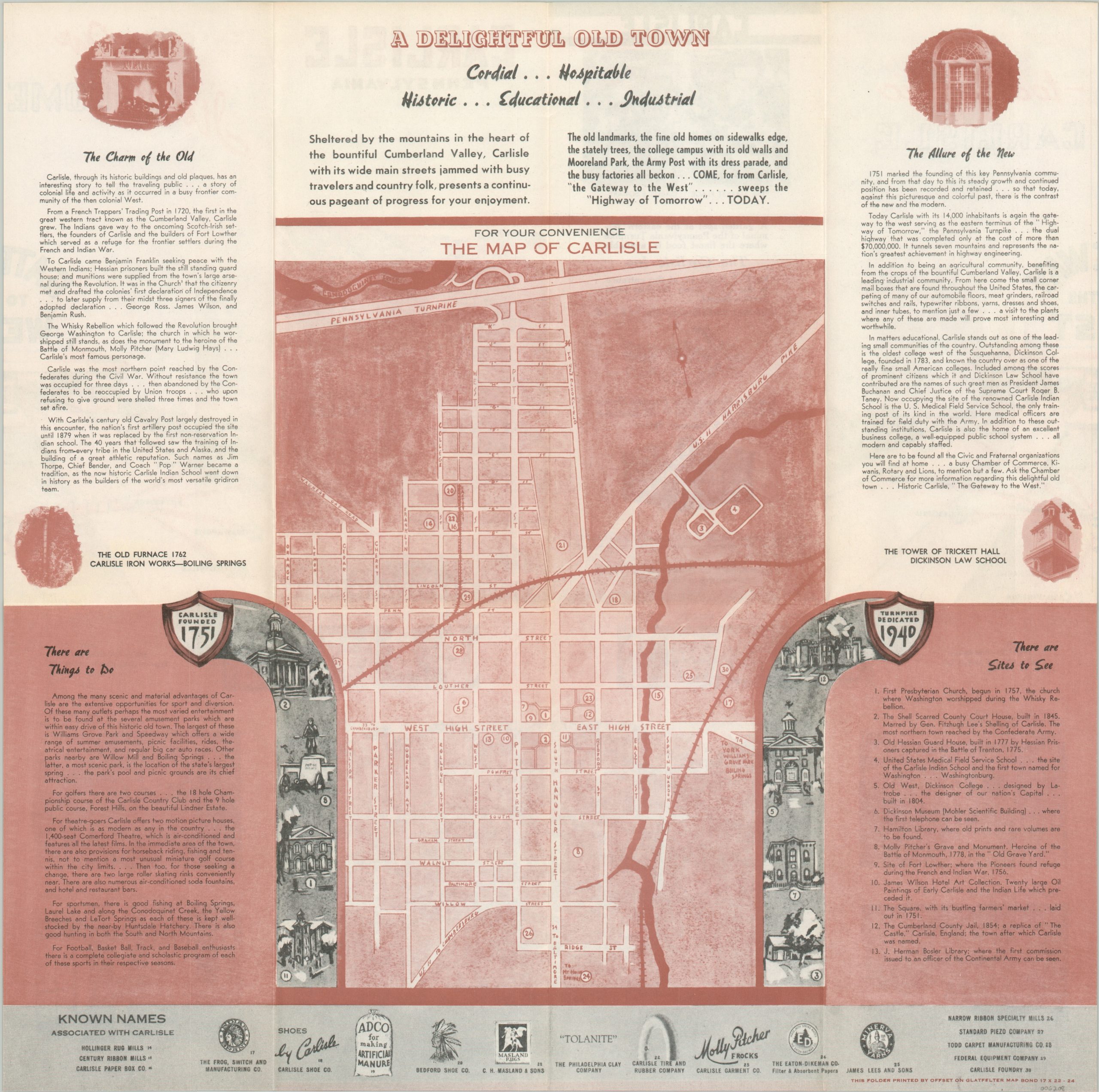
For Your Convenience The Map of Carlisle
$175.00
A well-designed promotional brochure for Carlisle, PA.
1 in stock
Description
“Sheltered by the mountains in the heart of the bountiful Cumberland Valley, Carlisle with its wide main streets jammed with busy travelers and country folk, presents a continuous pageant of progress for your enjoyment.” – Text, top.
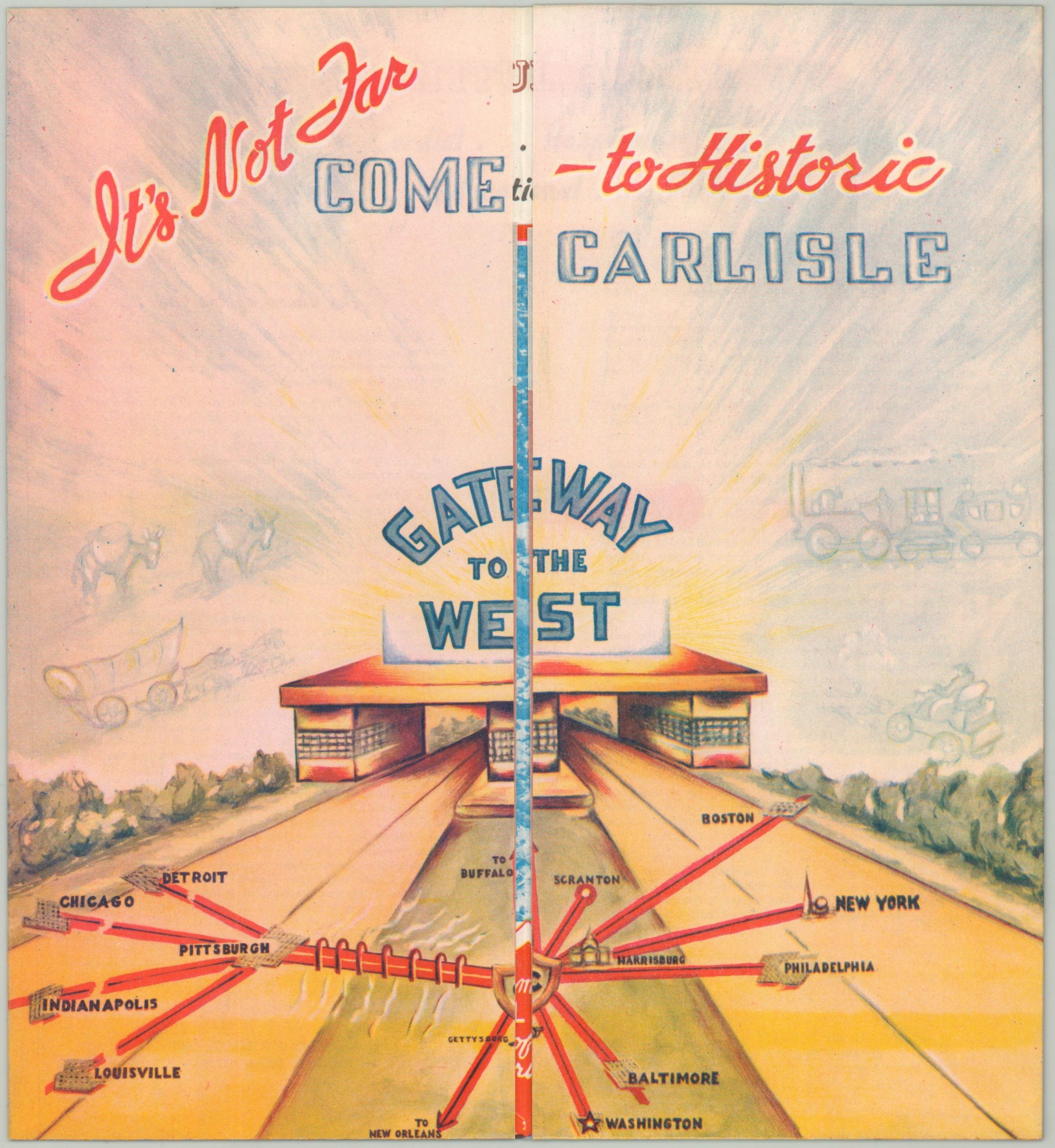
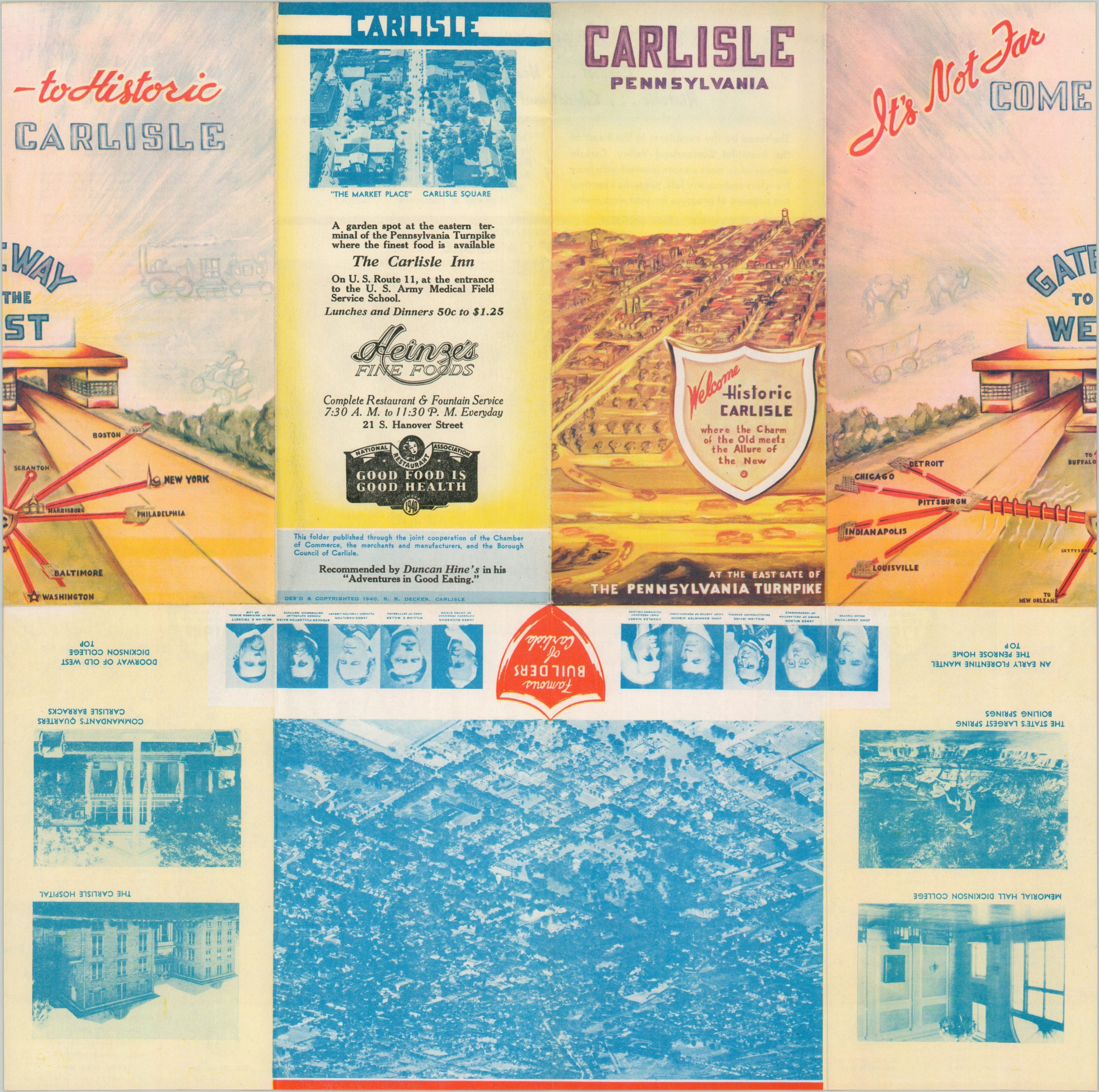
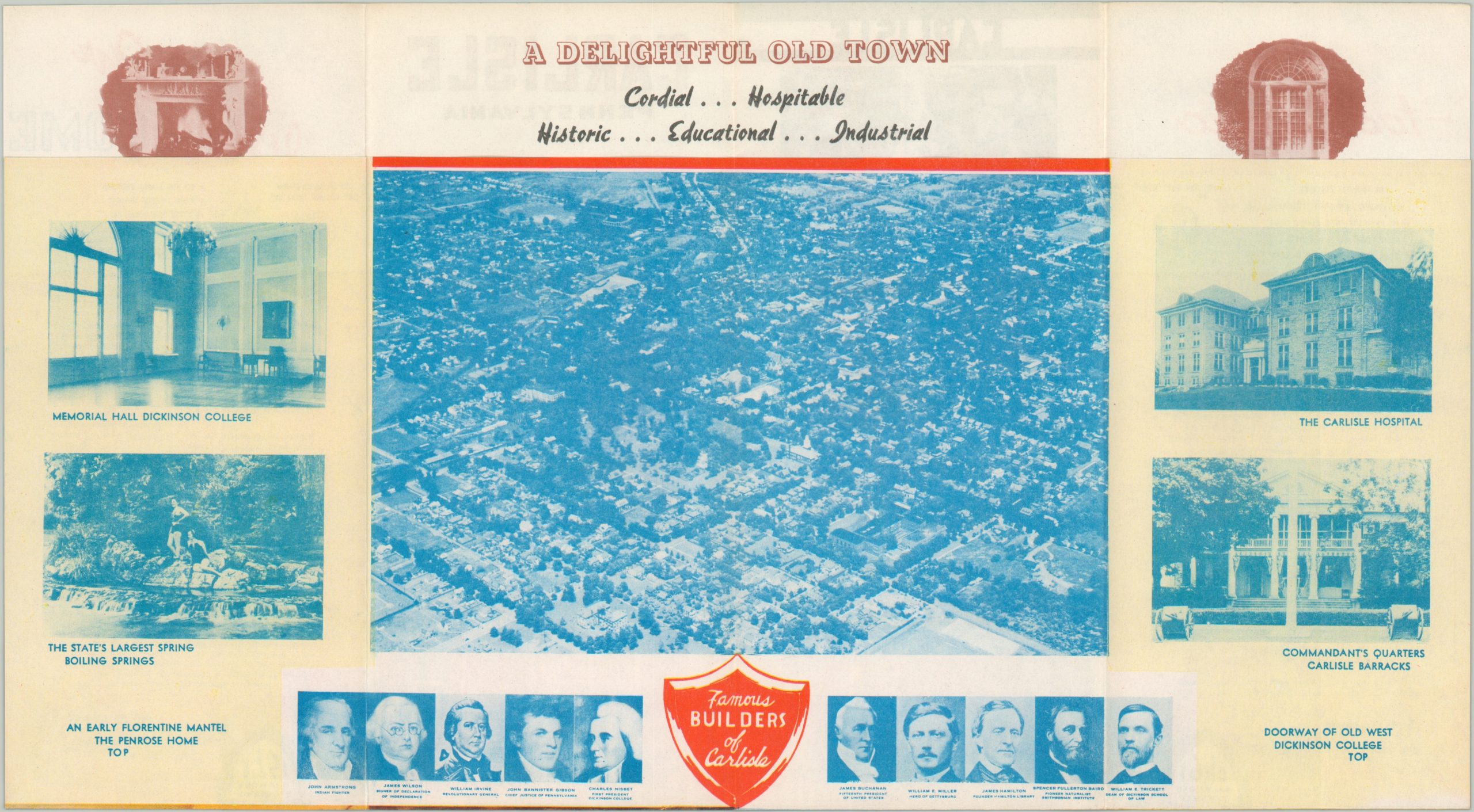
This clever brochure was designed in 1940 by R.R. Decker and published as a joint effort between the Chamber of Commerce, local merchants, and the Borough Council. The Pennsylvania Turnpike had opened that same year and Carlisle was well-positioned as the eastern terminus of the new highway. A tollbooth welcomes the reader as they open the front panels, revealing the ‘Gateway to the West’ and a stylized map situating Carlisle in the center of major cities between Chicago and New York (then hosting a World’s Fair). Unfolding again presents a bird’s eye view of the city, along with photographs of major attractions and portraits of historic ‘Builders of Carlisle.’ A final fold reveals a street plan, noting thirty different points of interest including historic sites, recreational activities, and local businesses. Descriptive text compares ‘The Charm of the Old’ and ‘The Allure of the New.’
The map is scarce and unlisted in WorldCat as of June 2024.
Map Details
Publication Date: 1940
Author: R.R. Decker
Sheet Width (in): 15.9
Sheet Height (in): 15.75
Condition: A
Condition Description: Creasing along fold lines, as issued. Near fine condition overall.
$175.00
1 in stock