
Fold-O-Globe
$75.00
“The first important innovation in map making in 474 years.”
1 in stock


Description
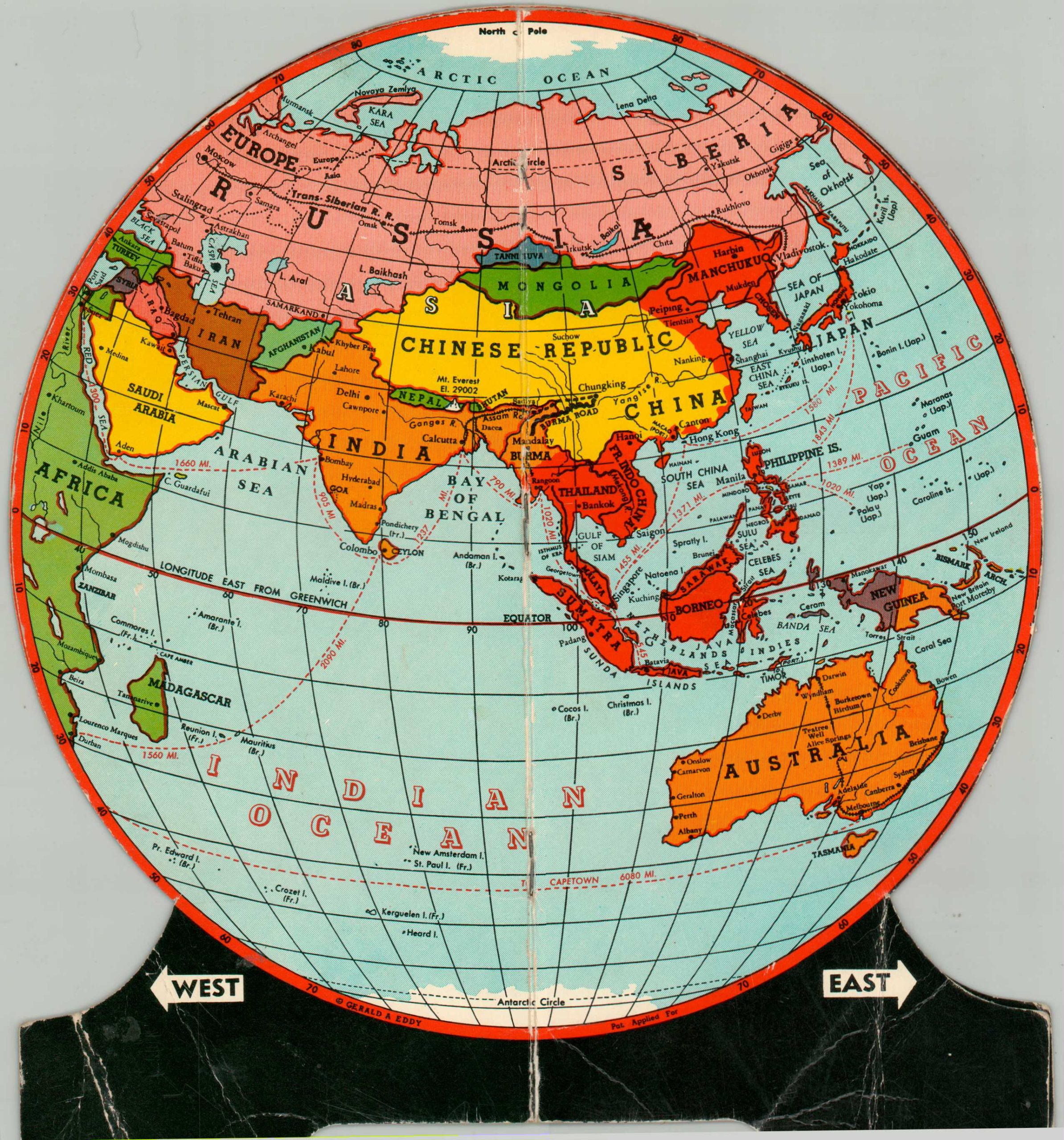
This neat little wartime novelty was designed by the talented Gerald Eddy and published in 1942 by Fold-O-Globe in Glendale, California. A different political map – essentially a quadrant- is presented on each of the four sides, offering a pseudo-3D perspective of the world.
Ocean distances between different points are labeled and a few important transportation routes – the Trans-Siberian Railway and the Burma Road – are emphasized. The application of different lines and colors indicates the extent of Axis occupation (red) and British territory (orange). Part of the descriptive text reads, “Note the adjusted equator which gives the illusion of Earth’s curvature and the true relation of one continent to another.”
Map Details
Publication Date: 1942
Author: Gerald Eddy
Sheet Width (in): 8.25
Sheet Height (in): 9
Condition: B+
Condition Description: Two folding cardboard panels affixed along the center seam with staples. When unfolded, the 'globe' sits upright on the legs at the bottom. Heavy wear and creasing visible in the supports, but remains functional and in good condition overall.
$75.00
1 in stock