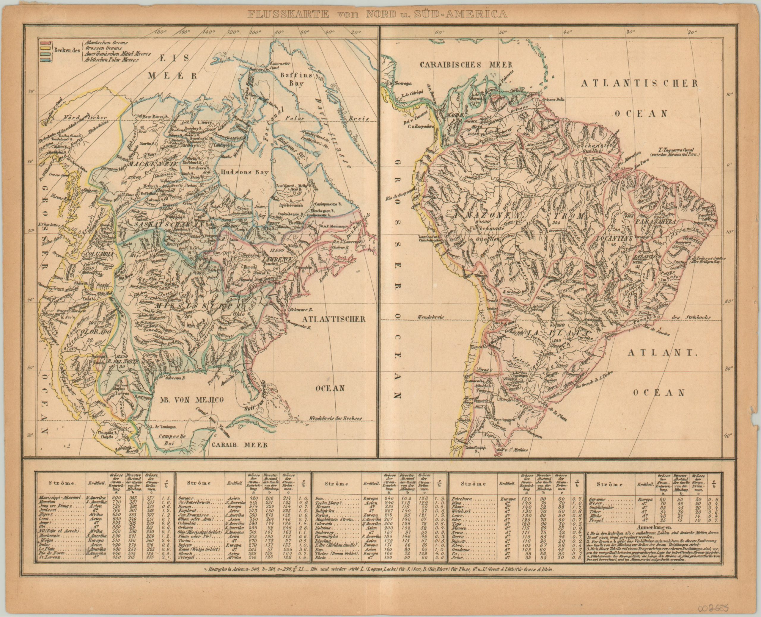
Flusskarte von Nord u. Sud-America
$80.00
Watersheds of the Western Hemisphere.
1 in stock
Description
This striking map of North and South America was published by the firm of Gross & Klein, likely as part of a late 19th century German geography text. Though it vaguely represents early colonial outlines, the original hand color delineates which areas flow into the primary bodies of water.
German text labels the individual watersheds and major waterways throughout, while tables along the bottom of the sheet list the longest rivers around the globe.
Map Details
Publication Date: c. 1880
Author: Gross & Klein
Sheet Width (in): 11.5
Sheet Height (in): 9.25
Condition: B+
Condition Description: Sheet moderately toned, consistent with age; with a few minor tears and one small chip along the outer margins. Light discoloration along vertical centerfold. Features original outline color.
$80.00
1 in stock