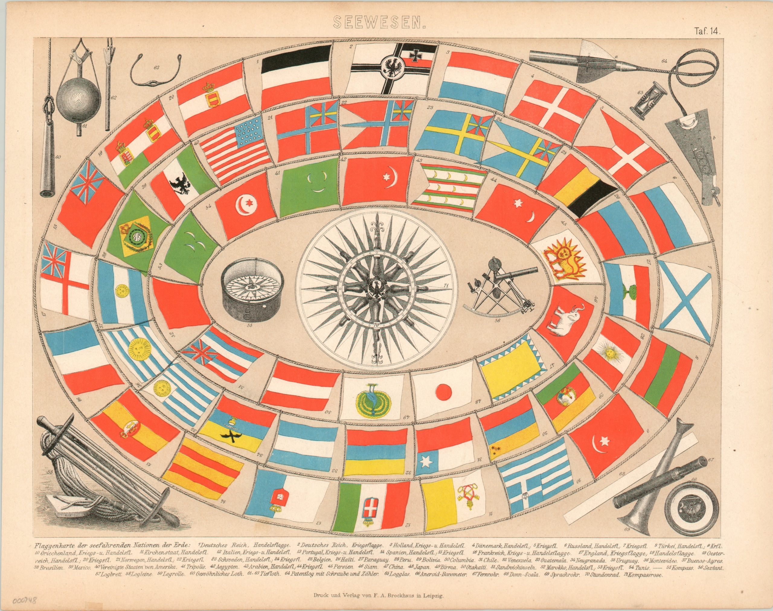
Flaggenkarte der Seefahrenden Nationen der Erde [Flag Map of the Seafaring Nations of the Earth]
$150.00
Spiral maritime flag chart published in German shortly after the Franco-Prussian War.
Description
Germany was ascendant after the defeat of their hated rivals, the French, in the Franco-Prussian war. This flag chart is one of a number of methods jubilant German publishers used to cement their newly unified country’s status as an imperial power on the global stage. The flag of the German Empire (the Second Reich) is first and foremost, followed by the flag of the newly created German Imperial Navy. Kaiser Wilhelm would seek to greatly expand the size and role of the new navy in the coming years, which would ultimately become one cause behind the start of the First World War.
Following Germany are the flags of over forty other seafaring nations, ranging from the all-powerful British to tiny Haiti. Illustrations of maritime tools on the sheet are also individually labeled near the bottom of the page.
Map Details
Publication Date: 1871
Author: F.A. Brockhaus
Sheet Width (in): 13.10
Sheet Height (in): 10.30
Condition: A-
Condition Description: One small tear (.5") along the lower edge and a few tiny pinholes in the right margin. Faint discoloration around the exterior, but very good to excellent overall.
$150.00

