Field of Waterloo Towards Sunset, on June 18th 1815
Uncommon separate edition of a firsthand account of the Battle of Waterloo.
Out of stock
Description
“This Plan of the field of Waterloo, represents the position of the different armies at the moment when the situation of Napoleon and his devoted legions had become most desperate; the battle had been raging for nearly eight hours, and the victory still wavering on the balance.” – text, upper left.
The Battle of Waterloo is perhaps the most well-known engagement of the 19th century – Napoleon and his Grand Armee turned away from domination of Europe by the heroic leadership of Wellington and Blucher. The battlefield became an almost immediate attraction, with locals scouring the landscape for souvenirs to sell to the throngs of tourists that began visiting shortly after the smoke had cleared, and continue to this day.
This map of the battlefield was compiled by British officer (and Waterloo participant) Edward Cotton. It was printed by L.T. Hoffman in Brussels in 1854, while Cotton was working as a tour guide of Waterloo in nearby Mont St. Jean, just south of the battleground. Red, yellow, and blue boxes show the troop dispositions of the Allies, Prussian, and French armies, respectively, on the evening of June 18th, 1815. Respective fighting strengths are noted in a table in the lower right, with the French clearly outnumbered after the arrival of the Prussians.
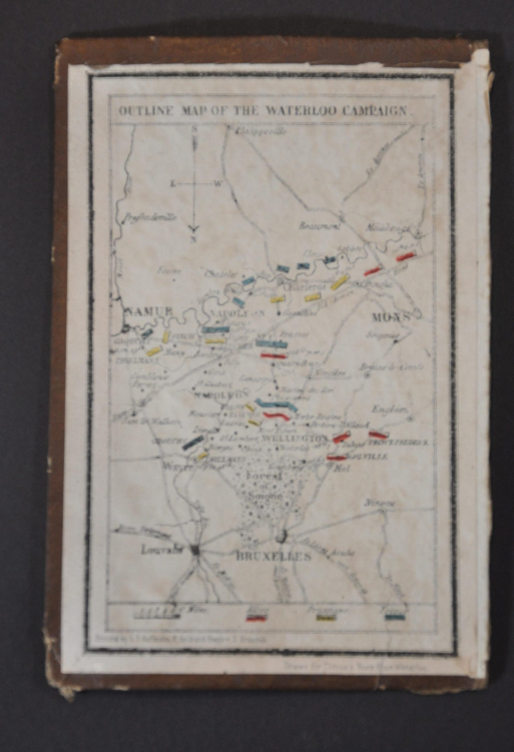
Topography is depicted in hachure and woods are shown pictorially, offering some context to the physical geography of the field of conflict. Text surrounding the image describes the units and major events therein. Originally issued for Cotton’s Voice from Waterloo, this uncommon example was issued separately in leather covers. Now disbound, the front cover has an outline map of the entire Waterloo Campaign.
Map Details
Publication Date: 1854
Author: Edward Cotton
Sheet Width (in): 18.25
Sheet Height (in): 17.75
Condition: A-
Condition Description: Separately issued map professionally disbound from its original leather cover and professionally flattened and cleaned. Some very minor image loss along old fold lines. Several small tears around the outer edges and fold intersections have been mended with Japanese tissue on the verso. Very good condition overall.
Out of stock


