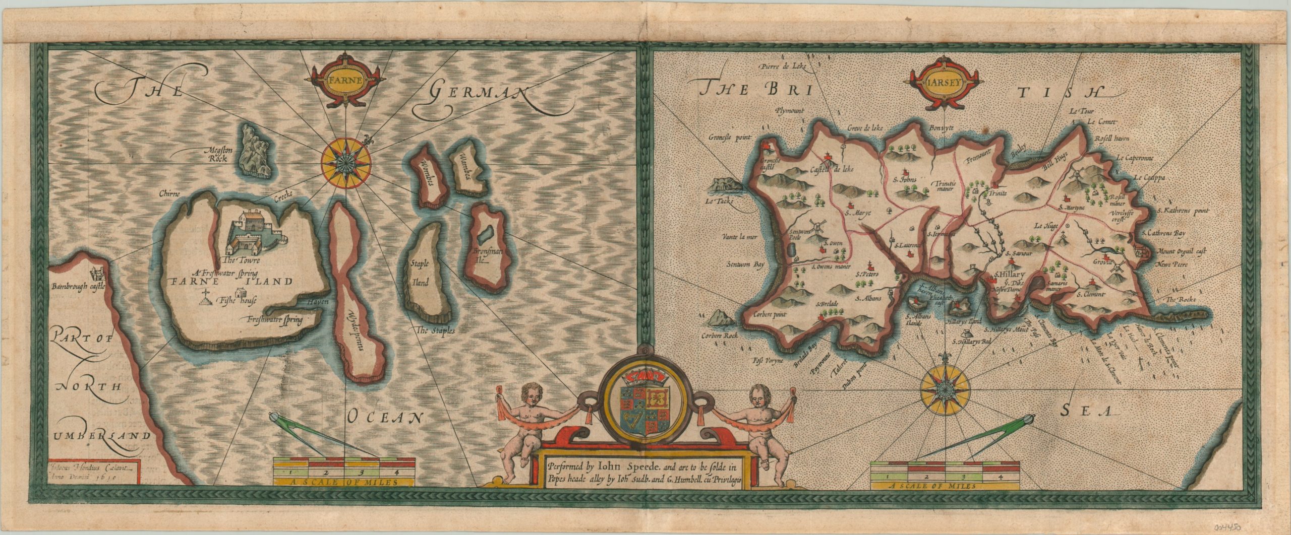
Farne [and] Iarsey
$90.00
Beautiful map of Jersey and the Farne Islands from the early 17th century.
1 in stock
Description
This eye-catching map, formerly part of a larger sheet containing four boxes, rather than two, was published in London by George Humball in 1610. It was created by the famous English cartographer John Speed but is based largely off an earlier image supplied by the Dutch mapmaker Jocodus Hondius.
The left panel shows the Farne Islands, off the northeast coast of Northumberland in England. The tower, freshwater springs, and a fish house are all labeled, in addition to Barnbrough Castle on the mainland. The right panel shows the Channel Island of Jersey, off the French coast of Normandy. Various features are displayed pictorially and labeled, including St. Hilary’s Bed and the castle at Mount Orguil.
Map Details
Publication Date: 1610
Author: John Speed
Sheet Width (in): 20.5
Sheet Height (in): 8.4
Condition: B
Condition Description: Half-sheet that's been professionally remargined at the top. Minor wear and discoloration visible in the margins and along the vertical centerfold. Good condition, with attractive hand color.
$90.00
1 in stock

