Farm Ownership Map and Plat Book Guide Kane County, Illinois
$110.00
“These Ownership Plat Maps Are a Necessary Part of Every Household in Kane County.” [front cover]
1 in stock


Description
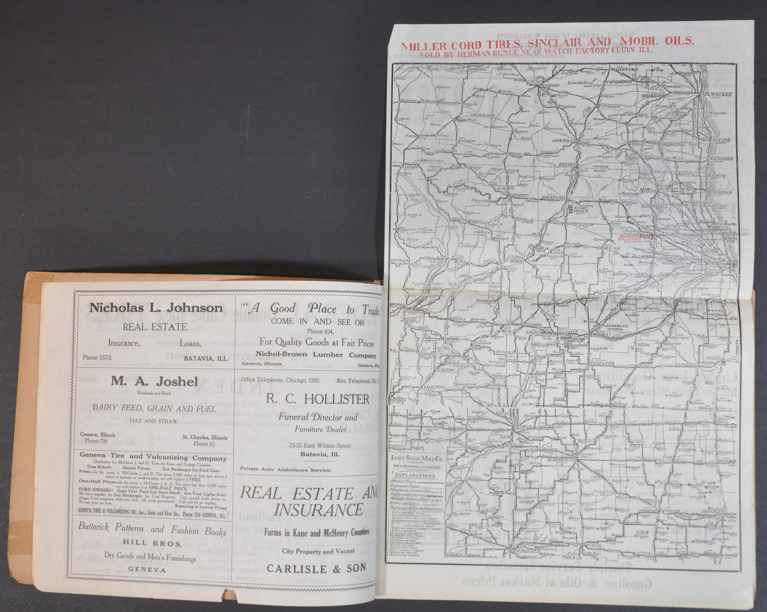
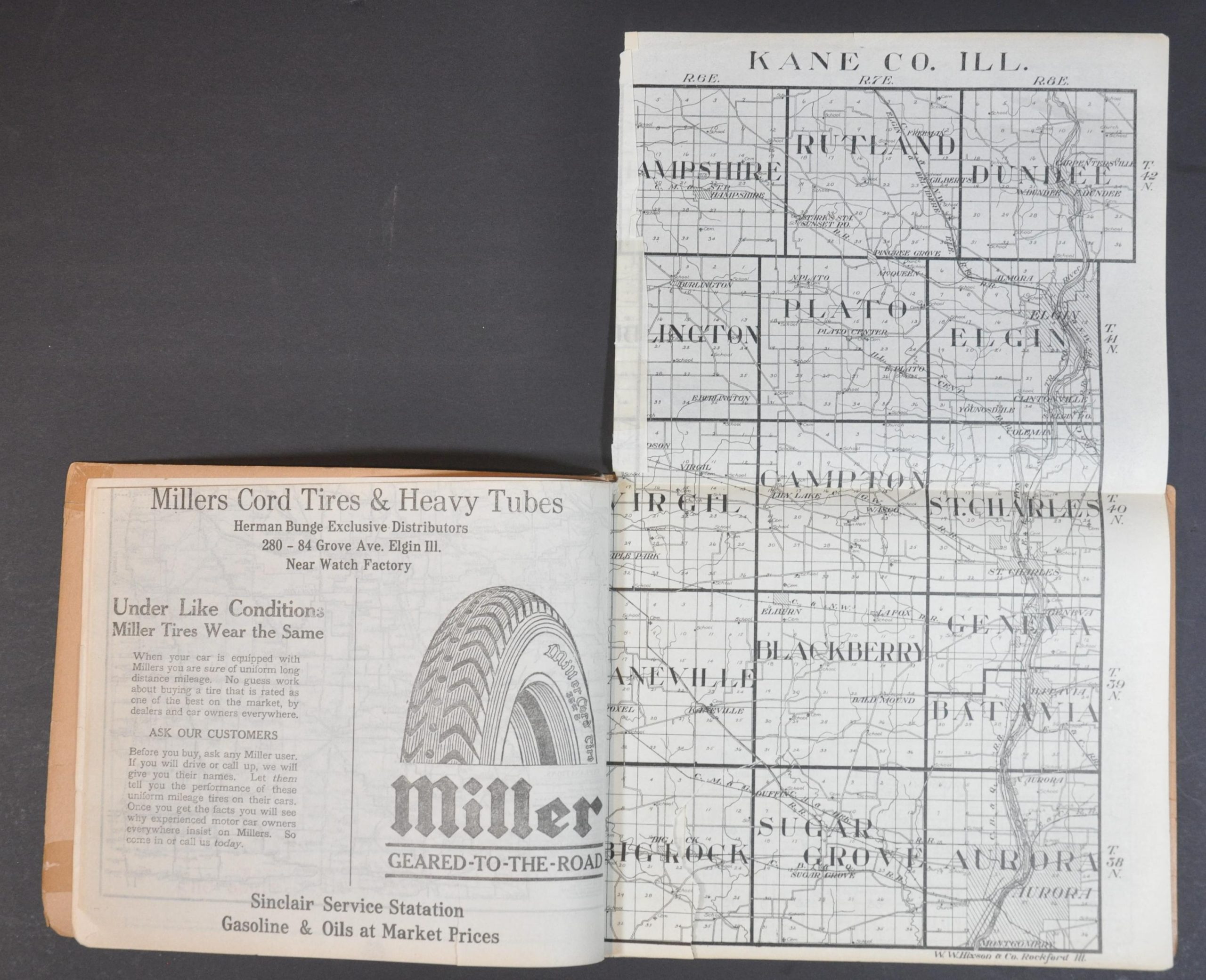
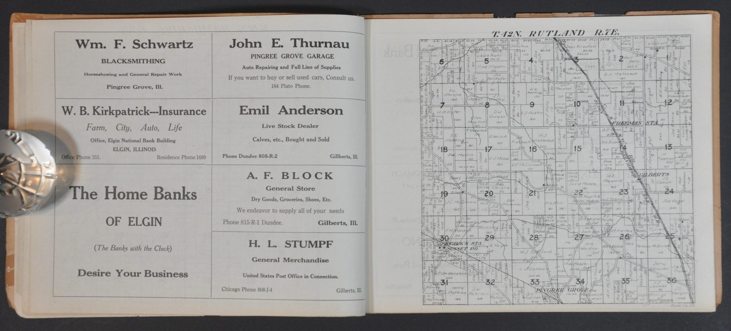
This fascinating atlas of Kane County, Illinois was published by the Elgin Daily News in 1920, with plat maps by W.W. Hixson & Co. of Rockford and printing by Lowrie & Black Co.
A folding map by the Interstate Map Company the status of available roads across the Great Chicago area, while sixteen subsequent plat maps provide land ownership information for each township within the county. Numerous contemporary advertisements on the verso of each map promote auto suppliers, appliance stores, banks, and other local businesses.
Map Details
Publication Date: 1920
Author: W.W. Hixson & Co.
Sheet Width (in): 10.4
Sheet Height (in): 8.3
Condition: A-
Condition Description: 22 pp. atlas bound with staples in original stiff paper wraps. Covers are toned and brittle, with several old tape repairs around the outer edges. Includes 2 fold-out maps - the Kane County sheet has a crooked 3" tear on the left sound where bound. About very good overall.
$110.00
1 in stock