Evolving Commonwealth
$195.00
“An Association of Independent States, together with their Dependencies at Various Stages of Political Advance; January 1964”
1 in stock

Description
This reference map of the British Commonwealth was created by the British Information Services’ New York office and printed in London by James Townsend & Sons Ltd. It presents the latest political situation of the approximately 740 million inhabitants spread across the 14 million square miles that made up the postwar remnants of the British Empire.
The large swathes of blue and green on the map show independent nations, while Southern Rhodesia is given its own distinct category in the midst of the crisis after the dissolution of the Central African Republic in January. The complex and constantly evolving status of the various member states and dependencies are outlined in the text and charts immediately below.
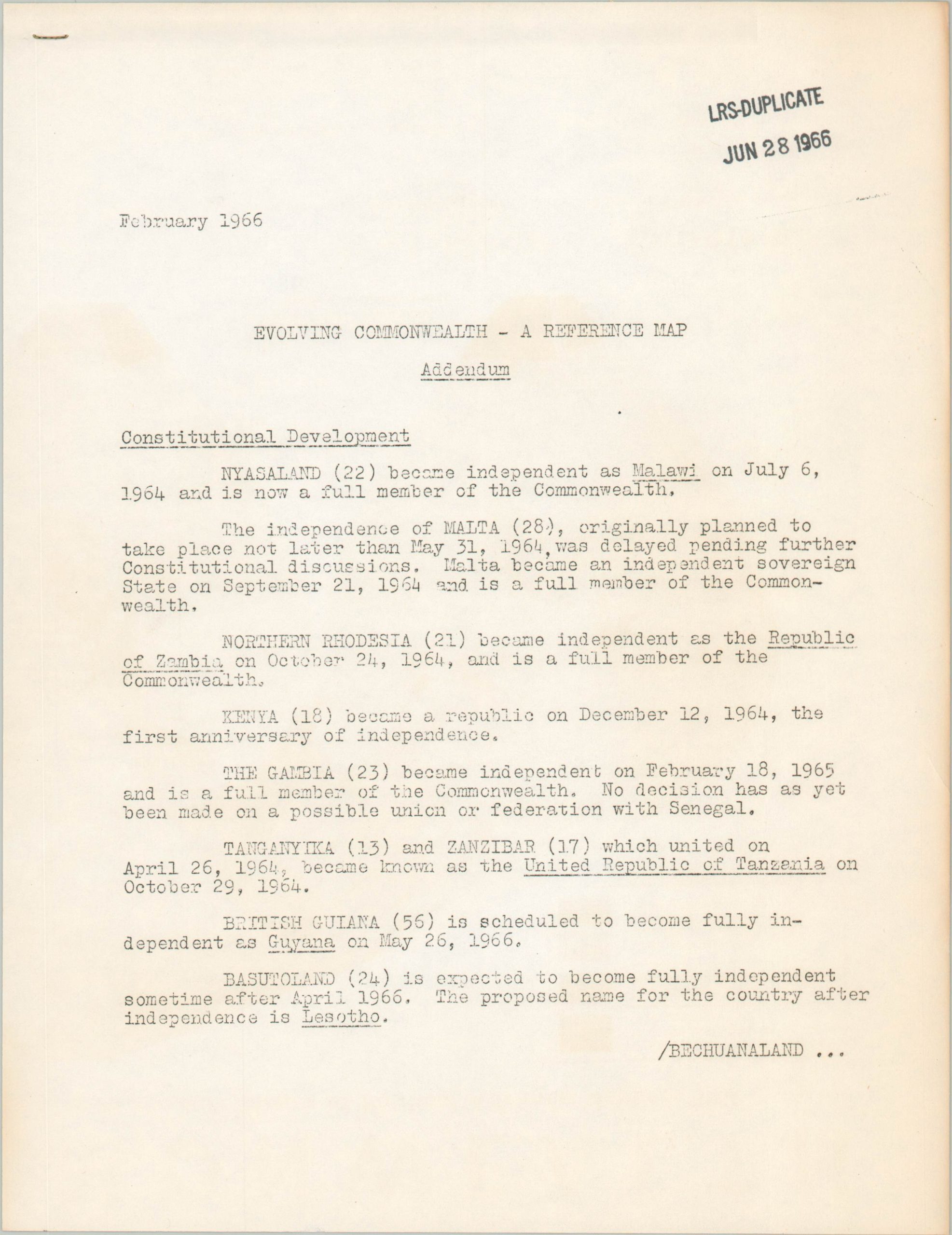
Additional information on the process of constitutional development and the composition of local governments can be found on the verso. The map includes a two-page typewritten addendum that includes updates to February 1966.
Source: Commonwealth Chronology
Map Details
Publication Date: 1964
Author: British Information Services
Sheet Width (in): 17.9
Sheet Height (in): 23.9
Condition: A-
Condition Description: Creased along fold lines, as issued, with a bit of wrinkling near the top center. Light toning along the fold lines and outer edges, with some on the verso that does not affect the image. Includes a two page typewritten addendum. Both stamped LRS-DUPLICATE JUNE 28 1966
$195.00
1 in stock