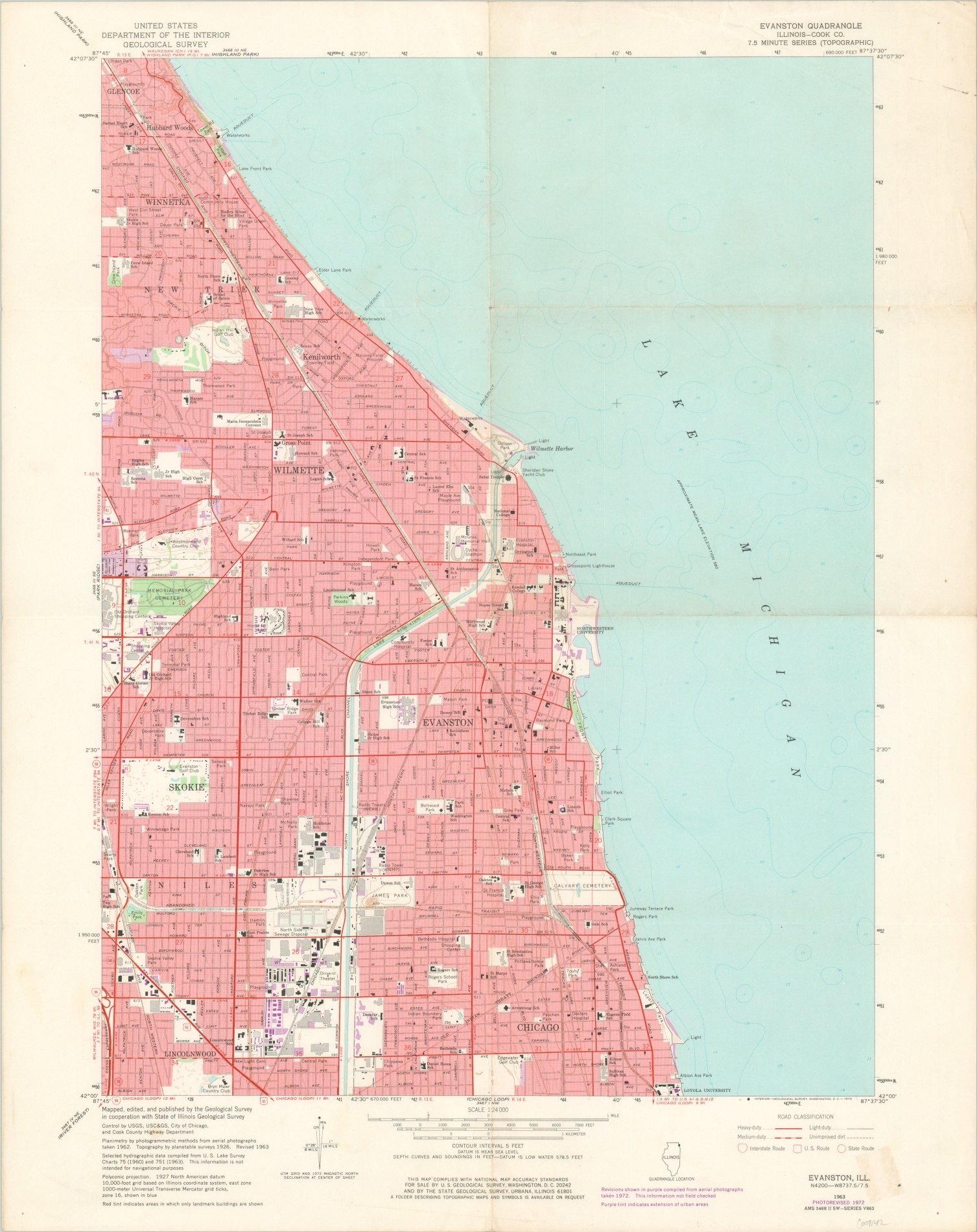
Evanston, Ill.
$75.00
U.S.G.S. geologic map of Evanston, Illinois.
1 in stock
Description
Red tint and purple highlights show the density and extent of urbanization experienced by Evanston, Illinois in the second half of the 20th century. Streets are shown according to their classification outlined in the lower right, and prominent buildings are outlined within the image.
Locations of interest, individually labeled, include a drive-in theater, Northwestern University, schools, shopping centers, and cemeteries. The map was originally published by the United States Geological Survey in 1963, but this example reflects updates as of 1973.
Map Details
Publication Date: 1973
Author: United States Geological Survey
Sheet Width (in): 21.25
Sheet Height (in): 26.5
Condition: B+
Condition Description: Creasing, light wear, and moderate discoloration along former fold lines. A bit of scattered discoloration visible in the margins and old price stamp on the verso.
$75.00
1 in stock

