Europe 1939
An American perspective on the War in Europe, 1939.
Out of stock
Description
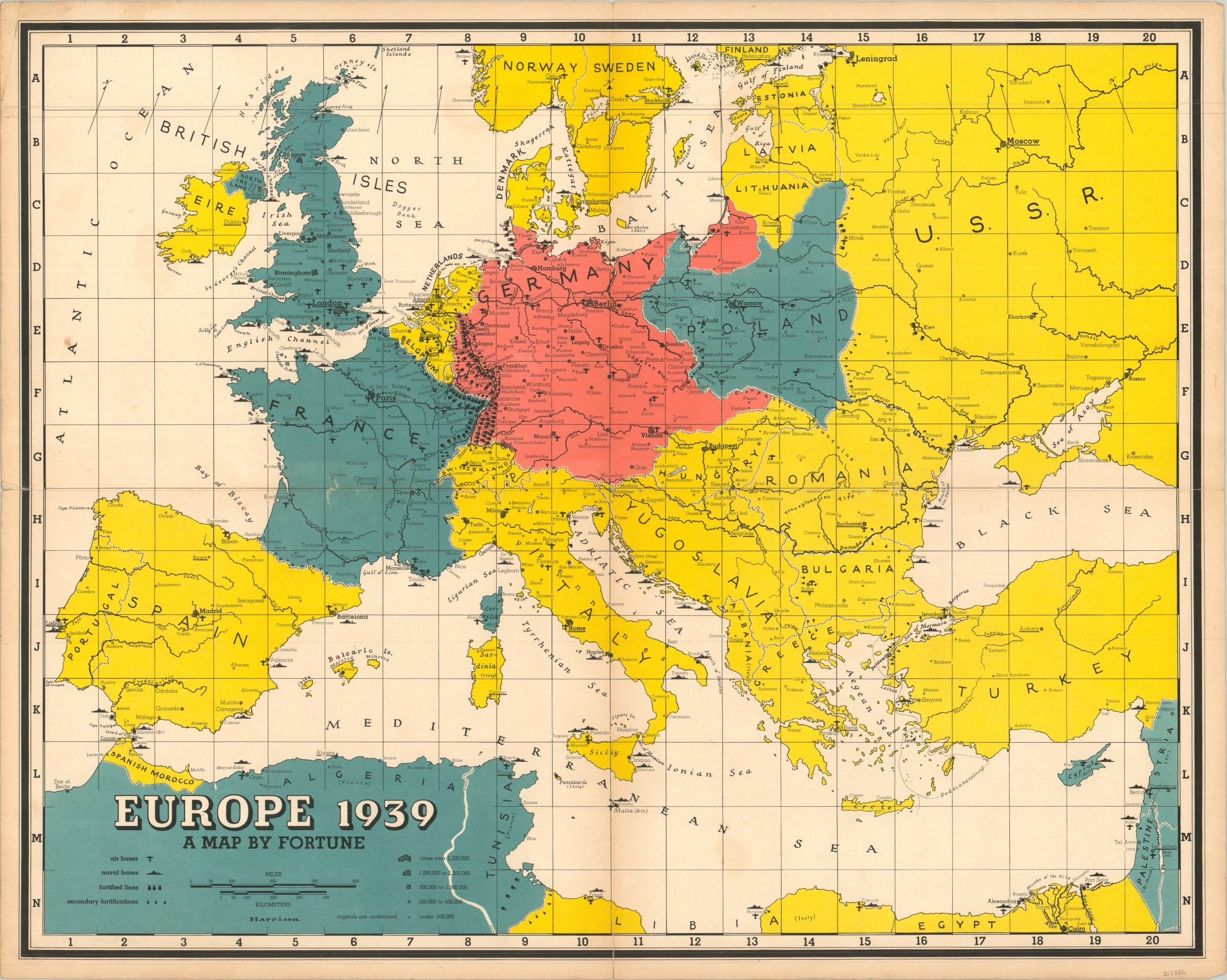
The bright colors splashed across the map of Europe belie the menacing subject matter they depict. The soft red covering German territory is at war with the blue of Poland, France, and England. Military installations are noted throughout, with an evident concentration on the borders of Germany and France. Neutral countries are shown in yellow, with a pathway through Belgium highlighted as if to predict the forthcoming military advance.
The map was issued in a supplement to Fortune Magazine published just days after Germany’s invasion of Poland and the subsequent declarations of war. The verso includes the results from a nationwide summary on domestic attitudes towards the war, providing fascinating context to American opinions in the early days of the ‘European conflict.’
Map Details
Publication Date: 1939
Author: Richard Edes Harrison
Sheet Width (in): 26.75
Sheet Height (in): 21.40
Condition: B+
Condition Description: Formerly folded twice, with moderate creasing and wear along vertical and horizontal fold lines. Several small tears along the centerfold and in the margins have been repaired on the verso with archival tape.
Out of stock

