
English Channel (La Manche) Eastern Sheet
$850.00
Commercial hydrographic chart of the English Channel owned by a veteran of World War II.
1 in stock
Description
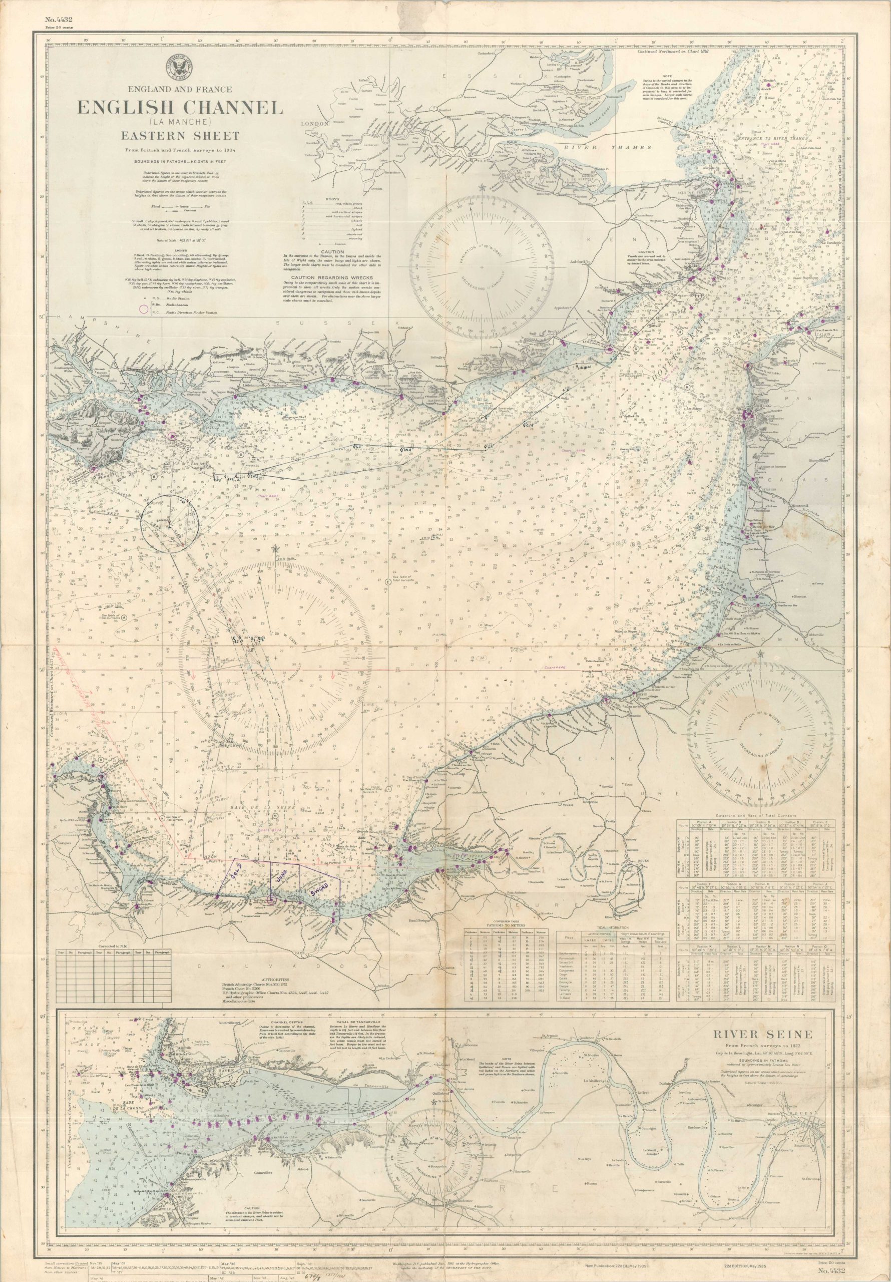
This detailed nautical chart of the English Channel and River Seine was first issued in May 1935 – the 22nd edition published by the U.S. Navy Hydrographic Office. Blocks of small text in the lower left indicate revisions had taken place through August 1943, the latest date of printing. Depth soundings are noted throughout the image; along with navigational hazards, landmarks, local settlements, and buoys/beacons (highlighted in purple).
The chart has been updated with manuscript annotations indicating probable use by British forces in the days and weeks following D-Day. Several routes (one marked canceled) are presented for at least one ship, with corresponding headings and reciprocal headings. Red diamonds have also been drawn at various points along the route. These likely reflect waypoint positions where a specific action was to be taken – perhaps a visual cue, radio communication, etc. A large circle represents a marshaling area (or ‘mixing bowl’), from which the courses then diverge and approach France. Gold, Juno, and Sword Beaches are outlined in purple ink along the Calvados coast, and a large ‘Area Believed to be Mined’ is blocked off in red pencil.
The map was acquired from the descendants of Ensign James (JJ) Keys. After enlisting in the Navy in San Francisco in 1941, Keys joined the Naval Reserve in 1943 and enrolled at the USNR Midshipmen’s School in New York that year. By the end of the war, he was a Lieutenant Junior Grade and had been aboard the U.S.S. Dixie and the U.S.S. Alden (and perhaps other ships). Keys retired from the Navy Reserve as a Lieutenant Commander in 1968. His participation in D-Day is uncertain, but family photos indicate he was in Normandy in the weeks following the invasion. Context on the map indicates that it was used in some official capacity. For example, numbers of other (presumably larger-scale) map sheets are referenced in small squares along the coast. A similar number is written on the verso.
Many thanks to Former Fleet LT USN A. Pyanoe for his years of naval service and his assistance in deciphering the content of the map.
Map Details
Publication Date: 1944
Author: United States Hydrographic Office
Sheet Width (in): 27.25
Sheet Height (in): 39.75
Condition: B
Condition Description: Single-sided nautical chart formerly folded into 8 segments. Creasing and moderate wear along old folds and scattered soiling, concentrated in the center right and bottom of the page. A small damp stain in the upper margin and some toning along the vertical seam. Scattered manuscript annotations in gray/red pencil and ink. The information presented remains almost entirely legible and the wear is consistent with a map used in difficult circumstances. About good condition overall.
$850.00
1 in stock