Encroachments and Obstructions in the Chicago River and on the Chicago Lake Front
$2,000.00
Improving commercial navigation around Chicago in the early 20th century.
1 in stock


Description
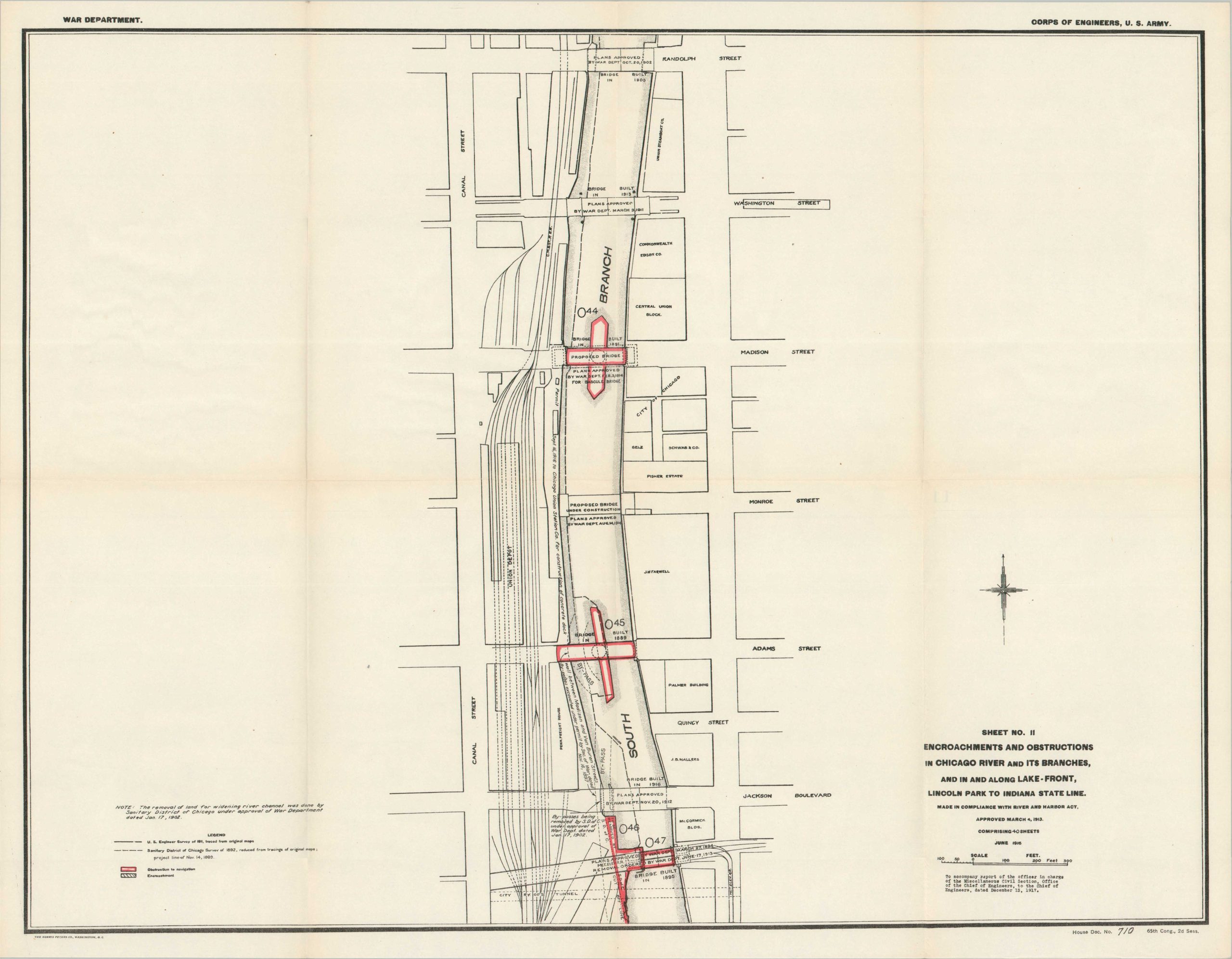
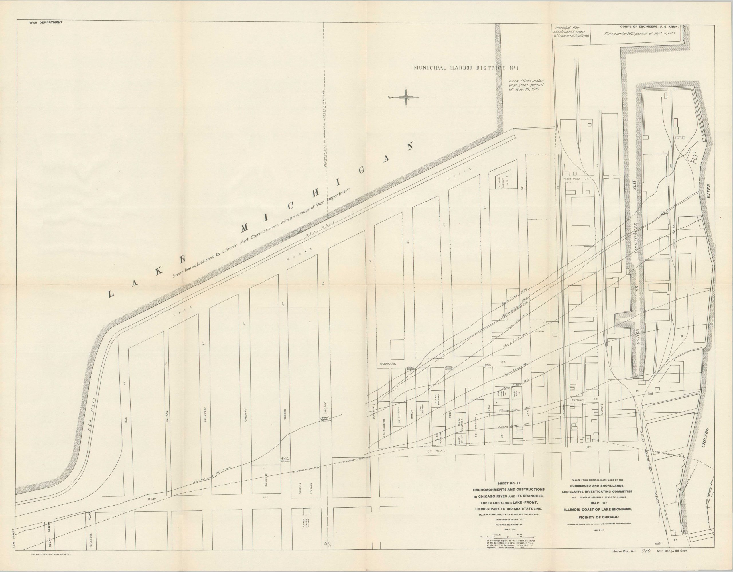
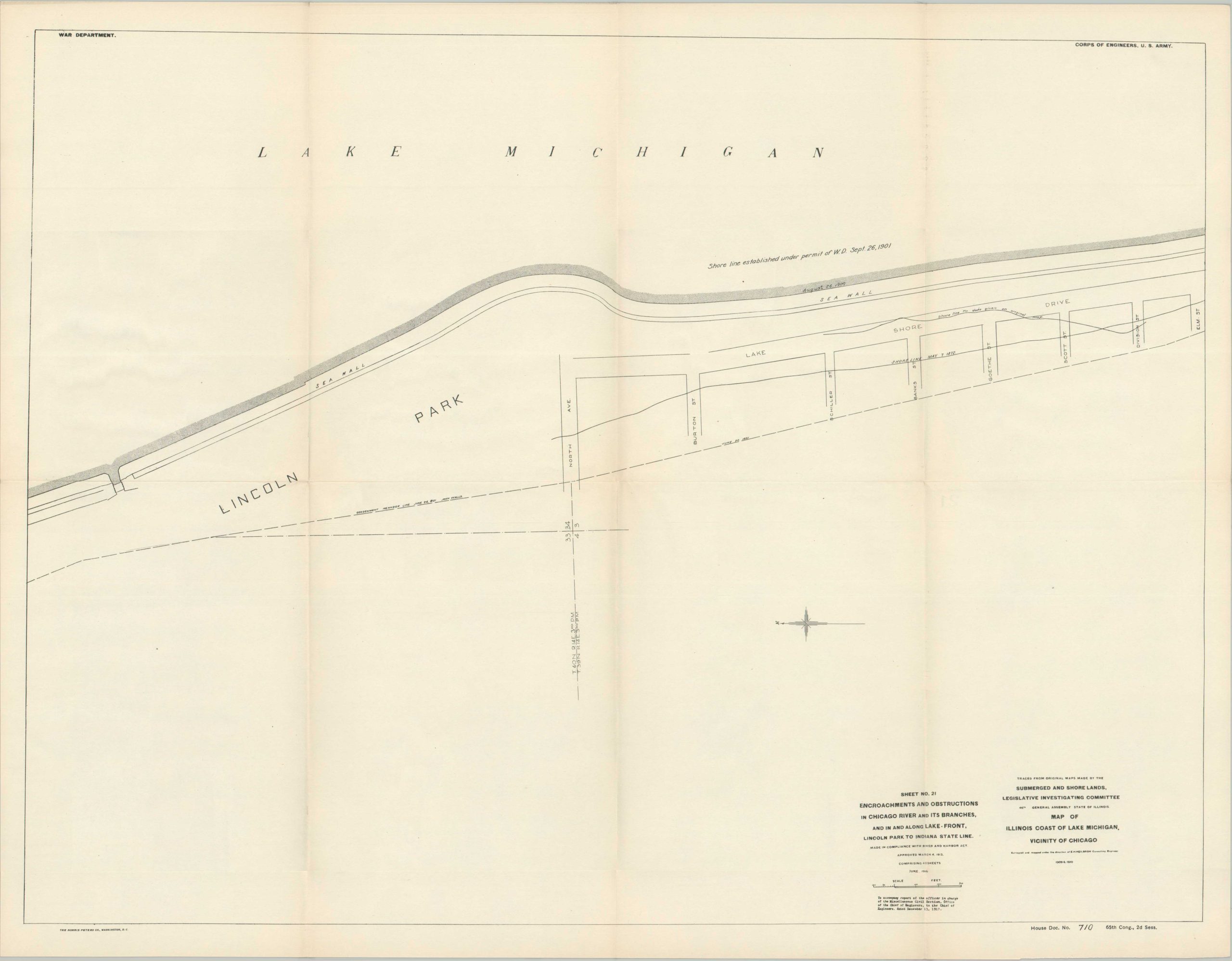
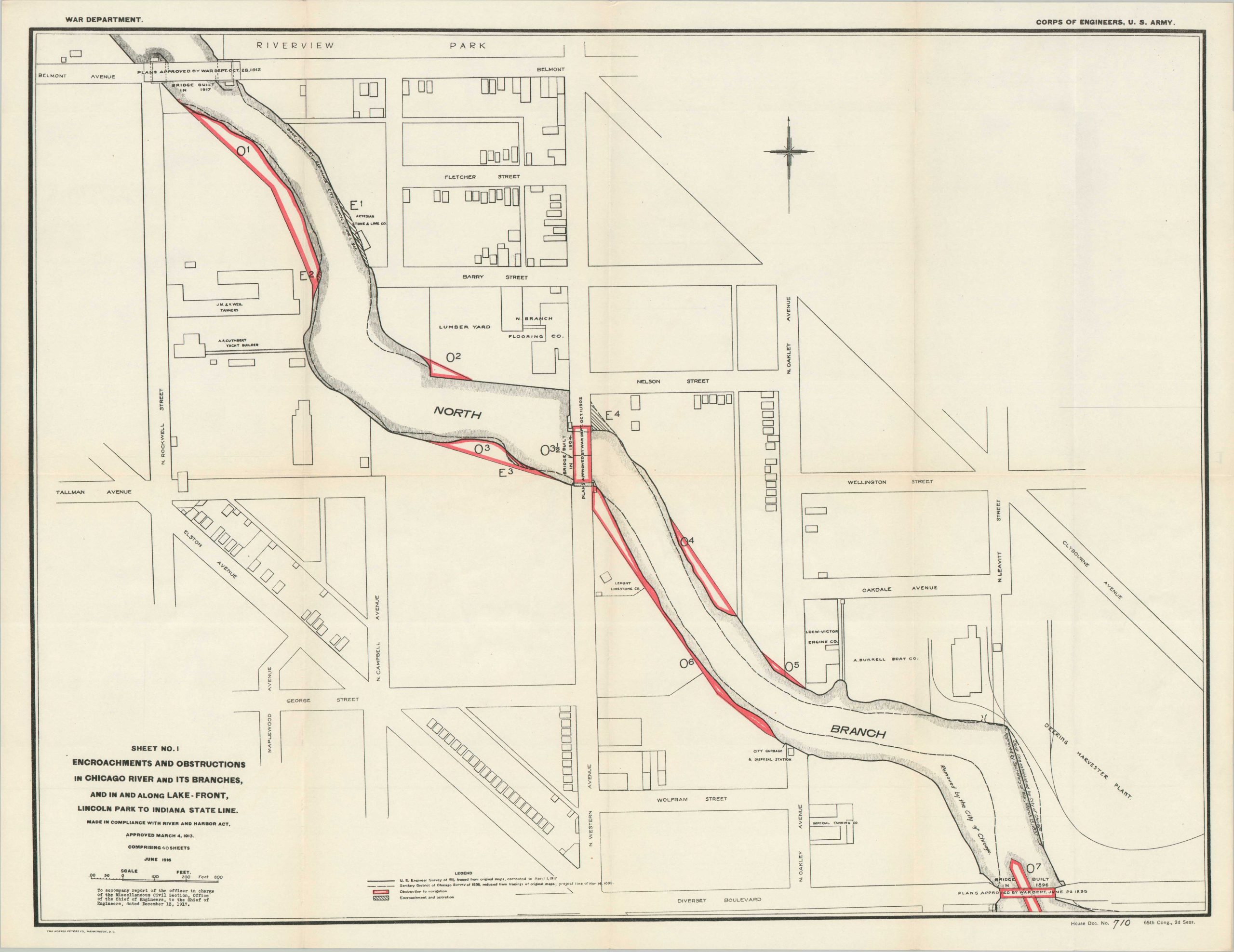
“The following report on encroachments and obstructions in the Chicago River and its branches, and on encroachments in Lake Michigan on the Chicago front between Lincoln Park and the Indiana State line, is submitted in accordance with an item in the river and harbor act approved March 4, 1913.” – Pg. 2.
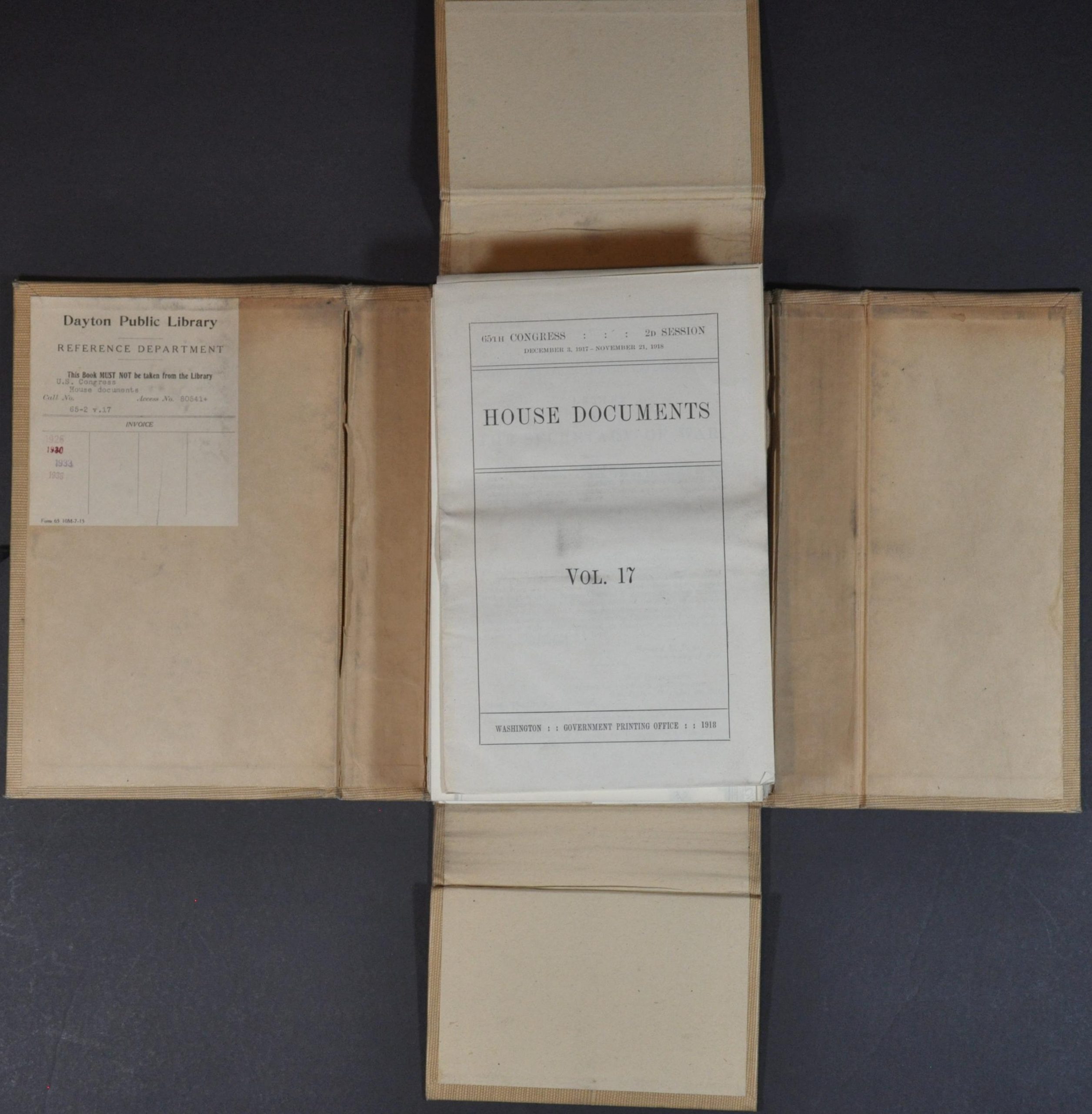
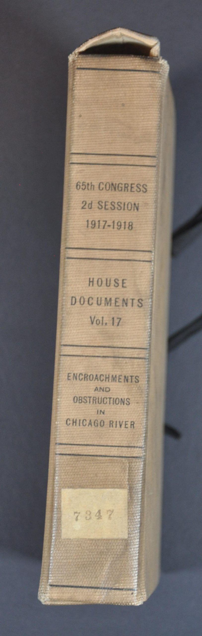
This fascinating set of maps and accompanying report was compiled by Army Corps of Engineers Colonel Charles Keller and published by the Government Printing Office in 1918. The volume was presented by the U.S. War Department as House Document Vol. 17, for use by the 65th Congress. It contains an extensive overview of the obstructions and encroachments (mostly docks, narrow bends, and bridges) along the Chicago River and the Lake Michigan lakefront – all of which represent hindrances to efficient commercial navigation and military preparedness of the region.
Forty large-scale maps provide extensive coverage of the primary waterways, noting building outlines, property owners/businesses, and primary transportation routes (streets, railways, etc.). Obstructions to navigation are brightly highlighted in red, while shoreline encroachments are shaded. The 16-page report provides a chronology of improvements of Chicago’s rivers and harbors, a brief legislative review, and two appendices that list each encroachment and the Chicago River bridges (current and proposed).
At the time of publication, much of the Chicago River was heavily polluted from high concentrations of industry along its banks (reflected in the various commercial properties on the maps and index). Upton Sinclair’s ‘The Jungle’ was published just over a decade prior, coining a portion of the South Branch as ‘Bubbly Creek’ because of the noxious gaseous discharges from waste products (blood, offal, etc.) of the Union Stockyards. Under the Sanitary District of Chicago, significant efforts were made to improve the quality of the water, including the construction of the North Shore Channel in 1910 and the Cal-Sag Channel in 1922.
Source: WTTW.
Map Details
Publication Date: 1918
Author: Col. Charles Keller
Sheet Width (in): See Description
Sheet Height (in): See Description
Condition: A
Condition Description: Complete collection of forty lithographed maps (folded, with an index) and an 18 pp. booklet with stapled binding, bound in a custom slipcase with title on the spine. Ex-Libris from the Dayton Public Library. Sharp creasing along folds and light scattered soiling, consistent with age. Very good condition overall.
$2,000.00
1 in stock