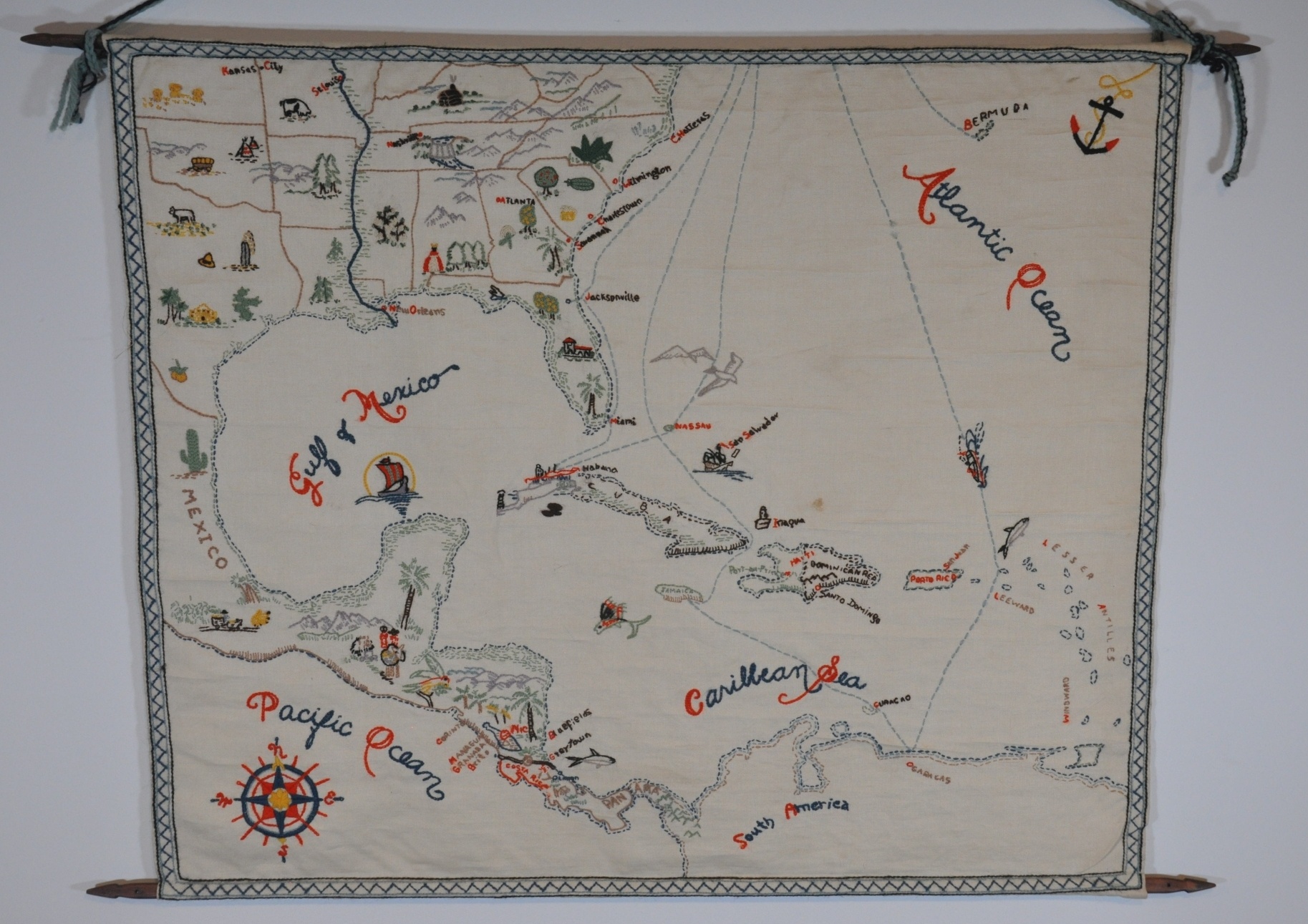
[Embroidered Map of Southeast United States and Caribbean]
Charming embroidered map of the South Atlantic.
Out of stock

Description
This stunning handmade map of the southeastern United States and the Caribbean is a wonderful example of domestic embroidery that became popular across America during the Great Depression and in the decades following. The materials were relatively inexpensive and helped improve sewing skills, which were in high demand. Maps were just one of numerous decorative and/or functional items created mostly by women in the home.
This tapestry-style map uses a variety of popular pictorial elements to represent contemporary regional identities across the image, from African-American farmworkers in the South to exotic animals in the jungles of Central America. Of particular interest is the dam depicted in Tennessee – possibly the Norris Dam completed in 1933 and one potential source of the approximate date.
Steamship routes are depicted along with coastlines and skillfully embroidered toponyms. Decorative elements in the form of an anchor (upper right), an elaborate compass rose and a geometric border provide an attractive, albeit slightly rustic, aesthetic.
Map Details
Publication Date: c. 1930s?
Author: Anonymous
Sheet Width (in): 31.00
Sheet Height (in): 26
Condition: A-
Condition Description: Charming hand-knit map and hanging arm, mounted on wooded 'spool' rollers. A dime sized spot in the center, directly above Hispaniola, and a few small tears in the embroidery. Very good condition overall, though I'm uncertain about its precise era.
Out of stock