Electric Railroad Map of the State of New York
Huge map showing the electric and steam railroads in operation across New York shortly before the outbreak of WWI.
Out of stock
Description
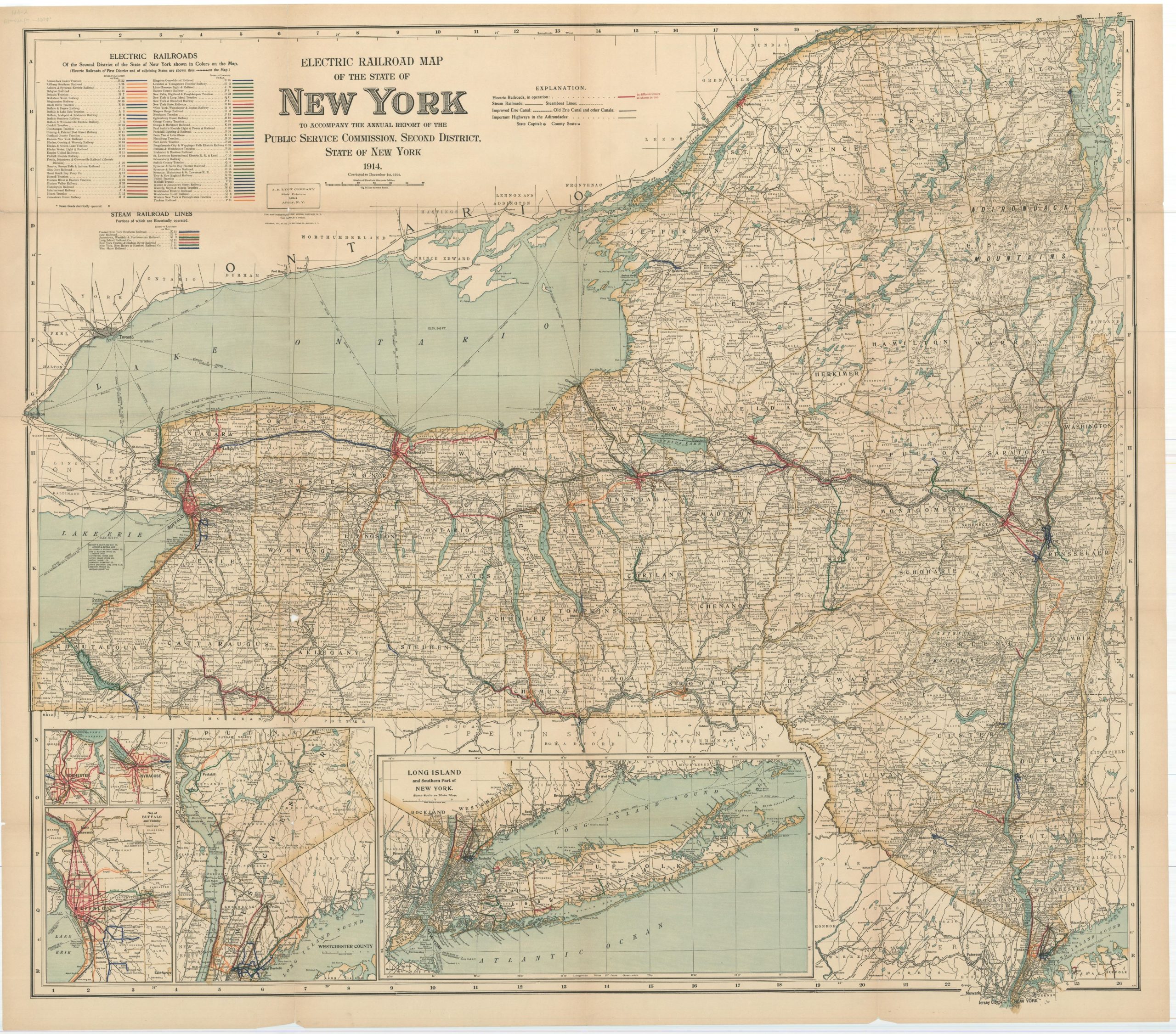
This large and detailed transportation map of New York was issued to accompany the Annual Report of the Public Service Commission of the state’s Second District in 1914. Legends in the upper left show the myriad of colors used to distinguish the dozens of operators of steam and electric railroads.
Additional red lines identify those not included in the exhaustive list. Canals, automobile highways, and steamboat lines are also identified throughout the image. The bottom of the sheet shows inset maps of New York and Long Island, Buffalo, Syracuse, Rochester, and Westchester County.
An exhaustive overview of New York’s transportation network shortly before the outbreak of World War I. Copyright 1914 by the J.N. Matthews Company of Buffalo. Lithographed by the Matthews-Northrup Works and printed in Albany by the J.B. Lyon Company.
Map Details
Publication Date: 1914
Author: New York Public Service Commissions
Sheet Width (in): 47.25
Sheet Height (in): 41.25
Condition: B+
Condition Description: Moderate creasing, toning, and wear along originally issued fold lines, including large areas of separation at fold intersections and along the outer edges of the sheet. Good to very good condition overall.
Out of stock