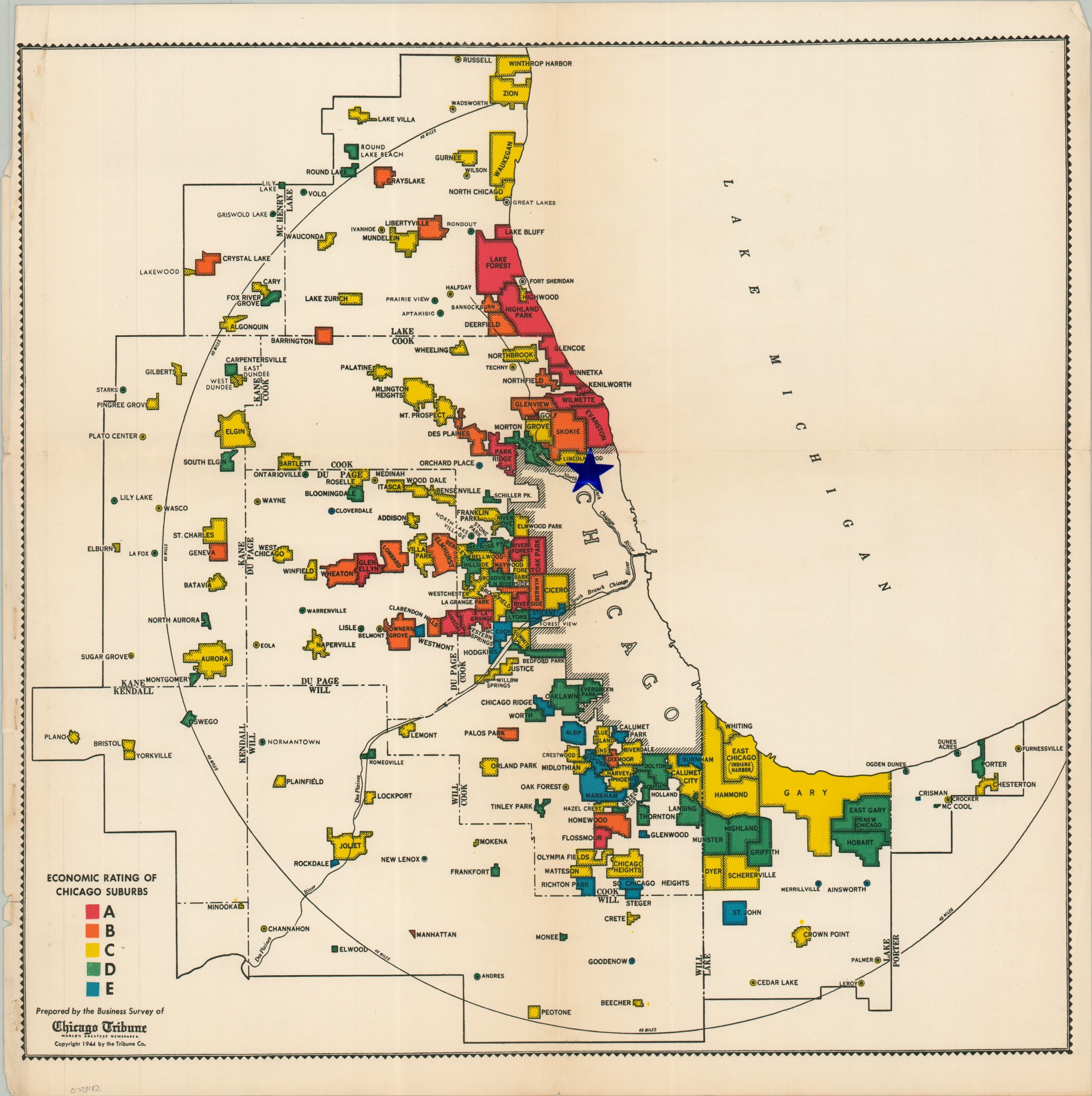
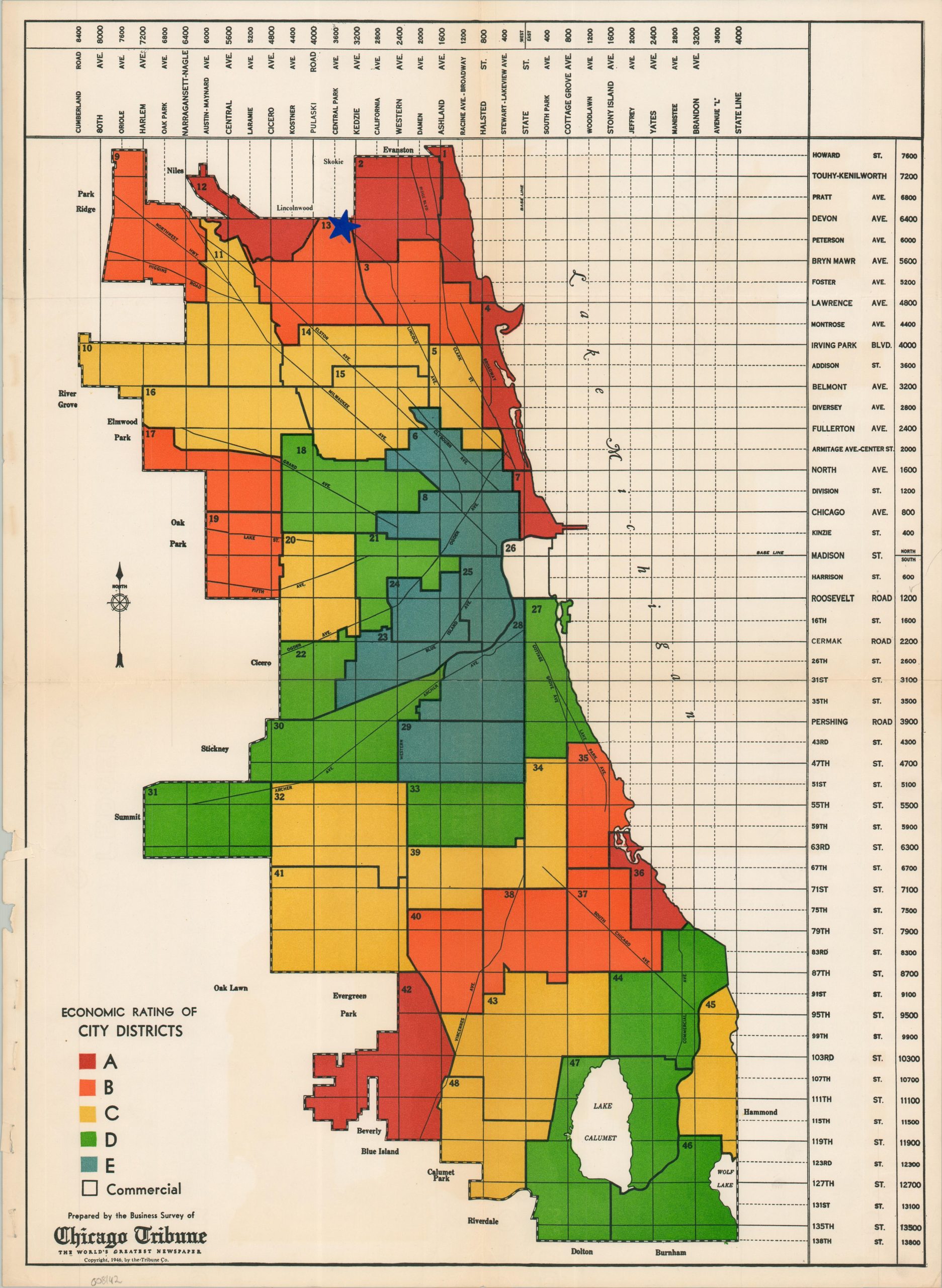
Economic Rating of City Districts and Chicago Suburbs
Mapping the profitability of Chicagoland in the postwar environment.
Out of stock
Description
This striking pair of color-printed maps was prepared by the Business Survey of the Chicago Tribune and published in 1946. Each image uses a scale of A-E (red to blue) to vibrantly grade the economic ratings of city districts (sheet 1, about 16.5″ x 22.5″) and the surrounding suburbs (sheet 2, about 17.75″ x 17.75″). Small blue star stickers have been placed at the same intersection on each map – the southeast corner of Kedzie and Devon – likely indicating they were part of a real estate assessment for the area.
The maps offer a frank depiction of Chicago’s postwar commercial geography. The North Shore remains an exclusive enclave of suburbs, but the city has made significant strides in developing the West Loop and adjacent areas. Development in the western suburbs is also evident, as a severe housing shortage after World War II encouraged ‘white flight’ from the urban center.
Map Details
Publication Date: 1946
Author: The Tribune Company
Sheet Width (in): See Description
Sheet Height (in): See Description
Condition: B+
Condition Description: Two color printed maps on thick sheets of single-sided paper, creased along old folds and ragged in a lower left margin, indicating a former binding. Blue star stickers affixed to each. Good shape overall.
Out of stock