Eastern Hemisphere [and] Western Hemisphere
The mid-19th century world, across two sheets.
Out of stock
Description
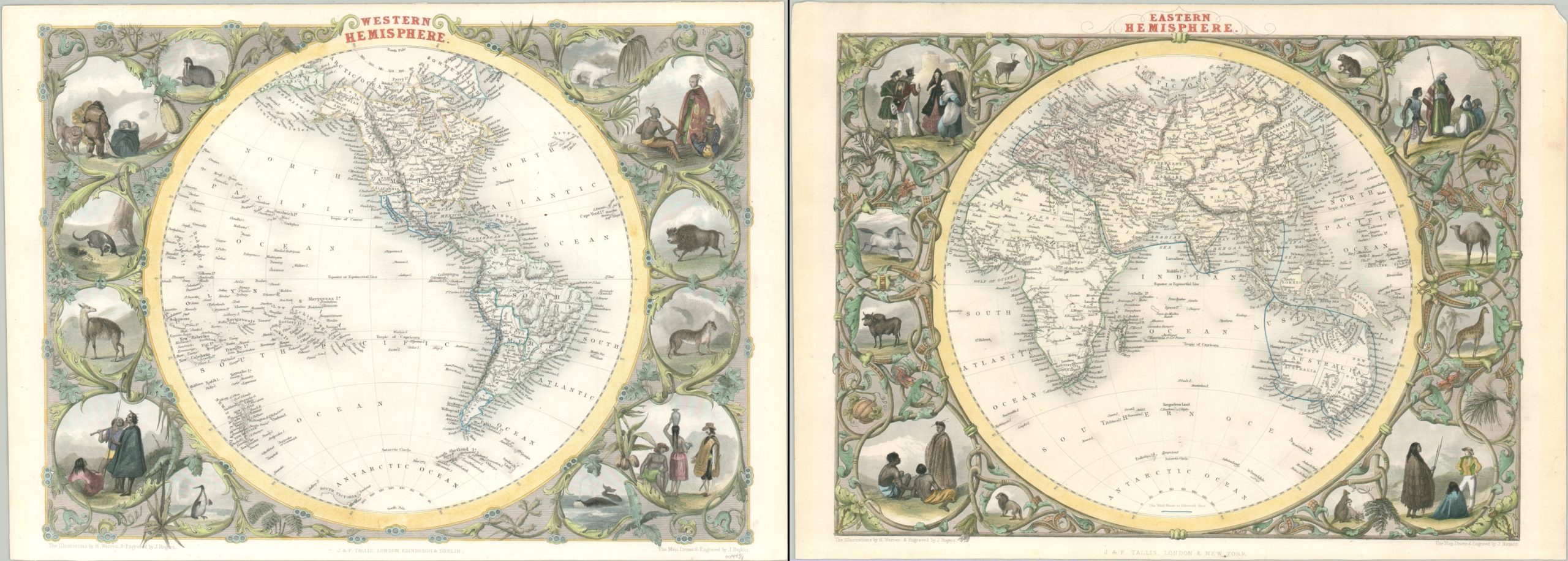
This alluring pair of hemispheric maps are fantastical representations of the world from the mid-19th century. The maps were drawn and engraved by John Rapkin and published around 1851 by brothers John and Frederick Tallis. The decorative vignettes were designed by H. Warren and engraved by J. Rogers.
Each sheet presents a comprehensive geographic and political overview of the Eastern or Western Hemisphere. An incredible variety of toponyms identifies cities, kingdoms, geographic features, and more. Of particular interest is the steam mail route between Canton and London, highlighted in blue on the map of the Eastern Hemisphere. In addition to following the path of the lucrative tea trade, it also shows several stops in the Dutch East Indies and along the coast of Australia and Van Dieman’s Land, then a penal colony for the British Empire.
The maps reflect the latest geographical discoveries, such as isolated islands in the South Pacific, portions of the coastline of Antarctica, and geographic features of the African interior. Despite the inclusion of these details, several prominent cartographic myths are also represented. Several possibilities for the elusive Northwest Passage are shown in the Arctic Circle and Africa still retains the fictitious Mountains of Kong and Mountains of the Moon. Australia contains an oversized Lake Torrens and several of the charted islands throughout both the Atlantic and Pacific Oceans would be later confirmed as non-existent.
Surrounding each hemisphere is a series of illustrated vignettes entwined in decorative vinework. These depict the native inhabitants and various wild animals like the buffalo, walrus, camel, and giraffe. The exotic additions would have undoubtedly caught the eye of a contemporary audience, helping to boost the sales of the Tallis atlas in which the maps were originally included.
Map Details
Publication Date: c. 1851
Author: John Tallis
Sheet Width (in): 14.4
Sheet Height (in): 10.6
Condition: A
Condition Description: Two sheets with trimmed margins and faint wear and discoloration visible in the margins. Very faint scattered spotting visible in the Eastern Hemisphere. Very good overall, with attractive modern hand color.
Out of stock


