East Tennessee Touring Guide and Scenic Map
$60.00
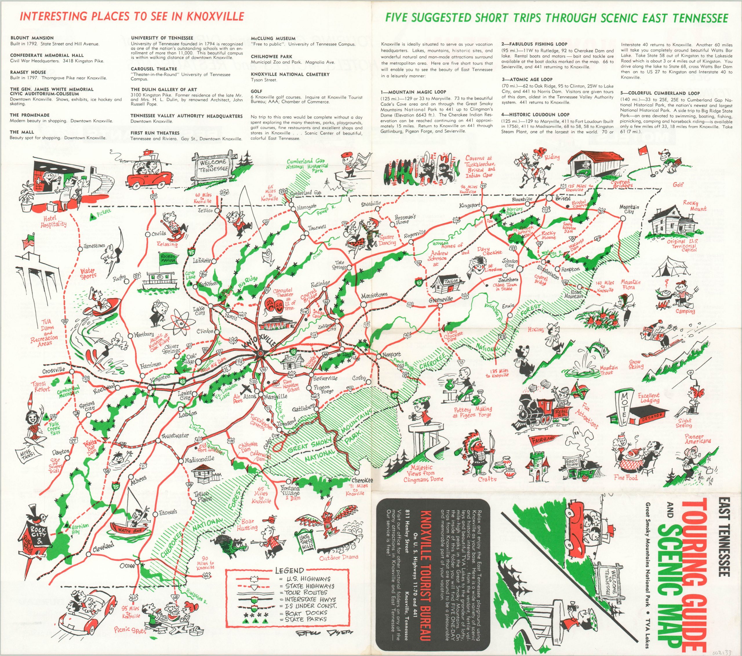
Retro tourist map of East Tennessee drawn by a prominent local cartoonist.
1 in stock
Description
This charming tourist guide to East Tennessee was published in the 1950’s in an effort to draw tourism into the region. A basic transportation outline is accompanied by numerous illustrations highlighting many of the local attractions, outdoor activities, and natural landmarks. Boat docks and state parks are also identified according to the legend in the lower left.
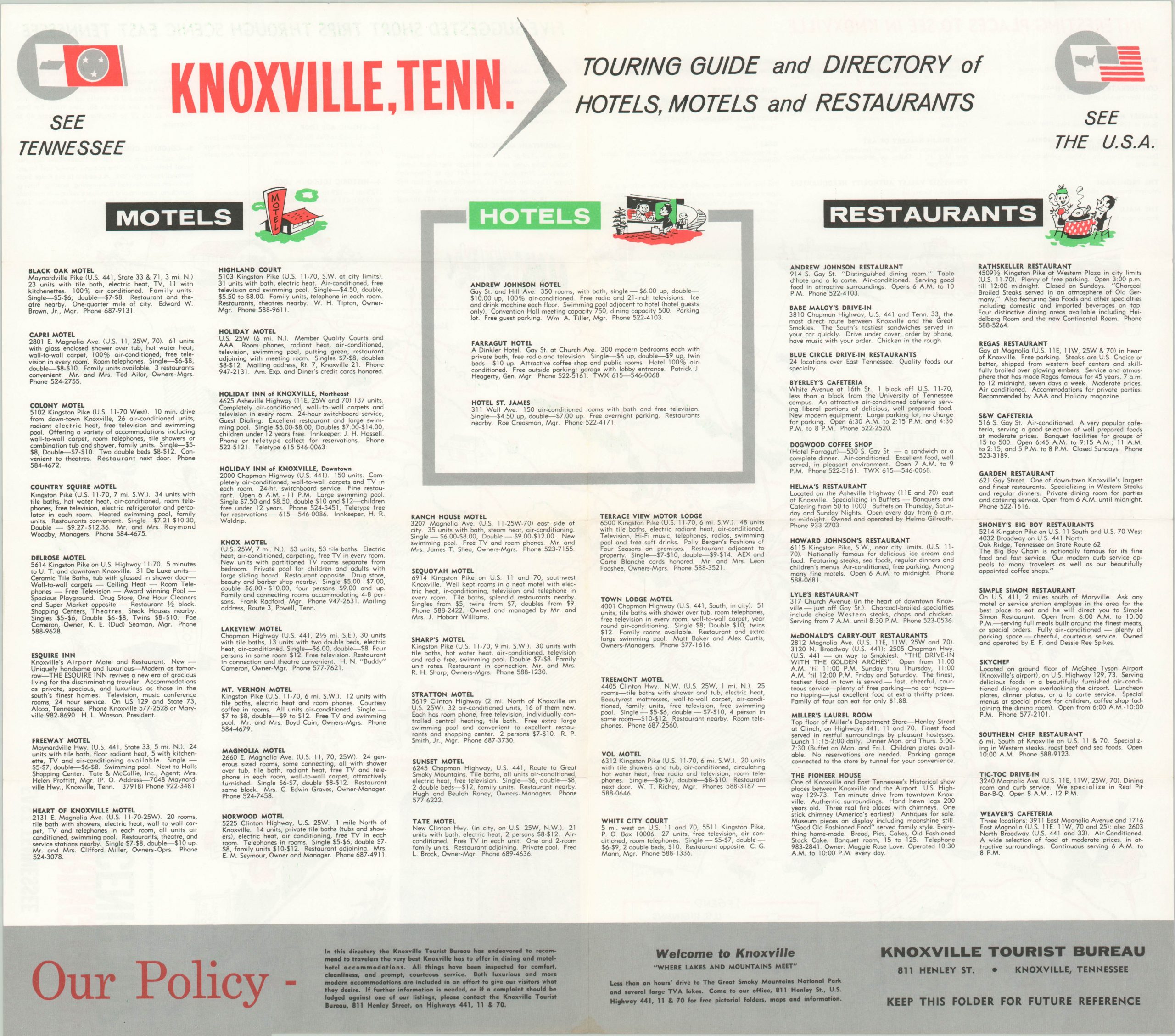
The top of the map includes a list of interesting places to see in Knoxville, Tennessee as well as five suggested tour itineraries. The verso includes detailed information on local hotels, motels, and restaurants including diving directions, amenities, and prices. The image was drawn by Bill Dyer, a well-known cartoonist who worked for the Knoxville News-Sentinel for over 40 years. Published by the Knoxville Tourist Bureau.
Map Details
Publication Date: c. 1955
Author: Bill Dyer
Sheet Width (in): 17.60
Sheet Height (in): 15.50
Condition: A-
Condition Description: Tourist brochure originally folded into eight panels and showing faint creasing and minor discoloration along the fold lines.
$60.00
1 in stock