East Indies
$295.00
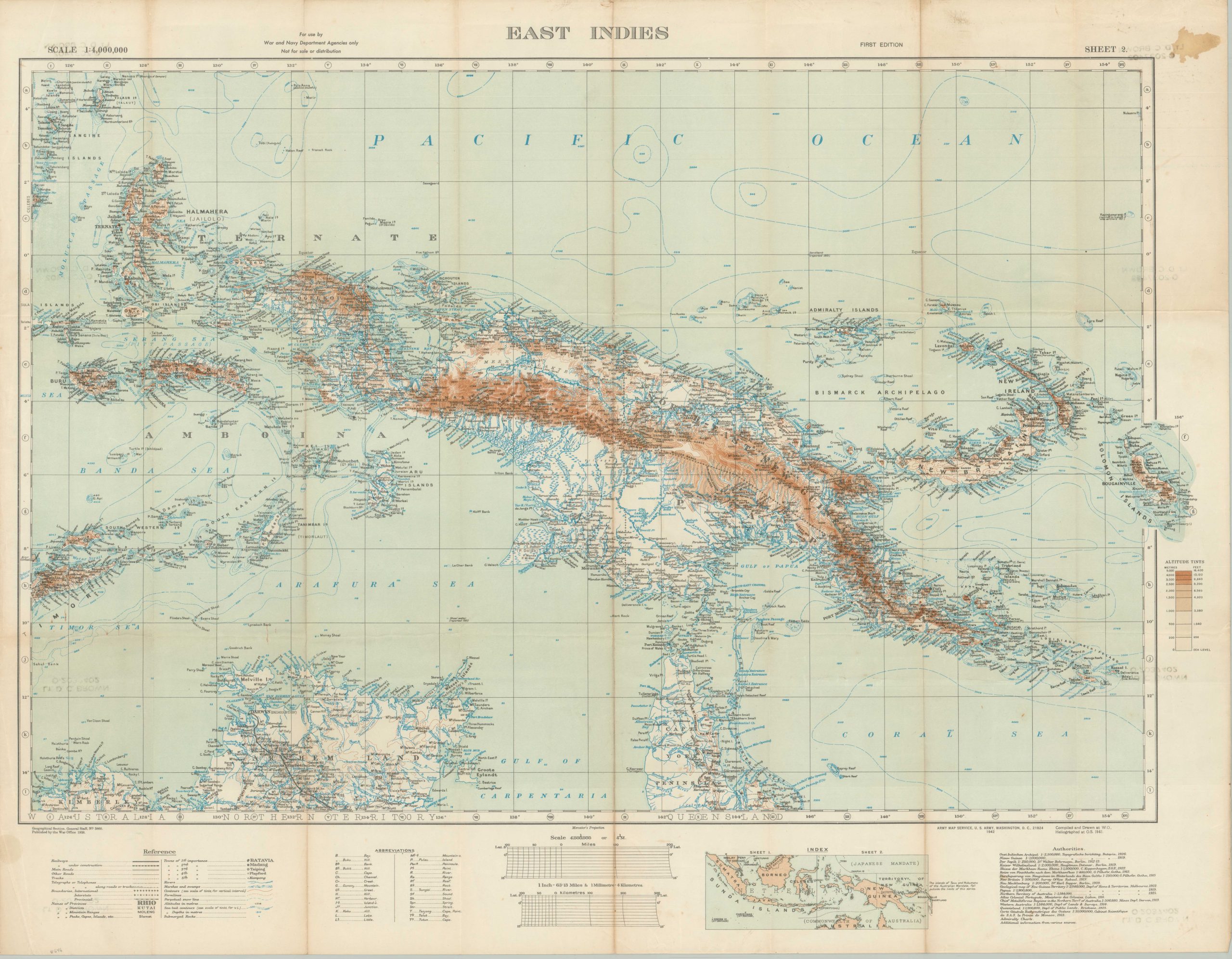
Preparing for the Battle of the Coral Sea.
1 in stock
Description
In the early stages of the Pacific Theater of World War II, Japanese naval forces looked to continue their onslaught against Allied defenses across the South Pacific. After the succession capture of the island of Tulagi (May 3, 1942), an invasion of Port Moresby was planned to isolate Australia and New Guinea from the critical supply lines of the United States. American intelligence services intercepted the instructions and reacted accordingly, resulting in the pivotal Battle of the Coral Sea.
Fought from May 4-8, it was the first naval battle in history in which the engaging ships were entirely out of the line of sight – carrier-based fighters and bombers replaced cannons. While the Allied fleet suffered greater loss in terms of ships, Japan lost the strategic initiative and the invasion was repulsed.
This map of the East Indies is centered on the island of New Guinea, with Port Moresby and the Coral Sea labeled in the lower right. Other (future) battle sites across the area include the islands of Bougainville, New Britain, and Peleliu. Various geographic features, infrastructure elements, and abbreviations are defined in the keys and legends in the lower margin.
Published by the Army Map Service in Washington, D.C. in 1942, with various sources listed in the lower right. First edition, it is the second of two sheets, reflected in the index at the bottom of the sheet.
Map Details
Publication Date: 1942
Author: Army Map Service
Sheet Width (in): 36.25
Sheet Height (in): 28.25
Condition: B+
Condition Description: Large damp stain in the upper right corner (confined to the margin) and several spots of toning and wear along old fold lines. Rubberstamped Lt. D.C. Brown on several spots on the verso. About good condition overall.
$295.00
1 in stock