East Indies
$100.00
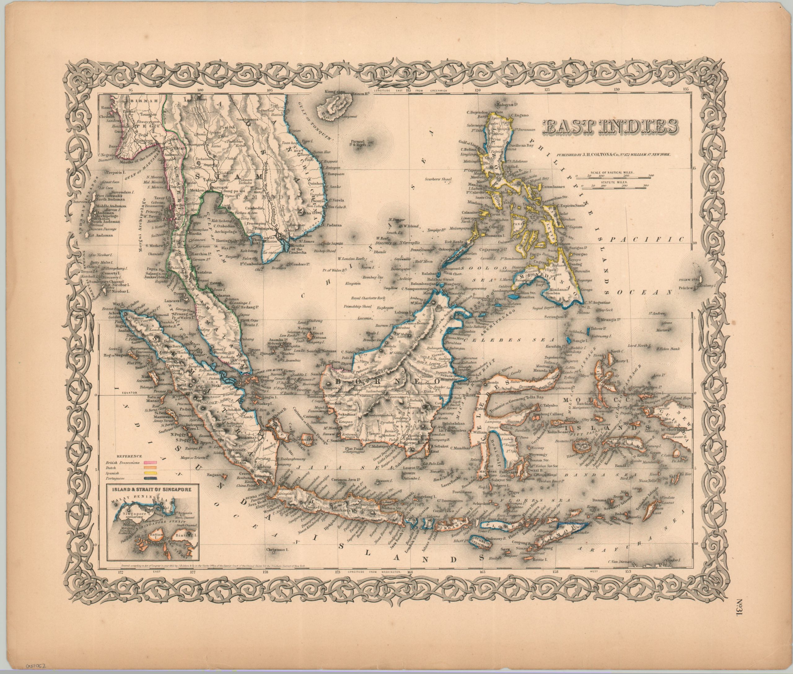
European territorial claims across southeast Asia during the mid-19th century.
1 in stock
Description
European interest in the East Indies, driven by the lucrative spice trade, began in the early 16th century with the arrival of the Portuguese. They were swiftly followed by the Dutch and English, who established powerful joint-stock companies like the Dutch East India Company (VOC) and the British East India Company. These private companies gradually transitioned from overseeing mere trading posts to exerting significant political and military control over vast swathes of the archipelago. By the mid-19th century, the Dutch had solidified their dominance over much of what is now Indonesia, while the British held sway over parts of the Malay Peninsula and Singapore, and the Spanish controlled the Philippines.
This wonderfully detailed map of the hotly contested region was published in New York in 1855 by J.H. Colton & Co. Pink, orange, yellow, and blue highlights coastal areas claimed by the British, Dutch, Spanish, and Portuguese, respectively. An inset in the lower left presents the Singapore Strait and toponyms identify a fascinating variety of European outposts, native settlements, geographic features, and notable landmarks. The image reflects the era of intense resource extraction and the establishment of complex colonial administrations that profoundly shaped the region’s future.
Map Details
Publication Date: 1855
Author: J.H. Colton
Sheet Width (in): 18.5
Sheet Height (in): 15.6
Condition: A-
Condition Description: Steel engraved sheet with original outline color, applied by hand. A somewhat brittle sheet is moderately toned in the margins, with a few creases and small tears (away from the image) and scattered foxing. Good to very good overall.
$100.00
1 in stock