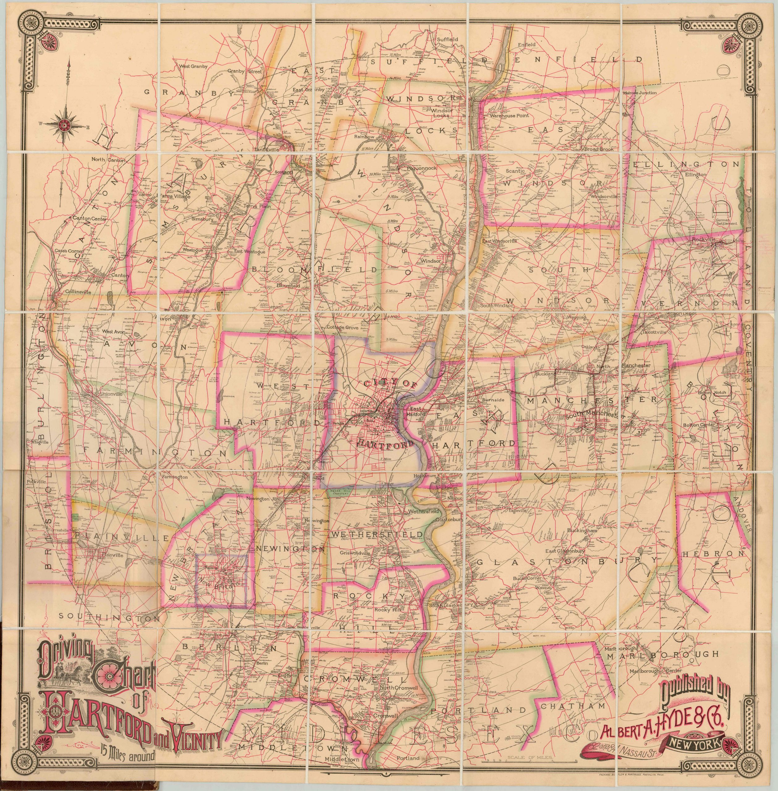
Driving Chart of Hartford and Vicinity 15 Miles Around
Late 19th century road map of the area around Hartford, Connecticut.
Out of stock
Description
As shown in the engraving in the background of the title, this driving chart was not for automobiles. Carl Benz wouldn’t apply for a patent for a “vehicle powered by a gas engine” for another two years. However, taking a leisurely ride has been an enjoyable pastime for much longer than cars have been around, and residents of Hartford would have used this chart in carriages and coaches, and on horseback, bicycle, and even foot.
Routes are marked boldly in red, linking the numerous small towns in the region. Dotted along each road are individual houses and farmsteads, each of which is named after its owner. Buildings of note, including colleges, industrial facilities, post offices, and hotels are also shown.
What is not shown, however, is the poor condition of the roads that forced recreational travel to be a largely seasonal affair. One of the many reasons while railroads (also boldly shown across the page) were the choice of travel for many in the late 19th century.
Map Details
Publication Date: 1884
Author: Albert A. Hyde & Co.
Sheet Width (in): 41
Sheet Height (in): 42
Condition: A-
Condition Description: Dissected into 25 panels and mounted onto linen, affixed to original gilt leather boards. Discoloration from old tape repairs along one seam in the center left of the map, and a bit of wear in the upper left corner. Very good, or better, overall.
Out of stock


