Dresden
$90.00
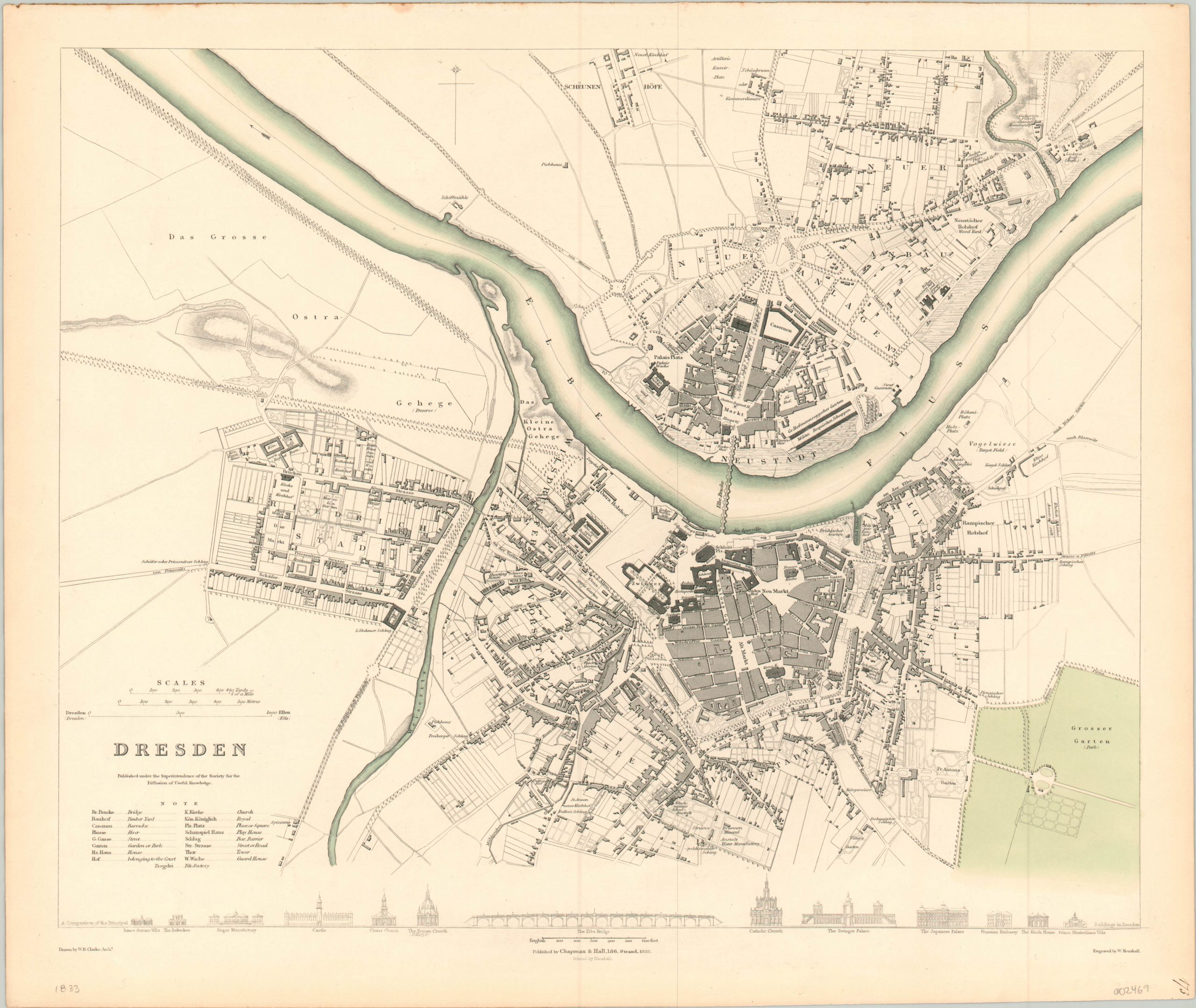
Intricately engraved street plan of Dresden, on the River Elbe.
1 in stock
Description
This terrifically detailed plan of Dresden, Germany was engraved by W. Henshall after a drawing by W.B. Clarke and published in London in 1833 by the Society for the Diffusion of Useful Knowledge (SDUK). It’s clearly legible, unadorned image and cheap purchase price was consistent with the aims of the organization, which was founded in 1826.
In operation until 1848, the SDUK focused on the publication and distribution of inexpensive and easily accessible learning material for the general public. It was thought that the ability to self-educate in the lower and middle classes would contribute to public order and advance the high minded ideals of Western science and civilization.
The maps the organization produced are some of the most detailed, practical, and accessible maps of the mid-19th century. This plan of Dresden is an excellent example, showing the city situated on both banks of the River Elbe. Streets and important public buildings are individually labeled, while dense urban spaces are generalized with shaded areas to improve legibility. An accompanying legend in the lower left assists with the translation of place names, and architectural profiles along the bottom of the sheet provide a view of some of Dresden’s most prominent buildings.
Map Details
Publication Date: 1833
Author: SDUK
Sheet Width (in): 16.00
Sheet Height (in):
Condition: A
Condition Description: Lightly toned margins, consistent with age, and a bit of discoloration around the outer edges of the sheet. Very good overall.
$90.00
1 in stock

