Dreher’s Mile Square Index, Paved Streets and House Number Map of the City of Columbus
Detailed WWI-era guidebook and map of Columbus, Ohio.
Out of stock
Description
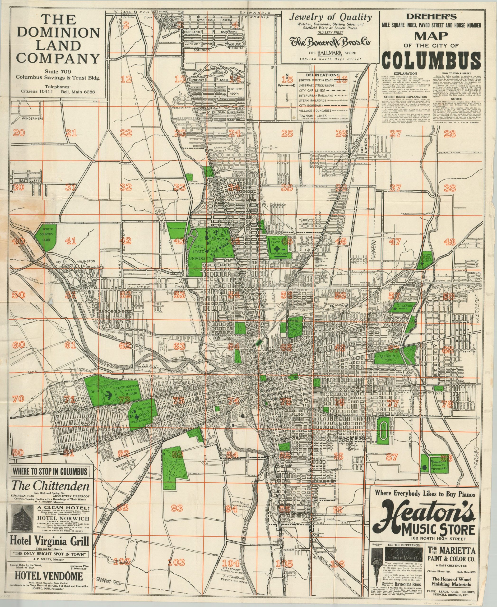
This fascinating street plan of Columbus, Ohio provides an interesting snapshot of the capital city at a pivotal moment in its history. The destruction from the Great Flood of 1913 can still be seen in a large blank area east of downtown and north of the Scioto River, today’s Franklinton neighborhood.
The interconnected web of transportation networks reflects changing preferences in public and private transit – towards automobiles and away from rail. Parks, cemeteries, and other public spaces are highlighted in green and include Ohio State University, Columbus Driving Park, and the Ohio Institution for the Feeble Minded. A number of other locations of interest are labeled within the image, anchored in the corners by contemporary advertisements.
Designed by C.V. Swinehart and published in Columbus by D. Frank Dreher in 1918. Following the conclusion of World War I, the city would undergo a significant building spree and drastically change its footprint further.
Map Details
Publication Date: 1918
Author: D.F. Dreher & Company
Sheet Width (in): 27.10
Sheet Height (in): 33.10
Condition: B+
Condition Description: Pocket map folded into 60 panels and affixed to original yellow paper wraps and 160 pp. guidebook. Moderate wear along fold lines, including creasing and one dime sized hole in the lower left. A bit of discoloration from where the map is affixed to the back panel in the center left, just above the hole. Remains in very good condition, given its age and use.
Out of stock