
Down-Town Pilot Map Minneapolis, Minnesota
$75.00
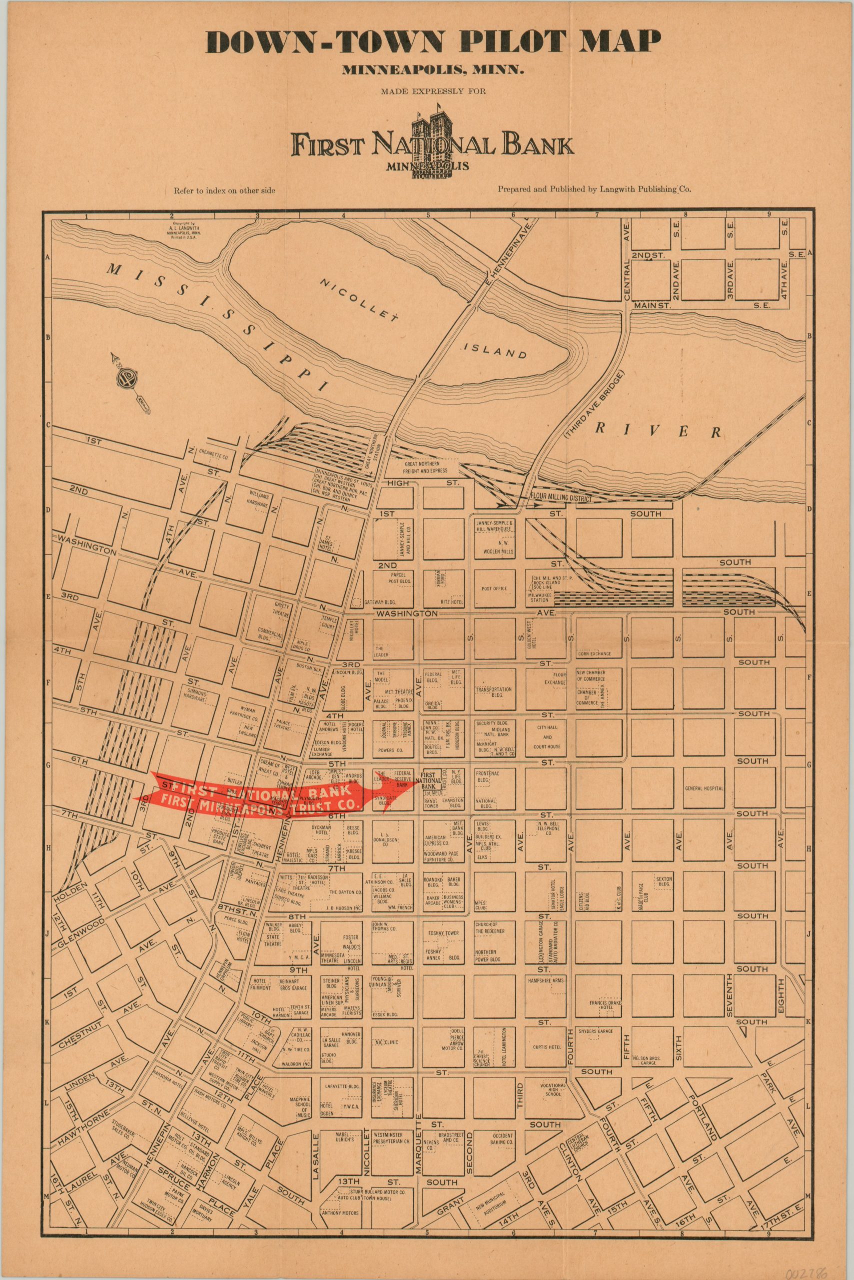
Walking map of downtown Minneapolis issued during the Great Depression.
1 in stock
Description
This detailed snapshot captures the composition of the downtown district in Minneapolis, Minnesota in the early years of the Great Depression. A variety of buildings and company names are situated on city blocks within a neatly organized street grid.
The map was published around 1930 by the Langwith Publishing Company on behalf of the First National Bank of Minneapolis. The location of the bank’s headquarters is highlighted with a red arrow on the map. A building index, sightseeing road map of the Twin Cities, and advertisement for the First National Group of Banks are all present on the verso.
Date estimated based on the presence of the Foley Building (constructed 1929) and the absence the Qwest Building, completed in 1932.
Map Details
Publication Date: c. 1930
Author: Langwith Publishing Company
Sheet Width (in): 11.8
Sheet Height (in): 17.75
Condition: A
Condition Description: Light creasing and faint wear along originally issued fold lines. Old rubberstamp on the front panel (verso) and moderate staining the does not affect the image. Very good to near fine overall.
$75.00
1 in stock